– Lat/Long: 54.45° S 70.83° W
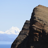
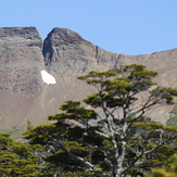
 Monte Sarmiento
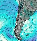
Weather Forecast, ChileIssued: 2 am Sun 14 Dec Local TimeUpdates in: hr min sUpdate imminent
Issued: 2 am Sun 14 Dec Local Time
Updates in:
Update imminent hr min s

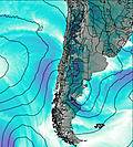
Issued: 2 am Sun 14 Dec Local Time
Updates in:
Update imminent hr min s
Days 1–3 Weather SummaryA heavy fall of snow, heaviest during Tue morning. Temperatures will be below freezing (max -3°C on Mon night, min -12°C on Tue night). Winds increasing (strong winds from the SW on Sun night, stormy winds from the W by Mon night). | Days 4–6 Weather SummaryA heavy fall of snow, heaviest during Wed morning. Temperatures will be well below freezing (max -7°C on Fri night, min -14°C on Wed night). Winds decreasing (near gales from the WSW on Wed morning, fresh winds from the WNW by Fri morning). | |||||||||||||||||
Sunday 14 | Monday 15 | Tuesday 16 | Wednesday 17 | Thursday 18 | Friday 19 | |||||||||||||
AM | PM | night | AM | PM | night | AM | PM | night | AM | PM | night | AM | PM | night | AM | PM | night | |
light snow | mod. snow | heavy snow | light snow | snow shwrs | heavy snow | heavy snow | light snow | heavy snow | heavy snow | light snow | heavy snow | snow shwrs | snow shwrs | snow shwrs | some clouds | cloudy | mod. snow | |
km/h | ||||||||||||||||||
 |  |  |  |  |  | |||||||||||||
5 | 7 | 18 | 5 | 1 | 11 | 20 | 2 | 17 | 13 | 3 | 12 | 6 | 3 | 1 | — | — | 6 | |
— | — | — | — | — | — | — | — | — | — | — | — | — | — | — | — | — | — | |
max°C | -11 | -11 | -9 | -9 | -8 | -3 | -4 | -5 | -8 | -9 | -10 | -12 | -14 | -12 | -10 | -10 | -9 | -7 |
min°C | -11 | -11 | -10 | -9 | -9 | -7 | -4 | -7 | -12 | -10 | -11 | -14 | -14 | -14 | -11 | -10 | -9 | -8 |
-23 | -24 | -23 | -20 | -20 | -17 | -16 | -19 | -25 | -22 | -23 | -27 | -27 | -27 | -23 | -20 | -19 | -18 | |
650 | 650 | 600 | 700 | 650 | 700 | 1250 | 1250 | 800 | 750 | 650 | 450 | 400 | 500 | 350 | 600 | 900 | 900 | |
Cloud base (m) | 300 | 300 | 300 | 350 | 350 | 350 | 250 | 250 | 250 | 250 | 300 | 300 | 300 | 300 | 300 | 400 | 350 | 300 |
5:01 | — | — | 5:01 | — | — | 5:01 | — | — | 5:01 | — | — | 5:01 | — | — | 5:03 | — | — | |
— | — | 10:13 | — | — | 10:14 | — | — | 10:15 | — | — | 10:15 | — | — | 10:16 | — | — | 10:16 | |
Loading...
Monte Sarmiento Weather (Days 0-3):
The weather forecast for Monte Sarmiento is: A heavy fall of snow, heaviest during Tue morning. Temperatures will be below freezing (max -3°C on Mon night, min -12°C on Tue night). Winds increasing (strong winds from the SW on Sun night, stormy winds from the W by Mon night).
Monte Sarmiento Weather (Days 3-6):
A heavy fall of snow, heaviest during Wed morning. Temperatures will be well below freezing (max -7°C on Fri night, min -14°C on Wed night). Winds decreasing (near gales from the WSW on Wed morning, fresh winds from the WNW by Fri morning).
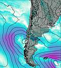
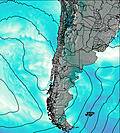
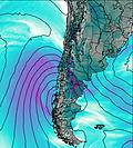
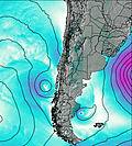
This table gives the weather forecast for Monte Sarmiento at the specific elevation of 2300 m. Our advanced weather models allow us to provide distinct weather forecasts for several elevations of Monte Sarmiento. To see the weather forecasts for the other elevations, use the tab navigation above the table. For a wider overview of the weather, consult the Weather Map of Chile.
| Weather Station | Temp. | Weather | Wind | Gusts | Cloud / Visibility |
|---|---|---|---|---|---|
SHIP7092 | |||||
Punta Arenas Unidad Aeropolicial | |||||
Instituto de la Patagonia (Jorge Schytte) | |||||
SHIP7565 | |||||
SHIP8412 | |||||
SHIP2626 | |||||
SHIP1803 | |||||
SHIP3270 |
* NOTE: not all weather observatories update at the same frequency which is the reason why some locations may show data from stations that are further away than known closer ones.
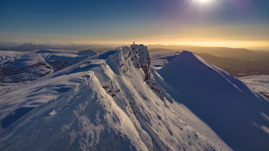
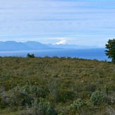
Monte Sarmiento Photos
View all
Patagonia photos (162) |
Andes photos (1001) |
photos from mountains in Chile (475) |
all photos
 Upload new photo
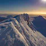
Monte Tarn amanecer en invierno
Monte tarn
Monte tarn en verano
Monte Sarmiento