
– Lat/Long: 36.40° N 80.28° W
 Moore's Knob
Weather Forecast, United StatesIssued: 1 pm Mon 31 Mar Local TimeUpdates in: hr min sUpdate imminent
Moore's Knob Weather Forecast, United States
Issued: 1 pm Mon 31 Mar Local Time
Updates in:
Update imminent hr min s

Issued: 1 pm Mon 31 Mar Local Time
Updates in:
Update imminent hr min s
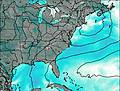
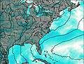
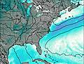
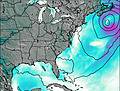
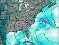
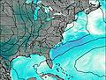
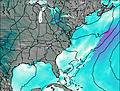
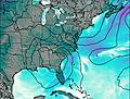
Days 1–4 Weather SummaryHeavy rain (total 25mm), heaviest during Mon night. Very mild (max 18°C on Thu morning, min 6°C on Mon night). Winds decreasing (strong winds from the WSW on Mon afternoon, calm by Tue afternoon). | Days 5–7 Weather SummaryMostly dry. Warm (max 23°C on Fri afternoon, min 17°C on Thu night). Winds increasing (moderate winds from the WSW on Fri afternoon, near gales from the SW by Sat night). | Days 8–10 Weather SummaryModerate rain (total 10mm), heaviest on Sun night. Very mild (max 18°C on Sun afternoon, min 1°C on Mon night). Winds decreasing (near gales from the SW on Sun night, calm by Tue night). | Days 11–13 Weather SummaryMostly dry. Very mild (max 11°C on Thu afternoon, min 1°C on Fri night). Wind will be generally light. | |||||||||||||||||||||||||||||||||
Mon 31 | Tuesday 1 | Wednesday 2 | Thursday 3 | Friday 4 | Saturday 5 | Sunday 6 | Monday 7 | Tuesday 8 | Wednesday 9 | Thursday 10 | Friday 11 | Sat 12 | ||||||||||||||||||||||||
PM | night | AM | PM | night | AM | PM | night | AM | PM | night | AM | PM | night | AM | PM | night | AM | PM | night | AM | PM | night | AM | PM | night | AM | PM | night | AM | PM | night | AM | PM | night | AM | |
risk tstorm | rain shwrs | clear | clear | some clouds | light rain | cloudy | light rain | light rain | risk tstorm | clear | clear | some clouds | some clouds | clear | clear | clear | clear | risk tstorm | rain shwrs | some clouds | clear | clear | clear | clear | clear | clear | some clouds | some clouds | some clouds | clear | rain shwrs | rain shwrs | rain shwrs | clear | some clouds | |
km/h | ||||||||||||||||||||||||||||||||||||
 |  |  |  |  |  |  |  |  |  |  |  |  | ||||||||||||||||||||||||
— | — | — | — | — | — | — | — | — | — | — | — | — | — | — | — | — | — | — | — | — | — | — | — | — | — | — | — | — | — | — | — | — | — | — | — | |
8 | 16 | — | — | — | 0.1 | — | 0.6 | 0.1 | 0.1 | — | — | — | — | — | — | — | — | 4 | 7 | — | — | — | — | — | — | — | — | — | — | — | 0.1 | 0.1 | 0.3 | — | — | |
max°C | 17 | 14 | 9 | 14 | 11 | 10 | 14 | 17 | 18 | 20 | 18 | 20 | 23 | 21 | 21 | 23 | 21 | 18 | 18 | 16 | 6 | 10 | 7 | 3 | 10 | 7 | 5 | 9 | 7 | 7 | 11 | 9 | 7 | 9 | 5 | 4 |
min°C | 16 | 6 | 6 | 12 | 7 | 8 | 12 | 14 | 17 | 19 | 17 | 17 | 22 | 17 | 18 | 22 | 18 | 17 | 17 | 8 | 6 | 9 | 1 | 1 | 8 | 1 | 1 | 7 | 4 | 4 | 10 | 7 | 6 | 7 | 1 | 2 |
14 | 1 | 2 | 11 | 5 | 5 | 9 | 12 | 15 | 18 | 15 | 15 | 22 | 16 | 17 | 22 | 16 | 15 | 15 | 4 | 1 | 6 | -4 | -3 | 6 | -2 | -2 | 6 | 2 | 1 | 10 | 4 | 3 | 3 | -5 | -3 | |
3400 | 3150 | 2650 | 3200 | 3700 | 3700 | 4050 | 4300 | 4100 | 4250 | 4400 | 4100 | 4050 | 4200 | 4100 | 4150 | 4100 | 3850 | 3700 | 3400 | 1550 | 2400 | 1200 | 1100 | 2050 | 1550 | 1400 | 2300 | 2050 | 2100 | 2350 | 2000 | 1750 | 1600 | 1100 | 1250 | |
Cloud base (m) | 600 | 8200 | 400 | 350 | 300 | 300 | 600 | 300 | 9650 | 2200 | 9450 | 500 | 1850 | 350 | 8450 | 8650 | 6900 | 5650 | 1800 | 900 | 800 | 1650 | 1650 | 650 | ||||||||||||
— | — | 7:07 | — | — | 7:05 | — | — | 7:03 | — | — | 7:03 | — | — | 7:01 | — | — | 7:00 | — | — | 6:58 | — | — | 6:56 | — | — | 6:56 | — | — | 6:54 | — | — | 6:52 | — | — | 6:52 | |
7:42 | — | — | 7:42 | — | — | 7:43 | — | — | 7:44 | — | — | 7:45 | — | — | 7:45 | — | — | 7:46 | — | — | 7:47 | — | — | 7:47 | — | — | 7:49 | — | — | 7:50 | — | — | 7:51 | — | — | |
Moore's Knob Weather (Days 0-3):
The weather forecast for Moore's Knob is: Heavy rain (total 25mm), heaviest during Mon night. Very mild (max 18°C on Thu morning, min 6°C on Mon night). Winds decreasing (strong winds from the WSW on Mon afternoon, calm by Tue afternoon).
Moore's Knob Weather (Days 3-6):
Mostly dry. Warm (max 23°C on Fri afternoon, min 17°C on Thu night). Winds increasing (moderate winds from the WSW on Fri afternoon, near gales from the SW by Sat night).
Moore's Knob Weather (Days 6-9):
Moderate rain (total 10mm), heaviest on Sun night. Very mild (max 18°C on Sun afternoon, min 1°C on Mon night). Winds decreasing (near gales from the SW on Sun night, calm by Tue night).
This table gives the weather forecast for Moore's Knob at the specific elevation of 786 m. Our advanced weather models allow us to provide distinct weather forecasts for several elevations of Moore's Knob. To see the weather forecasts for the other elevations, use the tab navigation above the table. For a wider overview of the weather, consult the Weather Map of North-Carolina.
| Weather Station | Temp. | Weather | Wind | Gusts | Cloud / Visibility |
|---|---|---|---|---|---|
Mount Air / urry Airport | |||||
lightning 9km S of Rural Hall | |||||
lightning 7km NE of Walkertown | |||||
lightning 18km NNE of Flat Rock | |||||
Winston Salem Airport | |||||
lightning 6km NNW of Winston-Salem | |||||
Martinsville Airport | |||||
Rockingham County North Carolina Shiloh - Reidsville Airport | |||||
lightning 4km N of Clemmons | |||||
lightning 5km WSW of Lewisville |
* NOTE: not all weather observatories update at the same frequency which is the reason why some locations may show data from stations that are further away than known closer ones.

