– Lat/Long: 42.94° S 146.42° E
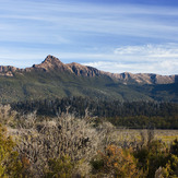
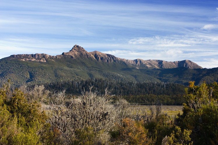
 Mount Anne
Weather Forecast, AustraliaIssued: 9 am Fri 25 Apr Local TimeUpdates in: hr min sUpdate imminent
Mount Anne Weather Forecast, Australia
Issued: 9 am Fri 25 Apr Local Time
Updates in:
Update imminent hr min s

Issued: 9 am Fri 25 Apr Local Time
Updates in:
Update imminent hr min s
Days 1–3 Weather SummaryLight rain (total 7mm), mostly falling on Fri night. Mild temperatures (max 7°C on Fri morning, min 2°C on Sat night). Winds decreasing (near gales from the WNW on Fri afternoon, calm by Sun night). | Days 4–6 Weather SummaryDrizzle at first, then turning colder with dusting of snow on Mon night. Freeze-thaw conditions (max 4°C on Mon afternoon, min -3°C on Tue night). Winds decreasing (fresh winds from the WSW on Mon night, calm by Wed morning). | |||||||||||||||||
Friday 25 | Saturday 26 | Sunday 27 | Monday 28 | Tuesday 29 | Wednesday 30 | |||||||||||||
AM | PM | night | AM | PM | night | AM | PM | night | AM | PM | night | AM | PM | night | AM | PM | night | |
cloudy | light rain | mod. rain | light rain | clear | some clouds | cloudy | light rain | light rain | light rain | light rain | light snow | some clouds | some clouds | some clouds | cloudy | some clouds | some clouds | |
km/h | ||||||||||||||||||
 |  |  |  |  |  | |||||||||||||
— | — | — | — | — | — | — | — | — | — | — | 1.0 | — | — | — | — | — | — | |
— | 0.1 | 6 | 0.2 | — | — | — | 0.6 | 0.8 | 0.2 | 0.1 | 1.0 | — | — | — | — | — | — | |
max°C | 7 | 7 | 6 | 5 | 5 | 4 | 4 | 3 | 3 | 3 | 4 | 4 | 0 | -2 | -2 | -2 | -1 | -1 |
min°C | 7 | 7 | 5 | 4 | 4 | 2 | 4 | 3 | 2 | 3 | 4 | 1 | -1 | -2 | -3 | -2 | -2 | -2 |
2 | 2 | 0 | -1 | 0 | -4 | -2 | -3 | -3 | -2 | -1 | -5 | -6 | -8 | -10 | -7 | -5 | -6 | |
2850 | 2700 | 2450 | 2650 | 2600 | 3350 | 3150 | 2750 | 2200 | 2150 | 2250 | 1900 | 1450 | 1200 | 950 | 1200 | 1250 | 1100 | |
Cloud base (m) | 1700 | 600 | 350 | 400 | 600 | 700 | 500 | 350 | 450 | 500 | 2000 | 450 | 600 | 800 | 800 | 650 | 750 | |
6:56 | — | — | 6:58 | — | — | 6:58 | — | — | 7:00 | — | — | 7:01 | — | — | 7:01 | — | — | |
— | 5:27 | — | — | 5:24 | — | — | 5:23 | — | — | 5:22 | — | — | 5:21 | — | — | 5:20 | — | |
Loading...
Mount Anne Weather (Days 0-3):
The weather forecast for Mount Anne is: Light rain (total 7mm), mostly falling on Fri night. Mild temperatures (max 7°C on Fri morning, min 2°C on Sat night). Winds decreasing (near gales from the WNW on Fri afternoon, calm by Sun night).
Mount Anne Weather (Days 3-6):
Drizzle at first, then turning colder with dusting of snow on Mon night. Freeze-thaw conditions (max 4°C on Mon afternoon, min -3°C on Tue night). Winds decreasing (fresh winds from the WSW on Mon night, calm by Wed morning).
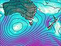
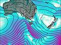
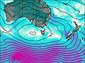
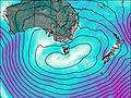
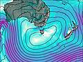
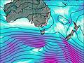
This table gives the weather forecast for Mount Anne at the specific elevation of 1423 m. Our advanced weather models allow us to provide distinct weather forecasts for several elevations of Mount Anne. To see the weather forecasts for the other elevations, use the tab navigation above the table. For a wider overview of the weather, consult the Weather Map of Tasmania.
| Weather Station | Temp. | Weather | Wind | Gusts | Cloud / Visibility |
|---|---|---|---|---|---|
Hartz Mountains (Keoghs Pimple) | |||||
BushyPark(Bushy Park Estates) | |||||
Ouse Fire Station | |||||
Mount Wellington | |||||
SHIP3882 | |||||
SHIP9700 |
* NOTE: not all weather observatories update at the same frequency which is the reason why some locations may show data from stations that are further away than known closer ones.