Mountain resort image
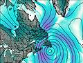
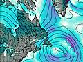
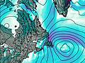
– Lat/Long: 58.88° N 63.72° W

Mount Caubvick
Weather Forecast, Canada

Issued: 12 pm Sat 22 Feb Local Time
Updates in:
hr min s
Update imminent

Days 1–3 Weather Summary

Some drizzle, heaviest during Mon night. Temperatures will be well below freezing (max -8°C on Mon night, min -28°C on Sun night). Wind will be generally light.

Days 4–6 Weather Summary

Some drizzle, heaviest during Tue morning. Temperatures will be below freezing (max -5°C on Tue morning, min -32°C on Thu night). Wind will be generally light.

Days 7–9 Weather Summary

Some drizzle, heaviest during Sat night. Extremely cold (max -25°C on Sun morning, min -32°C on Fri afternoon). Wind will be generally light.

Days 10–12 Weather Summary

Mostly dry. Extremely cold (max -17°C on Thu morning, min -27°C on Tue night). Wind will be generally light.

Saturday
22
Sunday
23
Monday
24
Tuesday
25
Wednesday
26
Thursday
27
Friday
28
Saturday
1
Sunday
2
Monday
3
Tuesday
4
Wednesday
5
AM
PM
night
AM
PM
night
AM
PM
night
AM
PM
night
AM
PM
night
AM
PM
night
AM
PM
night
AM
PM
night
AM
PM
night
AM
PM
night
AM
PM
night
AM
PM
night
part cloud
part cloud
rain showers
clear
clear
part cloud
light rain
light rain
light rain
light rain
rain showers
part cloud
part cloud
cloud
part cloud
cloud
light rain
rain showers
clear
part cloud
part cloud
rain showers
rain showers
rain showers
rain showers
light rain
rain showers
cloud
cloud
rain showers
part cloud
part cloud
part cloud
clear
clear
clear
some clouds
some clouds
rain shwrs
clear
clear
some clouds
light rain
light rain
light rain
light rain
rain shwrs
some clouds
some clouds
cloudy
some clouds
cloudy
light rain
rain shwrs
clear
some clouds
some clouds
rain shwrs
rain shwrs
rain shwrs
rain shwrs
light rain
rain shwrs
cloudy
cloudy
rain shwrs
some clouds
some clouds
some clouds
clear
clear
clear
 km/h
10
WSW
10
WSW
10
WSW
10
WSW
10
WSW
10
WSW
10
SW
10
SSW
10
SW
10
SW
15
W
15
WSW
10
WSW
10
SW
5
SW
0
SSW
5
WSW
10
W
10
WSW
10
WSW
10
WSW
15
WSW
10
WSW
15
WSW
15
WSW
15
WSW
10
WSW
5
WSW
5
W
10
WSW
15
W
10
WSW
10
WSW
10
WSW
10
WSW
10
WSW
 cm 
 mm 
0.1
0.1
0.2
0.8
1.2
0.1
0.2
0.1
0.1
0.1
0.8
0.2
0.2
0.2
0.1
max°C
-12
-16
-15
-18
-24
-25
-15
-14
-8
-5
-15
-25
-21
-22
-22
-15
-15
-21
-27
-30
-31
-27
-26
-26
-25
-26
-26
-22
-23
-19
-20
-22
-26
-19
-21
-23
min°C
-13
-16
-18
-19
-27
-28
-18
-14
-13
-6
-21
-28
-24
-24
-24
-16
-17
-32
-28
-32
-32
-28
-28
-28
-26
-26
-30
-25
-23
-23
-21
-25
-27
-21
-26
-26
chill°C 
-19
-23
-25
-27
-36
-37
-24
-20
-20
-12
-30
-38
-32
-31
-30
-16
-23
-42
-37
-42
-42
-38
-38
-39
-37
-36
-38
-32
-29
-31
-30
-34
-36
-29
-34
-33
Freezing level (m
0
0
0
0
0
0
0
0
0
0
0
0
0
0
0
0
0
0
0
0
0
0
0
0
0
0
0
0
0
0
0
0
0
0
0
0
Cloud base (m)
4750
8250
400
450
500
500
1800
400
550
350
400
450
450
450
550
450
400
400
400
500
450
400
400
400
400
450
450
500
500
1500
600
450
450
450
450
600
Sea lvl1000m2000m3000m4000m5000m
-18-19-23-27-28-26-23-19-16-17-25-29-28-28-27-25-27-32-37-37-36-36-34-33-31-32-31-28-26-22-20-21-21-22-22-22-16-18-21-26-28-25-21-17-15-13-23-29-27-26-24-22-23-30-34-34-34-34-34-32-31-32-31-27-25-21-19-21-22-21-22-22-13-16-17-19-26-27-17-14-11-6-18-27-23-23-23-16-16-27-28-31-32-28-27-27-26-26-28-24-23-21-21-24-27-20-24-25
Sunrise
6:30
6:26
6:24
6:22
6:18
6:16
6:13
6:09
6:07
6:05
6:01
5:58
Sunset
4:27
4:29
4:31
4:34
4:37
4:38
4:42
4:44
4:45
4:49
4:51
4:53

Mount Caubvick Weather (Days 0-3):

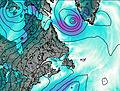
The weather forecast for Mount Caubvick is: Some drizzle, heaviest during Mon night. Temperatures will be well below freezing (max -8°C on Mon night, min -28°C on Sun night). Wind will be generally light.

Mount Caubvick Weather (Days 3-6):
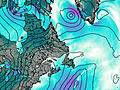
Some drizzle, heaviest during Tue morning. Temperatures will be below freezing (max -5°C on Tue morning, min -32°C on Thu night). Wind will be generally light.

Mount Caubvick Weather (Days 6-9):

Some drizzle, heaviest during Sat night. Extremely cold (max -25°C on Sun morning, min -32°C on Fri afternoon). Wind will be generally light.

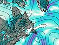
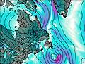
This table gives the weather forecast for Mount Caubvick at the specific elevation of 0 m. Our advanced weather models allow us to provide distinct weather forecasts for several elevations of Mount Caubvick. To see the weather forecasts for the other elevations, use the tab navigation above the table. For a wider overview of the weather, consult the Weather Map of Newfoundland.

Live conditions reported by 5 closest weather stations

Weather StationTemp.WeatherWindGusts
Cloud
Visibility
Cloud / Visibility
Kangiksualujjuaq Airport
132 km WSW
282m alt.
2 hours ago
-14° C
moderate snow
Low drifting moderate snow.
39
Strong winds from the SSE
(39 kph at 150).
24 km
Low: broken
Mid: overcast
Nain A- Nfld
287 km SSE
7m alt.
1 hour ago
-
Kuujjuaq- Ua- Que
287 km SW
123m alt.
1 hour ago
-
Kuujjuaq Airport
288 km SW
216m alt.
2 hours ago
-10° C
cloudy
Dry and cloudy.
30
Fresh winds from the SSW
(30 kph at 210).
24 km
Low: broken
Mid: overcast
289 km SSE
472m alt.
2 hours ago
clear
-
15
Light winds from the W.(Wind varies from 240 to 300 degs)
(15 kph at 270).
24 km
361 km WSW
274m alt.
2 hours ago
-13° C
light snow
Light snow.
43
Strong winds from the SW
(43 kph at 230).
5 km
Mid: overcast
Kangirsuk Airport
378 km W
229m alt.
2 hours ago
-15° C
light snow
Light snow.
35
Fresh winds from the WSW
(35 kph at 240).
5 km
Mid: overcast
Quaqtaq Airport
407 km WNW
264m alt.
2 hours ago
-16° C
light snow
Light snow.
22
Moderate winds from the WSW
(22 kph at 240).
16 km
Mid: overcast
Hopedale (Aut)- Nfld
437 km SSE
10m alt.
1 hour ago
-
-

( kph at 320)
Schefferville A- QC
492 km S
521m alt.
2 hours ago
-
Wind obs. (18 kph from 300 degs) was rejected.

* NOTE: not all weather observatories update at the same frequency which is the reason why some locations may show data from stations that are further away than known closer ones.