
– Lat/Long: 52.15° N 117.45° W
 Mount Columbia (Alberta)
Weather Forecast, CanadaIssued: 11 am Sun 27 Apr Local TimeUpdates in: 5hr 0min 47sUpdate imminent
Issued: 11 am Sun 27 Apr Local Time
Updates in:
Update imminent 5hr 0min 47s

Issued: 11 am Sun 27 Apr Local Time
Updates in:
Update imminent 5hr 0min 47s
Days 1–3 Weather SummaryA heavy fall of snow, heaviest during Tue afternoon. Temperatures will be well below freezing (max -9°C on Mon afternoon, min -12°C on Sun morning). Mainly fresh winds. | Days 4–6 Weather SummaryMostly dry. Temperatures will be below freezing (max -2°C on Fri afternoon, min -12°C on Wed morning). Wind will be generally light. | |||||||||||||||||
Sunday 27 | Monday 28 | Tuesday 29 | Wednesday 30 | Thursday 1 | Friday 2 | |||||||||||||
AM | PM | night | AM | PM | night | AM | PM | night | AM | PM | night | AM | PM | night | AM | PM | night | |
light snow | light snow | snow shwrs | some clouds | some clouds | snow shwrs | light snow | snow shwrs | clear | clear | clear | some clouds | clear | some clouds | clear | clear | clear | clear | |
mph | ||||||||||||||||||
 |  |  |  |  |  | |||||||||||||
1 | 2 | 0.4 | — | — | 1 | 2 | 3 | — | — | — | — | — | — | — | — | — | — | |
— | — | — | — | — | — | — | — | — | — | — | — | — | — | — | — | — | — | |
max°F | 10 | 12 | 12 | 14 | 16 | 16 | 12 | 10 | 10 | 10 | 16 | 18 | 21 | 25 | 27 | 27 | 28 | 28 |
min°F | 10 | 12 | 10 | 12 | 14 | 14 | 10 | 10 | 10 | 10 | 14 | 16 | 19 | 21 | 25 | 25 | 27 | 27 |
-2 | -0 | -2 | -0 | -2 | -0 | -2 | -4 | -0 | -2 | -0 | 1 | 10 | 12 | 16 | 14 | 16 | 16 | |
6900 | 7400 | 6200 | 6600 | 7700 | 7200 | 6900 | 6900 | 5700 | 6200 | 7700 | 7900 | 8500 | 9500 | 10200 | 10700 | 11000 | 11500 | |
Cloud base (ft) | 7500 | 7700 | 7500 | 7500 | 8400 | 7700 | 7500 | 7500 | 7500 | 7500 | 9000 | 9500 | — | — | — | — | — | 30300 |
6:28 | — | — | 6:26 | — | — | 6:24 | — | — | 6:22 | — | — | 6:20 | — | — | 6:18 | — | — | |
— | — | 9:07 | — | — | 9:08 | — | — | 9:10 | — | — | 9:13 | — | — | 9:14 | — | — | 9:15 | |
Days 7-12 Weather Summary
Interested in the 12-day Forecast? Unlock the full forecast and many more features by becoming a Pro member.
 MountainPro
Your membership benefits:
- Expert mountain forecasts
- 12 day forecast
- Hourly forecast detail
- Offline mapping (app only)
- Unlock our mobile app
- Remove ads
Mount Columbia (Alberta) Weather (Days 0-3):
The weather forecast for Mount Columbia (Alberta) is: A heavy fall of snow, heaviest during Tue afternoon. Temperatures will be well below freezing (max -9°C on Mon afternoon, min -12°C on Sun morning). Mainly fresh winds.
Mount Columbia (Alberta) Weather (Days 3-6):
Mostly dry. Temperatures will be below freezing (max -2°C on Fri afternoon, min -12°C on Wed morning). Wind will be generally light.
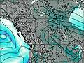
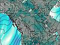
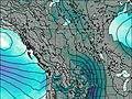
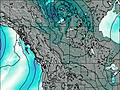
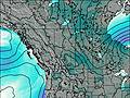
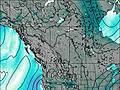
This table gives the weather forecast for Mount Columbia (Alberta) at the specific elevation of 3747 m. Our advanced weather models allow us to provide distinct weather forecasts for several elevations of Mount Columbia (Alberta). To see the weather forecasts for the other elevations, use the tab navigation above the table. For a wider overview of the weather, consult the Weather Map of Alberta.
* NOTE: not all weather observatories update at the same frequency which is the reason why some locations may show data from stations that are further away than known closer ones.

