– Lat/Long: 47.52° N 123.26° W
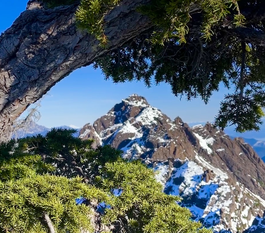
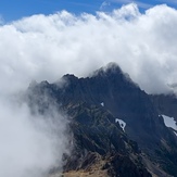
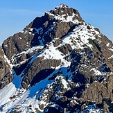
 Mount Ellinor
Weather Forecast, United StatesIssued: 10 pm Fri 18 Apr Local TimeUpdates in: hr min sUpdate imminent
Mount Ellinor Weather Forecast, United States
Issued: 10 pm Fri 18 Apr Local Time
Updates in:
Update imminent hr min s

Issued: 10 pm Fri 18 Apr Local Time
Updates in:
Update imminent hr min s
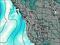
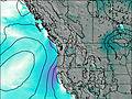
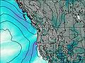
Days 1–4 Weather SummaryMostly dry. Freeze-thaw conditions (max 7°C on Fri night, min -5°C on Sun night). Wind will be generally light. | Days 5–7 Weather SummaryMostly dry. Freeze-thaw conditions (max 4°C on Wed night, min -4°C on Mon night). Wind will be generally light. | ||||||||||||||||||
Saturday 19 | Sunday 20 | Monday 21 | Tuesday 22 | Wednesday 23 | Thursday 24 | ||||||||||||||
night | AM | PM | night | AM | PM | night | AM | PM | night | AM | PM | night | AM | PM | night | AM | PM | night | |
rain shwrs | some clouds | some clouds | some clouds | some clouds | some clouds | some clouds | some clouds | cloudy | some clouds | some clouds | some clouds | some clouds | clear | some clouds | clear | cloudy | cloudy | light rain | |
km/h | |||||||||||||||||||
 |  |  |  |  |  |  | |||||||||||||
— | — | — | — | — | — | — | — | — | — | — | — | — | — | — | — | — | — | — | |
0.1 | — | — | — | — | — | — | — | — | — | — | — | — | — | — | — | — | — | 0.5 | |
max°C | 7 | 0 | 2 | 0 | -3 | -2 | -4 | -4 | -2 | -3 | -3 | -1 | -1 | -1 | 3 | 4 | 4 | 4 | 2 |
min°C | 1 | 0 | 1 | -3 | -4 | -2 | -5 | -5 | -3 | -4 | -4 | -2 | -1 | -1 | 2 | 2 | 4 | 4 | -2 |
-3 | -3 | -1 | -7 | -9 | -6 | -10 | -9 | -6 | -7 | -6 | -2 | -3 | -1 | 2 | 2 | 2 | 1 | -9 | |
2350 | 1850 | 2000 | 1250 | 1300 | 1550 | 850 | 1200 | 1400 | 1100 | 1250 | 1500 | 1500 | 1650 | 2250 | 2400 | 2400 | 2250 | 1750 | |
Cloud base (m) | 2350 | 750 | 1800 | 750 | 700 | 900 | 600 | 700 | 1600 | 650 | 700 | 800 | 950 | 950 | 1900 | 9000 | 6450 | 2850 | 2100 |
— | 6:16 | — | — | 6:15 | — | — | 6:13 | — | — | 6:11 | — | — | 6:09 | — | — | 6:07 | — | — | |
— | — | — | 8:07 | — | — | 8:08 | — | — | 8:09 | — | — | 8:10 | — | — | 8:13 | — | — | 8:14 | |
Loading...
Mount Ellinor Weather (Days 0-3):
The weather forecast for Mount Ellinor is: Mostly dry. Freeze-thaw conditions (max 7°C on Fri night, min -5°C on Sun night). Wind will be generally light.
Mount Ellinor Weather (Days 3-6):
Mostly dry. Freeze-thaw conditions (max 4°C on Wed night, min -4°C on Mon night). Wind will be generally light.
This table gives the weather forecast for Mount Ellinor at the specific elevation of 1812 m. Our advanced weather models allow us to provide distinct weather forecasts for several elevations of Mount Ellinor. To see the weather forecasts for the other elevations, use the tab navigation above the table. For a wider overview of the weather, consult the Weather Map of Washington.
| Weather Station | Temp. | Weather | Wind | Gusts | Cloud / Visibility |
|---|---|---|---|---|---|
BUOY-46123 | |||||
Bremerton National Airport | |||||
BUOY-46122 | |||||
BUOY-BMTW1 | |||||
BUOY-WPOW1 | |||||
* NOTE: not all weather observatories update at the same frequency which is the reason why some locations may show data from stations that are further away than known closer ones.
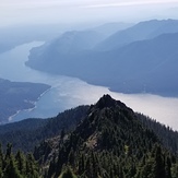
Mount Ellinor Photos
View all
Olympic Mountains photos (15) |
Pacific Coast Ranges photos (1000) |
photos from mountains in United States (2885) |
all photos
 Upload new photo
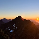
Mt Washington
Sunrise on Mt Washington
Mount Ellinor
Mt Washington
Descending back into smoke

