
– Lat/Long: 50.76° N 115.10° W
 Mount Evan-Thomas
Weather Forecast, CanadaIssued: 5 am Thu 17 Apr Local TimeUpdates in: 4hr 55min 19sUpdate imminent
Issued: 5 am Thu 17 Apr Local Time
Updates in:
Update imminent 4hr 55min 19s

Issued: 5 am Thu 17 Apr Local Time
Updates in:
Update imminent 4hr 55min 19s
Days 1–3 Weather SummaryA heavy fall of snow, heaviest during Sat night. Temperatures will be below freezing (max 0°C on Fri night, min -14°C on Thu morning). Winds decreasing (fresh winds from the WSW on Fri night, calm by Sat night). | Days 4–6 Weather SummaryA heavy fall of snow, heaviest during Sun afternoon. Temperatures will be well below freezing (max -10°C on Sun afternoon, min -12°C on Sun night). Wind will be generally light. | |||||||||||||||||
Thursday 17 | Friday 18 | Saturday 19 | Sunday 20 | Monday 21 | Tuesday 22 | |||||||||||||
AM | PM | night | AM | PM | night | AM | PM | night | AM | PM | night | AM | PM | night | AM | PM | night | |
light snow | snow shwrs | snow shwrs | clear | clear | some clouds | light snow | snow shwrs | heavy snow | light snow | heavy snow | heavy snow | light snow | mod. snow | heavy snow | light snow | mod. snow | snow shwrs | |
mph | ||||||||||||||||||
 |  |  |  |  |  | |||||||||||||
0.4 | 1 | 0.4 | — | — | — | 1 | 2 | 5 | 2 | 4 | 6 | 1 | 2 | 6 | 1 | 2 | 0.4 | |
— | — | — | — | — | — | — | — | — | — | — | — | — | — | — | — | — | — | |
max°F | 9 | 12 | 18 | 25 | 30 | 32 | 21 | 21 | 19 | 12 | 14 | 12 | 10 | 12 | 12 | 10 | 12 | 14 |
min°F | 7 | 10 | 12 | 21 | 27 | 25 | 19 | 19 | 14 | 12 | 12 | 10 | 10 | 12 | 10 | 10 | 12 | 12 |
-4 | -6 | 1 | 14 | 19 | 14 | 9 | 7 | 14 | 5 | 12 | 10 | 10 | 5 | 1 | 3 | 12 | 12 | |
3800 | 5200 | 3000 | 5700 | 8700 | 10200 | 7100 | 7100 | 5600 | 4600 | 5700 | 4100 | 4300 | 5400 | 4300 | 4600 | 5400 | 3400 | |
Cloud base (ft) | 8400 | 9400 | 7400 | 7200 | — | 22500 | 8200 | 7400 | 7400 | 7200 | 7400 | 7200 | 7200 | 7400 | 7400 | 7400 | 7500 | 7400 |
6:41 | — | — | 6:39 | — | — | 6:37 | — | — | 6:35 | — | — | 6:33 | — | — | 6:31 | — | — | |
— | 8:37 | — | — | 8:39 | — | — | 8:40 | — | — | 8:43 | — | — | 8:44 | — | — | 8:45 | — | |
Days 7-12 Weather Summary
Interested in the 12-day Forecast? Unlock the full forecast and many more features by becoming a Pro member.
 MountainPro
Your membership benefits:
- Expert mountain forecasts
- 12 day forecast
- Hourly forecast detail
- Offline mapping (app only)
- Unlock our mobile app
- Remove ads
Mount Evan-Thomas Weather (Days 0-3):
The weather forecast for Mount Evan-Thomas is: A heavy fall of snow, heaviest during Sat night. Temperatures will be below freezing (max 0°C on Fri night, min -14°C on Thu morning). Winds decreasing (fresh winds from the WSW on Fri night, calm by Sat night).
Mount Evan-Thomas Weather (Days 3-6):
A heavy fall of snow, heaviest during Sun afternoon. Temperatures will be well below freezing (max -10°C on Sun afternoon, min -12°C on Sun night). Wind will be generally light.
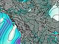
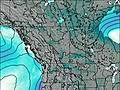
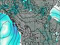
This table gives the weather forecast for Mount Evan-Thomas at the specific elevation of 3098 m. Our advanced weather models allow us to provide distinct weather forecasts for several elevations of Mount Evan-Thomas. To see the weather forecasts for the other elevations, use the tab navigation above the table. For a wider overview of the weather, consult the Weather Map of Alberta.
| Weather Station | Temp. | Weather | Wind | Gusts | Cloud / Visibility |
|---|---|---|---|---|---|
Nakiska Ridgetop- Alta | |||||
BowValley-Alta | |||||
Banff Airport | |||||
BanffCs-Alta | |||||
* NOTE: not all weather observatories update at the same frequency which is the reason why some locations may show data from stations that are further away than known closer ones.

