
– Lat/Long: 49.12° N 113.94° W
 Mount Galwey
Weather Forecast, CanadaIssued: 5 pm Mon 15 Jun Local TimeUpdates in: hr min sUpdate imminent
Issued: 5 pm Mon 15 Jun Local Time
Updates in:
Update imminent hr min s

Issued: 5 pm Mon 15 Jun Local Time
Updates in:
Update imminent hr min s
Days 1–4 Weather SummaryModerate rain (total 13mm) heaviest on Wed afternoon, then becoming colder with a dusting of snow on Wed night. Very mild (max 13°C on Mon afternoon, min 2°C on Wed night). Winds decreasing (gales from the W on Tue afternoon, calm by Wed night). | Days 5–7 Weather SummaryHeavy rain (total 23mm), heaviest during Sat afternoon. Very mild (max 11°C on Sat morning, min 1°C on Sun morning). Wind will be generally light. | ||||||||||||||||
Mon 15 | Tuesday 16 | Wednesday 17 | Thursday 18 | Friday 19 | Saturday 20 | ||||||||||||
PM | night | AM | PM | night | AM | PM | night | AM | PM | night | AM | PM | night | AM | PM | night | |
some clouds | some clouds | clear | clear | rain shwrs | rain shwrs | rain shwrs | snow shwrs | rain shwrs | rain shwrs | rain shwrs | clear | rain shwrs | rain shwrs | rain shwrs | risk tstorm | mod. rain | |
km/h | |||||||||||||||||
 |  |  |  |  |  | ||||||||||||
— | — | — | — | — | — | — | 4 | — | — | — | — | — | — | — | — | — | |
— | — | — | — | 4 | 0.9 | 7 | 0.6 | 0.1 | 0.7 | 0.8 | — | 1.2 | 0.6 | 0.1 | 12 | 8 | |
max °C | 13 | 12 | 12 | 12 | 4 | 5 | 4 | 3 | 7 | 10 | 7 | 9 | 10 | 9 | 11 | 10 | 5 |
min °C | 13 | 10 | 11 | 10 | 3 | 4 | 4 | 2 | 5 | 7 | 5 | 7 | 10 | 8 | 10 | 7 | 2 |
11 | 6 | 7 | 6 | -2 | 1 | 3 | -2 | 3 | 4 | 5 | 5 | 10 | 7 | 8 | 5 | -3 | |
4100 | 4200 | 4050 | 4000 | 2800 | 2900 | 3000 | 2750 | 3150 | 3300 | 3350 | 3650 | 3850 | 4000 | 3900 | 3900 | 3200 | |
Cloud base (m) | 3550 | 4400 | 3950 | 2000 | 2350 | 2000 | 3000 | 1950 | 1950 | 1950 | 6350 | 2000 | |||||
— | — | 5:30 | — | — | 5:30 | — | — | 5:30 | — | — | 5:30 | — | — | 5:30 | — | — | |
— | 9:42 | — | — | 9:42 | — | — | 9:43 | — | — | 9:43 | — | — | 9:43 | — | — | 9:44 | |
Loading...
Mount Galwey Weather (Days 0-3):
The weather forecast for Mount Galwey is: Moderate rain (total 13mm) heaviest on Wed afternoon, then becoming colder with a dusting of snow on Wed night. Very mild (max 13°C on Mon afternoon, min 2°C on Wed night). Winds decreasing (gales from the W on Tue afternoon, calm by Wed night).
Mount Galwey Weather (Days 3-6):
Heavy rain (total 23mm), heaviest during Sat afternoon. Very mild (max 11°C on Sat morning, min 1°C on Sun morning). Wind will be generally light.
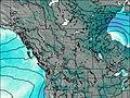
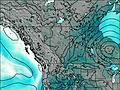
This table gives the weather forecast for Mount Galwey at the specific elevation of 2377 m. Our advanced weather models allow us to provide distinct weather forecasts for several elevations of Mount Galwey. To see the weather forecasts for the other elevations, use the tab navigation above the table. For a wider overview of the weather, consult the Weather Map of Alberta.
| Weather Station | Temp. | Weather | Wind | Gusts | Cloud / Visibility |
|---|---|---|---|---|---|
WatertonParkGate- Alta | |||||
Bullhorn Headwaters- Alta | |||||
Glenwood- Alta | |||||
Carway-Alta | |||||
Pincher Creek Airport | |||||
Pincher Creek Climate- Alta | |||||
Bullhorn Coulee Reservoir- Alta | |||||
Cardston- Alta |
* NOTE: not all weather observatories update at the same frequency which is the reason why some locations may show data from stations that are further away than known closer ones.