
– Lat/Long: 42.23° N 143.18° E
 Mount Hiroo
Weather Forecast, JapanIssued: 8 pm Fri 18 Apr Local TimeUpdates in: hr min sUpdate imminent
Mount Hiroo Weather Forecast, Japan
Issued: 8 pm Fri 18 Apr Local Time
Updates in:
Update imminent hr min s

Issued: 8 pm Fri 18 Apr Local Time
Updates in:
Update imminent hr min s
Days 1–4 Weather SummaryHeavy rain (total 22mm), heaviest during Fri night. Freeze-thaw conditions (max 9°C on Sun morning, min -1°C on Sun night). Winds decreasing (gales from the WSW on Sun afternoon, light winds from the NW by Mon afternoon). | Days 5–7 Weather SummaryModerate rain (total 16mm), heaviest on Tue night. Freeze-thaw conditions (max 9°C on Wed night, min 0°C on Mon night). Winds increasing (light winds from the WNW on Tue morning, near gales from the SSW by Tue night). | ||||||||||||||||||
Saturday 19 | Sunday 20 | Monday 21 | Tuesday 22 | Wednesday 23 | Thursday 24 | ||||||||||||||
night | AM | PM | night | AM | PM | night | AM | PM | night | AM | PM | night | AM | PM | night | AM | PM | night | |
rain shwrs | rain shwrs | cloudy | light rain | rain shwrs | rain shwrs | clear | some clouds | some clouds | clear | clear | cloudy | mod. rain | rain shwrs | clear | rain shwrs | light rain | rain shwrs | clear | |
km/h | |||||||||||||||||||
 |  |  |  |  |  |  | |||||||||||||
— | — | — | — | — | — | — | — | — | — | — | — | — | — | — | — | — | — | — | |
16 | 0.4 | — | 0.4 | 5 | 0.5 | — | — | — | — | — | — | 10 | 0.5 | — | 0.1 | 4 | 2.0 | — | |
max°C | 7 | 5 | 7 | 8 | 9 | 5 | 3 | 1 | 0 | 2 | 3 | 5 | 4 | 5 | 8 | 9 | 8 | 8 | 6 |
min°C | 3 | 4 | 7 | 7 | 7 | 4 | -1 | 0 | -1 | 0 | 2 | 5 | 3 | 3 | 7 | 6 | 8 | 8 | 1 |
-5 | -3 | 3 | 1 | 1 | -4 | -9 | -5 | -4 | -6 | -2 | 2 | -4 | -2 | 4 | 1 | 3 | 4 | -6 | |
2700 | 2200 | 2750 | 2850 | 2850 | 2500 | 1850 | 1450 | 1250 | 1100 | 2200 | 2900 | 2050 | 3100 | 3150 | 2900 | 2750 | 2750 | 2250 | |
Cloud base (m) | 250 | 200 | 200 | 2750 | 350 | 200 | 400 | 750 | 800 | 6750 | 6550 | 200 | 250 | 200 | 200 | 150 | |||
— | 4:41 | — | — | 4:39 | — | — | 4:37 | — | — | 4:35 | — | — | 4:35 | — | — | 4:33 | — | — | |
— | — | 6:12 | — | — | 6:13 | — | — | 6:14 | — | — | 6:15 | — | — | 6:16 | — | — | 6:17 | — | |
Loading...
Mount Hiroo Weather (Days 0-3):
The weather forecast for Mount Hiroo is: Heavy rain (total 22mm), heaviest during Fri night. Freeze-thaw conditions (max 9°C on Sun morning, min -1°C on Sun night). Winds decreasing (gales from the WSW on Sun afternoon, light winds from the NW by Mon afternoon).
Mount Hiroo Weather (Days 3-6):
Moderate rain (total 16mm), heaviest on Tue night. Freeze-thaw conditions (max 9°C on Wed night, min 0°C on Mon night). Winds increasing (light winds from the WNW on Tue morning, near gales from the SSW by Tue night).
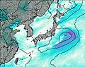
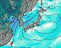
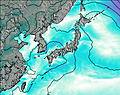
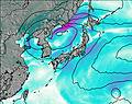
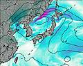
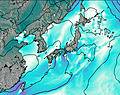
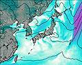
This table gives the weather forecast for Mount Hiroo at the specific elevation of 1231 m. Our advanced weather models allow us to provide distinct weather forecasts for several elevations of Mount Hiroo. To see the weather forecasts for the other elevations, use the tab navigation above the table. For a wider overview of the weather, consult the Weather Map of Japan.
| Weather Station | Temp. | Weather | Wind | Gusts | Cloud / Visibility |
|---|---|---|---|---|---|
lightning 14km SE of Shizunai | |||||
SHIP2189 | |||||
lightning 31km ENE of Chitose | |||||
SHIP2530 | |||||
SHIP3604 | |||||
SHIP10423 | |||||
SHIP3989 | |||||
SHIP6699 | |||||
SHIP3083 | |||||
SHIP5763 |
* NOTE: not all weather observatories update at the same frequency which is the reason why some locations may show data from stations that are further away than known closer ones.

