– Lat/Long: 49.42° N 124.92° W
 Mount Joan
Weather Forecast, CanadaIssued: 4 am Sat 19 Apr Local TimeUpdates in: hr min sUpdate imminent
Mount Joan Weather Forecast, Canada
Issued: 4 am Sat 19 Apr Local Time
Updates in:
Update imminent hr min s

Issued: 4 am Sat 19 Apr Local Time
Updates in:
Update imminent hr min s
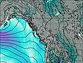
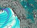
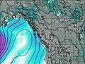
Days 1–3 Weather SummaryA light covering of new snow mostly falling on Sun night. Temperatures will be below freezing (max 0°C on Sat morning, min -4°C on Mon morning). Wind will be generally light. | Days 4–6 Weather SummaryA dusting of new snow. Freeze-thaw conditions (max 4°C on Thu afternoon, min -3°C on Tue morning). Winds increasing (calm on Tue night, fresh winds from the SSW by Thu night). | |||||||||||||||||
Saturday 19 | Sunday 20 | Monday 21 | Tuesday 22 | Wednesday 23 | Thursday 24 | |||||||||||||
AM | PM | night | AM | PM | night | AM | PM | night | AM | PM | night | AM | PM | night | AM | PM | night | |
clear | cloudy | cloudy | light snow | snow shwrs | snow shwrs | some clouds | cloudy | snow shwrs | clear | some clouds | some clouds | clear | clear | some clouds | cloudy | some clouds | light snow | |
km/h | ||||||||||||||||||
 |  |  |  |  |  | |||||||||||||
— | — | — | 2.0 | 1.0 | 2.0 | — | — | 1.0 | — | — | — | — | — | — | — | — | 1.0 | |
— | — | — | — | — | — | — | — | — | — | — | — | — | — | — | — | — | — | |
max°C | 0 | 0 | 0 | -3 | -2 | -3 | -4 | -3 | -2 | -3 | 0 | 0 | -1 | 2 | 3 | 3 | 4 | 3 |
min°C | -1 | -1 | -2 | -3 | -2 | -3 | -4 | -3 | -3 | -3 | -1 | -1 | -1 | 2 | 3 | 3 | 4 | -3 |
-4 | -3 | -4 | -3 | -4 | -7 | -6 | -3 | -5 | -6 | -3 | -1 | -1 | 2 | 3 | 0 | 0 | -10 | |
1450 | 1550 | 1250 | 1150 | 1250 | 1050 | 1050 | 1250 | 1050 | 1200 | 1650 | 1400 | 1400 | 2000 | 2050 | 2050 | 2100 | 1350 | |
Cloud base (m) | 550 | 750 | 450 | 400 | 450 | 750 | 700 | 700 | 800 | 650 | 950 | 1500 | 950 | 1850 | 6500 | 5300 | 4750 | 2150 |
6:20 | — | — | 6:18 | — | — | 6:16 | — | — | 6:13 | — | — | 6:11 | — | — | 6:09 | — | — | |
— | — | 8:17 | — | — | 8:19 | — | — | 8:21 | — | — | 8:22 | — | — | 8:23 | — | — | 8:24 | |
Loading...
Mount Joan Weather (Days 0-3):
The weather forecast for Mount Joan is: A light covering of new snow mostly falling on Sun night. Temperatures will be below freezing (max 0°C on Sat morning, min -4°C on Mon morning). Wind will be generally light.
Mount Joan Weather (Days 3-6):
A dusting of new snow. Freeze-thaw conditions (max 4°C on Thu afternoon, min -3°C on Tue morning). Winds increasing (calm on Tue night, fresh winds from the SSW by Thu night).
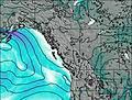
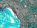
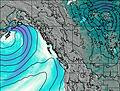
This table gives the weather forecast for Mount Joan at the specific elevation of 1556 m. Our advanced weather models allow us to provide distinct weather forecasts for several elevations of Mount Joan. To see the weather forecasts for the other elevations, use the tab navigation above the table. For a wider overview of the weather, consult the Weather Map of British-Columbia.
| Weather Station | Temp. | Weather | Wind | Gusts | Cloud / Visibility |
|---|---|---|---|---|---|
Port Alberni (Aut)- BC | |||||
Comox Millitary Base Airport | |||||
Cfb - Comox- BC | |||||
Sisters Il Airport | |||||
* NOTE: not all weather observatories update at the same frequency which is the reason why some locations may show data from stations that are further away than known closer ones.
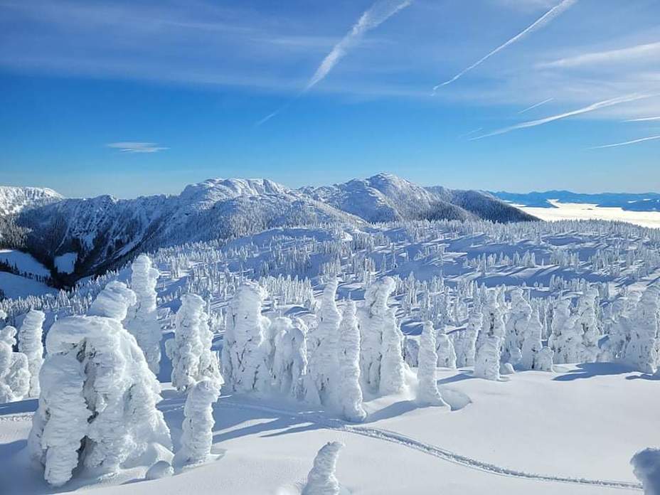
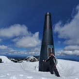
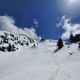
Mount Joan Photos
View all
Vancouver Island Ranges photos (45) |
Pacific Coast Ranges photos (1000) |
photos from mountains in Canada (441) |
all photos
 Upload new photo
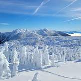

Mount Joan from Mount apps
Mount Joan side of the square head
Repeater on Mount joan
Joan bowl port alberni side

