– Lat/Long: 36.52° N 118.30° W
 Mount Langley
Weather Forecast, United StatesIssued: 10 pm Tue 15 Apr Local TimeUpdates in: hr min sUpdate imminent
Mount Langley Weather Forecast, United States
Issued: 10 pm Tue 15 Apr Local Time
Updates in:
Update imminent hr min s

Issued: 10 pm Tue 15 Apr Local Time
Updates in:
Update imminent hr min s
Days 1–4 Weather SummaryA moderate fall of snow, heaviest on Thu afternoon. Temperatures will be below freezing (max -5°C on Tue night, min -10°C on Thu night). Winds increasing (light winds from the E on Wed afternoon, strong winds from the N by Fri afternoon). | Days 5–7 Weather SummaryA light covering of new snow mostly falling on Mon afternoon. Temperatures will be below freezing (max -3°C on Sat afternoon, min -8°C on Fri night). Winds decreasing (strong winds from the N on Fri night, calm by Mon morning). | ||||||||||||||||||
Wednesday 16 | Thursday 17 | Friday 18 | Saturday 19 | Sunday 20 | Monday 21 | ||||||||||||||
night | AM | PM | night | AM | PM | night | AM | PM | night | AM | PM | night | AM | PM | night | AM | PM | night | |
cloudy | some clouds | light snow | snow shwrs | light snow | mod. snow | snow shwrs | clear | some clouds | clear | clear | clear | clear | clear | snow shwrs | clear | clear | mod. snow | snow shwrs | |
km/h | |||||||||||||||||||
 |  |  |  |  |  |  | |||||||||||||
— | — | 1.0 | 2.0 | 1.0 | 8 | 3 | — | — | — | — | — | — | — | 1.0 | — | — | 8 | 2.0 | |
— | — | — | — | — | — | — | — | — | — | — | — | — | — | — | — | — | — | — | |
max°C | -5 | -7 | -6 | -8 | -9 | -7 | -9 | -8 | -6 | -7 | -4 | -3 | -5 | -4 | -3 | -4 | -4 | -3 | -5 |
min°C | -7 | -7 | -7 | -9 | -9 | -8 | -10 | -10 | -7 | -8 | -7 | -3 | -6 | -5 | -3 | -6 | -6 | -6 | -5 |
-13 | -12 | -10 | -15 | -16 | -14 | -20 | -20 | -16 | -16 | -13 | -8 | -12 | -11 | -8 | -8 | -6 | -11 | -9 | |
3500 | 3500 | 3450 | 3050 | 3100 | 3350 | 2850 | 3050 | 3350 | 2900 | 3600 | 3850 | 3450 | 3750 | 3900 | 3550 | 3800 | 3450 | 3600 | |
Cloud base (m) | 5950 | 5400 | 3050 | 3000 | 4700 | 4000 | 3050 | ||||||||||||
— | 6:18 | — | — | 6:16 | — | — | 6:15 | — | — | 6:13 | — | — | 6:13 | — | — | 6:11 | — | — | |
— | — | 7:28 | — | — | 7:28 | — | — | 7:29 | — | — | 7:30 | — | — | 7:30 | — | — | 7:31 | — | |
Loading...
Mount Langley Weather (Days 0-3):
The weather forecast for Mount Langley is: A moderate fall of snow, heaviest on Thu afternoon. Temperatures will be below freezing (max -5°C on Tue night, min -10°C on Thu night). Winds increasing (light winds from the E on Wed afternoon, strong winds from the N by Fri afternoon).
Mount Langley Weather (Days 3-6):
A light covering of new snow mostly falling on Mon afternoon. Temperatures will be below freezing (max -3°C on Sat afternoon, min -8°C on Fri night). Winds decreasing (strong winds from the N on Fri night, calm by Mon morning).
This table gives the weather forecast for Mount Langley at the specific elevation of 4275 m. Our advanced weather models allow us to provide distinct weather forecasts for several elevations of Mount Langley. To see the weather forecasts for the other elevations, use the tab navigation above the table. For a wider overview of the weather, consult the Weather Map of California.
| Weather Station | Temp. | Weather | Wind | Gusts | Cloud / Visibility |
|---|---|---|---|---|---|
Bishop Airport | |||||
Visalia Municipal Airport | |||||
Hanford Airport | |||||
Delano Airport (California) | |||||
Bakersfield Airport |
* NOTE: not all weather observatories update at the same frequency which is the reason why some locations may show data from stations that are further away than known closer ones.
Mount Langley Photos
View all
photos (127) |
Sierra Nevada photos (197) |
photos from mountains in United States (2882) |
all photos
 Upload new photo
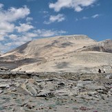
 See 9 more Mount Langley photos
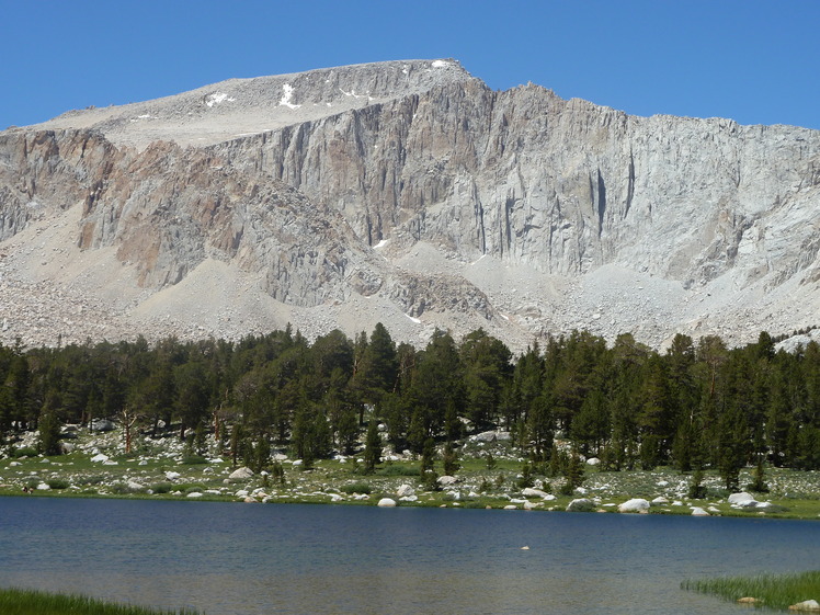
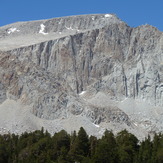
Mount Langley
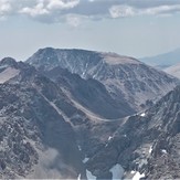
Mt. Langley
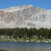
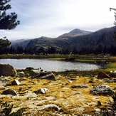
Dreamy Langley
Mount Langley
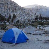
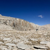
Approaching Summit from Old Army

