
– Lat/Long: 42.98° S 146.17° E
 Mount Lloyd Jones
Weather Forecast, AustraliaIssued: 3 pm Fri 25 Apr Local TimeUpdates in: hr min sUpdate imminent
Mount Lloyd Jones Weather Forecast, Australia
Issued: 3 pm Fri 25 Apr Local Time
Updates in:
Update imminent hr min s

Issued: 3 pm Fri 25 Apr Local Time
Updates in:
Update imminent hr min s
Days 1–4 Weather SummaryModerate rain (total 13mm), heaviest on Fri night. Very mild (max 15°C on Fri afternoon, min 8°C on Sun night). Wind will be generally light. | Days 5–7 Weather SummaryLight rain (total 9mm), mostly falling on Mon night. Very mild (max 14°C on Mon afternoon, min 5°C on Tue night). Wind will be generally light. | ||||||||||||||||
Fri 25 | Saturday 26 | Sunday 27 | Monday 28 | Tuesday 29 | Wednesday 30 | ||||||||||||
PM | night | AM | PM | night | AM | PM | night | AM | PM | night | AM | PM | night | AM | PM | night | |
light rain | heavy rain | light rain | rain shwrs | rain shwrs | light rain | rain shwrs | some clouds | cloudy | cloudy | mod. rain | cloudy | rain shwrs | rain shwrs | light rain | some clouds | some clouds | |
km/h | |||||||||||||||||
 |  |  |  |  |  | ||||||||||||
— | — | — | — | — | — | — | — | — | — | — | — | — | — | — | — | — | |
0.5 | 11 | 0.4 | 0.1 | 0.2 | 0.3 | 1.0 | — | — | — | 9 | — | 0.2 | 0.1 | 0.2 | — | — | |
max°C | 15 | 13 | 12 | 13 | 10 | 13 | 13 | 11 | 14 | 14 | 11 | 10 | 10 | 7 | 11 | 10 | 6 |
min°C | 14 | 11 | 12 | 11 | 9 | 12 | 11 | 8 | 12 | 12 | 9 | 9 | 7 | 5 | 9 | 7 | 5 |
14 | 11 | 12 | 11 | 9 | 12 | 11 | 8 | 12 | 12 | 8 | 7 | 7 | 5 | 9 | 7 | 5 | |
2650 | 2400 | 2550 | 2700 | 3300 | 3200 | 2750 | 2350 | 2300 | 2200 | 1950 | 1150 | 1250 | 1000 | 1200 | 1250 | 1500 | |
Cloud base (m) | 400 | 300 | 350 | 450 | 450 | 400 | 850 | 900 | 900 | 300 | 600 | 750 | 750 | 750 | 800 | 750 | |
— | — | 6:58 | — | — | 7:00 | — | — | 7:01 | — | — | 7:01 | — | — | 7:03 | — | — | |
5:28 | — | — | 5:25 | — | — | 5:24 | — | — | 5:22 | — | — | 5:22 | — | — | 5:21 | — | |
Loading...
Mount Lloyd Jones Weather (Days 0-3):
The weather forecast for Mount Lloyd Jones is: Moderate rain (total 13mm), heaviest on Fri night. Very mild (max 15°C on Fri afternoon, min 8°C on Sun night). Wind will be generally light.
Mount Lloyd Jones Weather (Days 3-6):
Light rain (total 9mm), mostly falling on Mon night. Very mild (max 14°C on Mon afternoon, min 5°C on Tue night). Wind will be generally light.
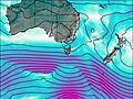
This table gives the weather forecast for Mount Lloyd Jones at the specific elevation of 116 m. Our advanced weather models allow us to provide distinct weather forecasts for several elevations of Mount Lloyd Jones. To see the weather forecasts for the other elevations, use the tab navigation above the table. For a wider overview of the weather, consult the Weather Map of Tasmania.
| Weather Station | Temp. | Weather | Wind | Gusts | Cloud / Visibility |
|---|---|---|---|---|---|
Hartz Mountains (Keoghs Pimple) | |||||
BushyPark(Bushy Park Estates) | |||||
Ouse Fire Station | |||||
Maatsuyker Island Lighthouse | |||||
* NOTE: not all weather observatories update at the same frequency which is the reason why some locations may show data from stations that are further away than known closer ones.

