
– Lat/Long: 54.43° S 36.55° W
 Mount Paget (Allardyce Range)
Weather Forecast, South Georgia and the South Sandwich IslandsIssued: 9 pm Tue 01 Apr Local TimeUpdates in: hr min sUpdate imminent
Mount Paget (Allardyce Range) Weather Forecast, South Georgia and the South Sandwich Islands
Issued: 9 pm Tue 01 Apr Local Time
Updates in:
Update imminent hr min s

Issued: 9 pm Tue 01 Apr Local Time
Updates in:
Update imminent hr min s
Days 1–4 Weather SummaryMild at first with light rain (total 5mm) on Wed afternoon followed by colder weather and light fall of snow, heaviest on Wed night. Freeze-thaw conditions (max 3°C on Wed afternoon, min -10°C on Thu night). Winds decreasing (gales from the WNW on Wed morning, light winds from the S by Thu morning). | Days 5–7 Weather SummaryMostly dry. Freeze-thaw conditions (max 5°C on Mon afternoon, min -10°C on Fri night). Wind will be generally light. | Days 8–10 Weather SummarySome drizzle, heaviest during Thu afternoon. Mild temperatures (max 7°C on Wed morning, min 5°C on Mon night). Winds increasing (light winds from the W on Mon night, strong winds from the WNW by Thu afternoon). | Days 11–13 Weather SummaryMild at first with light rain (total 8mm) on Fri morning followed by colder weather and light fall of snow, heaviest on Sat night. Freeze-thaw conditions (max 5°C on Thu night, min -8°C on Sat night). Mainly strong winds. | |||||||||||||||||||||||||||||||||
Wednesday 2 | Thursday 3 | Friday 4 | Saturday 5 | Sunday 6 | Monday 7 | Tuesday 8 | Wednesday 9 | Thursday 10 | Friday 11 | Saturday 12 | Sun 13 | |||||||||||||||||||||||||
night | AM | PM | night | AM | PM | night | AM | PM | night | AM | PM | night | AM | PM | night | AM | PM | night | AM | PM | night | AM | PM | night | AM | PM | night | AM | PM | night | AM | PM | night | AM | PM | |
snow shwrs | light snow | light rain | light snow | cloudy | cloudy | snow shwrs | light snow | some clouds | clear | clear | clear | some clouds | some clouds | clear | clear | clear | clear | clear | clear | clear | clear | clear | clear | clear | rain shwrs | rain shwrs | light rain | light rain | cloudy | snow shwrs | snow shwrs | light snow | mod. snow | snow shwrs | some clouds | |
km/h | ||||||||||||||||||||||||||||||||||||
 |  |  |  |  |  |  |  |  |  |  |  |  | ||||||||||||||||||||||||
3 | 3 | — | 4 | — | — | 1.0 | 4 | — | — | — | — | — | — | — | — | — | — | — | — | — | — | — | — | — | — | — | — | — | — | 1.0 | 3 | 4 | 10 | 1.0 | — | |
— | — | 5 | — | — | — | — | — | — | — | — | — | — | — | — | — | — | — | — | — | — | — | — | — | — | 0.1 | 1.0 | 4 | 4 | — | — | — | — | — | — | — | |
max°C | -2 | 2 | 3 | 1 | -7 | -9 | -9 | -9 | -10 | -8 | -5 | -4 | -2 | -1 | -1 | 2 | 4 | 5 | 5 | 6 | 6 | 6 | 7 | 7 | 7 | 6 | 6 | 5 | 3 | 1 | -2 | -7 | -7 | -7 | -8 | -8 |
min°C | -8 | 2 | 3 | -5 | -8 | -9 | -10 | -10 | -10 | -10 | -6 | -5 | -3 | -2 | -1 | 0 | 3 | 4 | 5 | 5 | 6 | 6 | 7 | 7 | 6 | 6 | 6 | 4 | 2 | 0 | -7 | -7 | -7 | -8 | -8 | -8 |
-17 | -6 | -5 | -10 | -13 | -15 | -16 | -18 | -18 | -17 | -10 | -11 | -9 | -8 | -6 | -4 | 0 | 1 | 1 | 0 | 1 | 1 | 4 | 4 | 2 | 1 | 1 | -2 | -3 | -5 | -15 | -16 | -16 | -16 | -16 | -15 | |
0 | 1350 | 1450 | 750 | 0 | 0 | 0 | 0 | 0 | 0 | 0 | 0 | 0 | 550 | 650 | 1100 | 2300 | 2650 | 3150 | 3050 | 3000 | 2850 | 2650 | 2650 | 2550 | 2500 | 2150 | 2050 | 1850 | 1350 | 500 | 150 | 100 | 0 | 0 | 0 | |
Cloud base (m) | 450 | 550 | 400 | 450 | 450 | 450 | 450 | 450 | 450 | 500 | 500 | 500 | 500 | 500 | 550 | 550 | 550 | 550 | 500 | 550 | 500 | 500 | 550 | 550 | 550 | 500 | 450 | 450 | 500 | 450 | 450 | 450 | 450 | 500 | 500 | |
— | 6:50 | — | — | 6:52 | — | — | 6:54 | — | — | 6:56 | — | — | 6:58 | — | — | 7:01 | — | — | 7:03 | — | — | 7:05 | — | — | 7:05 | — | — | 7:07 | — | — | 7:09 | — | — | 7:11 | — | |
— | — | 6:06 | — | — | 6:04 | — | — | 6:00 | — | — | 5:59 | — | — | 5:55 | — | — | 5:53 | — | — | 5:51 | — | — | 5:49 | — | — | 5:46 | — | — | 5:44 | — | — | 5:42 | — | — | 5:38 | |
Mount Paget (Allardyce Range) Weather (Days 0-3):
The weather forecast for Mount Paget (Allardyce Range) is: Mild at first with light rain (total 5mm) on Wed afternoon followed by colder weather and light fall of snow, heaviest on Wed night. Freeze-thaw conditions (max 3°C on Wed afternoon, min -10°C on Thu night). Winds decreasing (gales from the WNW on Wed morning, light winds from the S by Thu morning).
Mount Paget (Allardyce Range) Weather (Days 3-6):
Mostly dry. Freeze-thaw conditions (max 5°C on Mon afternoon, min -10°C on Fri night). Wind will be generally light.
Mount Paget (Allardyce Range) Weather (Days 6-9):
Some drizzle, heaviest during Thu afternoon. Mild temperatures (max 7°C on Wed morning, min 5°C on Mon night). Winds increasing (light winds from the W on Mon night, strong winds from the WNW by Thu afternoon).
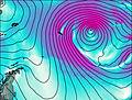
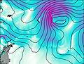
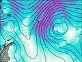
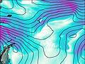
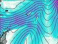
This table gives the weather forecast for Mount Paget (Allardyce Range) at the specific elevation of 1000 m. Our advanced weather models allow us to provide distinct weather forecasts for several elevations of Mount Paget (Allardyce Range). To see the weather forecasts for the other elevations, use the tab navigation above the table. For a wider overview of the weather, consult the Weather Map of South Georgia and the South Sandwich Islands.

