
– Lat/Long: 52.80° N 119.72° W
 Mount Sir Wilfrid Laurier
Weather Forecast, CanadaIssued: 5 pm Thu 02 Apr Local TimeUpdates in: hr min sUpdate imminent
Issued: 5 pm Thu 02 Apr Local Time
Updates in:
Update imminent hr min s

Issued: 5 pm Thu 02 Apr Local Time
Updates in:
Update imminent hr min s
Days 1–4 Weather SummaryA heavy fall of snow, heaviest during Fri night. Extremely cold (max -11°C on Sun morning, min -15°C on Fri night). Mainly fresh winds. | Days 5–7 Weather SummaryA moderate fall of snow, heaviest on Mon night. Temperatures will be well below freezing (max -7°C on Sun night, min -20°C on Tue morning). Winds decreasing (near gales from the SW on Mon night, calm by Wed morning). | ||||||||||||||||
Thu 2 | Friday 3 | Saturday 4 | Sunday 5 | Monday 6 | Tuesday 7 | ||||||||||||
PM | night | AM | PM | night | AM | PM | night | AM | PM | night | AM | PM | night | AM | PM | night | |
snow shwrs | some clouds | some clouds | cloudy | heavy snow | snow shwrs | light snow | cloudy | some clouds | some clouds | some clouds | some clouds | some clouds | mod. snow | snow shwrs | cloudy | cloudy | |
km/h | |||||||||||||||||
 |  |  |  |  |  | ||||||||||||
1 | — | — | — | 21 | 2 | 2 | — | — | — | — | — | — | 8 | 3 | — | — | |
— | — | — | — | — | — | — | — | — | — | — | — | — | — | — | — | — | |
max °C | -14 | -13 | -13 | -13 | -13 | -15 | -14 | -13 | -11 | -9 | -7 | -7 | -7 | -8 | -17 | -19 | -19 |
min °C | -14 | -13 | -13 | -13 | -15 | -15 | -14 | -14 | -12 | -10 | -8 | -7 | -8 | -12 | -20 | -20 | -20 |
-22 | -20 | -22 | -23 | -26 | -26 | -24 | -22 | -19 | -17 | -14 | -14 | -18 | -24 | -31 | -32 | -28 | |
1600 | 900 | 1250 | 1700 | 1450 | 1300 | 1600 | 1250 | 1350 | 1950 | 1500 | 2050 | 2450 | 2250 | 550 | 950 | 400 | |
Cloud base (m) | 2000 | 2000 | 2000 | 2000 | 2000 | 2200 | 2050 | 2350 | 2100 | 2000 | 2000 | 2000 | 2000 | 2000 | 2000 | 2550 | 2450 |
— | — | 7:28 | — | — | 7:26 | — | — | 7:24 | — | — | 7:20 | — | — | 7:18 | — | — | |
8:34 | — | — | 8:36 | — | — | 8:37 | — | — | 8:39 | — | — | 8:40 | — | — | 8:43 | — | |
Loading...
Mount Sir Wilfrid Laurier Weather (Days 0-3):
The weather forecast for Mount Sir Wilfrid Laurier is: A heavy fall of snow, heaviest during Fri night. Extremely cold (max -11°C on Sun morning, min -15°C on Fri night). Mainly fresh winds.
Mount Sir Wilfrid Laurier Weather (Days 3-6):
A moderate fall of snow, heaviest on Mon night. Temperatures will be well below freezing (max -7°C on Sun night, min -20°C on Tue morning). Winds decreasing (near gales from the SW on Mon night, calm by Wed morning).
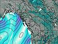
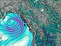
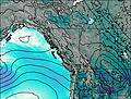
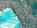
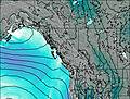
This table gives the weather forecast for Mount Sir Wilfrid Laurier at the specific elevation of 3516 m. Our advanced weather models allow us to provide distinct weather forecasts for several elevations of Mount Sir Wilfrid Laurier. To see the weather forecasts for the other elevations, use the tab navigation above the table. For a wider overview of the weather, consult the Weather Map of British-Columbia.
| Weather Station | Temp. | Weather | Wind | Gusts | Cloud / Visibility |
|---|---|---|---|---|---|
BlueRiverCs- BC | |||||
Jasper Warden Airport | |||||
Willow Creek 1- Alta | |||||
JasperWarden-Alta | |||||
Clearwater Auto- BC | |||||
Hendrickson Creek- Alta | |||||
Williams Lake Airport | |||||
WilliamsLakeA- BC |
* NOTE: not all weather observatories update at the same frequency which is the reason why some locations may show data from stations that are further away than known closer ones.