
– Lat/Long: 52.02° N 117.24° W
 Mount Spring-Rice
Weather Forecast, CanadaIssued: 5 am Sun 30 Mar Local TimeUpdates in: 3hr 28min 52sUpdate imminent
Issued: 5 am Sun 30 Mar Local Time
Updates in:
Update imminent 3hr 28min 52s

Issued: 5 am Sun 30 Mar Local Time
Updates in:
Update imminent 3hr 28min 52s
Days 1–3 Weather SummaryA light covering of new snow mostly falling on Tue afternoon. Extremely cold (max -11°C on Sun morning, min -15°C on Tue night). Wind will be generally light. | Days 4–6 Weather SummaryMostly dry. Temperatures will be below freezing (max -5°C on Fri night, min -15°C on Wed morning). Wind will be generally light. | Days 7–9 Weather SummaryMostly dry. Freeze-thaw conditions (max 3°C on Sun night, min -4°C on Sat morning). Wind will be generally light. | Days 10–12 Weather SummaryA dusting of new snow. Temperatures will be below freezing (max -1°C on Tue morning, min -9°C on Thu morning). Wind will be generally light. | |||||||||||||||||||||||||||||||||
Sunday 30 | Monday 31 | Tuesday 1 | Wednesday 2 | Thursday 3 | Friday 4 | Saturday 5 | Sunday 6 | Monday 7 | Tuesday 8 | Wednesday 9 | Thursday 10 | |||||||||||||||||||||||||
AM | PM | night | AM | PM | night | AM | PM | night | AM | PM | night | AM | PM | night | AM | PM | night | AM | PM | night | AM | PM | night | AM | PM | night | AM | PM | night | AM | PM | night | AM | PM | night | |
clear | clear | some clouds | cloudy | cloudy | some clouds | light snow | light snow | snow shwrs | some clouds | clear | some clouds | some clouds | some clouds | some clouds | some clouds | clear | clear | some clouds | clear | clear | clear | clear | clear | clear | clear | clear | clear | clear | some clouds | snow shwrs | cloudy | light snow | cloudy | some clouds | some clouds | |
mph | ||||||||||||||||||||||||||||||||||||
 |  |  |  |  |  |  |  |  |  |  |  | |||||||||||||||||||||||||
— | — | — | — | — | — | 0.4 | 2 | 2 | — | — | — | — | — | — | — | — | — | — | — | — | — | — | — | — | — | — | — | — | — | 0.4 | — | 1 | — | — | — | |
— | — | — | — | — | — | — | — | — | — | — | — | — | — | — | — | — | — | — | — | — | — | — | — | — | — | — | — | — | — | — | — | — | — | — | — | |
max°F | 12 | 12 | 12 | 12 | 12 | 12 | 9 | 10 | 9 | 5 | 9 | 9 | 7 | 10 | 10 | 10 | 14 | 23 | 27 | 30 | 32 | 36 | 36 | 37 | 36 | 36 | 32 | 30 | 28 | 28 | 23 | 25 | 23 | 18 | 19 | 27 |
min°F | 10 | 10 | 12 | 12 | 12 | 9 | 9 | 10 | 5 | 5 | 7 | 7 | 7 | 9 | 10 | 10 | 12 | 16 | 25 | 28 | 30 | 34 | 36 | 36 | 36 | 34 | 30 | 28 | 27 | 25 | 21 | 23 | 19 | 16 | 16 | 21 |
3 | 1 | 3 | 3 | 5 | -0 | -0 | -0 | -6 | -4 | -2 | -0 | -0 | -0 | 3 | 1 | 7 | 16 | 19 | 28 | 30 | 34 | 36 | 30 | 32 | 28 | 25 | 23 | 21 | 14 | 10 | 12 | 10 | 7 | 7 | 12 | |
2800 | 5400 | 2300 | 3800 | 5400 | 3900 | 4300 | 5400 | 3000 | 2800 | 4800 | 2600 | 3600 | 5200 | 3300 | 4600 | 6100 | 4400 | 5600 | 9000 | 10500 | 11200 | 11800 | 12000 | 11800 | 11600 | 10500 | 10200 | 9700 | 9800 | 8000 | 8900 | 7700 | 6600 | 7200 | 8400 | |
Cloud base (ft) | 6900 | 6900 | 6900 | 6900 | 6900 | 6900 | 6900 | 6900 | 6900 | 6900 | 7100 | 8700 | 7900 | 8500 | 9000 | 7700 | 8000 | 8200 | — | — | — | — | — | — | — | — | — | — | — | 11000 | 6900 | 9400 | 8700 | 6900 | 7100 | — |
7:28 | — | — | 7:26 | — | — | 7:24 | — | — | 7:22 | — | — | 7:18 | — | — | 7:16 | — | — | 7:15 | — | — | 7:11 | — | — | 7:09 | — | — | 7:07 | — | — | 7:05 | — | — | 7:03 | — | — | |
— | 8:17 | — | — | 8:20 | — | — | 8:22 | — | — | 8:23 | — | — | 8:24 | — | — | 8:27 | — | — | 8:29 | — | — | 8:30 | — | — | 8:31 | — | — | 8:34 | — | — | 8:36 | — | — | 8:37 | — | |
Mount Spring-Rice Weather (Days 0-3):
The weather forecast for Mount Spring-Rice is: A light covering of new snow mostly falling on Tue afternoon. Extremely cold (max -11°C on Sun morning, min -15°C on Tue night). Wind will be generally light.
Mount Spring-Rice Weather (Days 3-6):
Mostly dry. Temperatures will be below freezing (max -5°C on Fri night, min -15°C on Wed morning). Wind will be generally light.
Mount Spring-Rice Weather (Days 6-9):
Mostly dry. Freeze-thaw conditions (max 3°C on Sun night, min -4°C on Sat morning). Wind will be generally light.
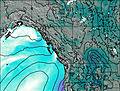
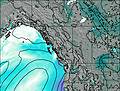
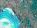
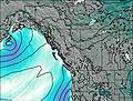
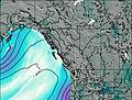
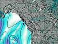
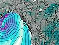
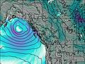
This table gives the weather forecast for Mount Spring-Rice at the specific elevation of 3276 m. Our advanced weather models allow us to provide distinct weather forecasts for several elevations of Mount Spring-Rice. To see the weather forecasts for the other elevations, use the tab navigation above the table. For a wider overview of the weather, consult the Weather Map of British-Columbia.
| Weather Station | Temp. | Weather | Wind | Gusts | Cloud / Visibility |
|---|---|---|---|---|---|
Golden Airport | |||||
Mount 7 | |||||
Yoho Park- BC | |||||
Nordegg Cs- Alta | |||||
Jasper Warden- Alta | |||||
Jasper Warden Airport | |||||
Revelstoke Airport | |||||
Revelstoke A- BC (71685 -0) | |||||
Blue River Airport |
* NOTE: not all weather observatories update at the same frequency which is the reason why some locations may show data from stations that are further away than known closer ones.

