– Lat/Long: 36.84° N 138.93° E
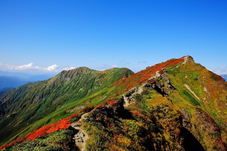
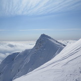
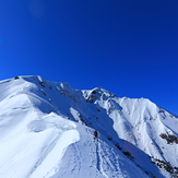
 Mount Tanigawa
Weather Forecast, JapanIssued: 8 am Sat 19 Apr Local TimeUpdates in: hr min sUpdate imminent
Mount Tanigawa Weather Forecast, Japan
Issued: 8 am Sat 19 Apr Local Time
Updates in:
Update imminent hr min s

Issued: 8 am Sat 19 Apr Local Time
Updates in:
Update imminent hr min s
Days 1–3 Weather SummaryLight rain (total 10mm), mostly falling on Sun afternoon. Very mild (max 18°C on Sat morning, min 4°C on Sun night). Wind will be generally light. | Days 4–6 Weather SummaryLight rain (total 5mm), mostly falling on Tue night. Very mild (max 16°C on Wed afternoon, min 4°C on Thu night). Wind will be generally light. | |||||||||||||||||
Saturday 19 | Sunday 20 | Monday 21 | Tuesday 22 | Wednesday 23 | Thursday 24 | |||||||||||||
AM | PM | night | AM | PM | night | AM | PM | night | AM | PM | night | AM | PM | night | AM | PM | night | |
clear | rain shwrs | some clouds | rain shwrs | rain shwrs | rain shwrs | clear | clear | clear | clear | some clouds | light rain | some clouds | some clouds | cloudy | rain shwrs | rain shwrs | rain shwrs | |
km/h | ||||||||||||||||||
 |  |  |  |  |  | |||||||||||||
— | — | — | — | — | — | — | — | — | — | — | — | — | — | — | — | — | — | |
— | 0.1 | — | 0.2 | 6 | 4 | — | — | — | — | — | 3 | — | — | — | 0.1 | 1.3 | 0.5 | |
max°C | 18 | 18 | 15 | 14 | 13 | 7 | 9 | 10 | 12 | 15 | 15 | 12 | 15 | 16 | 13 | 16 | 13 | 7 |
min°C | 16 | 17 | 14 | 14 | 9 | 4 | 6 | 10 | 9 | 14 | 13 | 10 | 13 | 14 | 12 | 15 | 10 | 4 |
16 | 17 | 14 | 14 | 7 | 0 | 3 | 8 | 8 | 14 | 12 | 8 | 13 | 14 | 12 | 15 | 8 | 0 | |
3250 | 3450 | 3700 | 3150 | 3050 | 2500 | 2600 | 3200 | 3650 | 3850 | 4050 | 3450 | 3900 | 3950 | 3800 | 3500 | 3300 | 2550 | |
Cloud base (m) | 9300 | 2900 | 9050 | 2400 | 9450 | 9200 | 8650 | 6900 | 1650 | 650 | 800 | 6500 | 6300 | 600 | ||||
5:05 | — | — | 5:03 | — | — | 5:03 | — | — | 5:01 | — | — | 5:00 | — | — | 4:58 | — | — | |
— | 6:21 | — | — | 6:22 | — | — | 6:22 | — | — | 6:23 | — | — | 6:24 | — | — | 6:25 | — | |
Loading...
Mount Tanigawa Weather (Days 0-3):
The weather forecast for Mount Tanigawa is: Light rain (total 10mm), mostly falling on Sun afternoon. Very mild (max 18°C on Sat morning, min 4°C on Sun night). Wind will be generally light.
Mount Tanigawa Weather (Days 3-6):
Light rain (total 5mm), mostly falling on Tue night. Very mild (max 16°C on Wed afternoon, min 4°C on Thu night). Wind will be generally light.
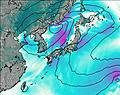
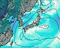
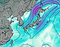
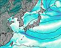
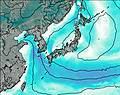
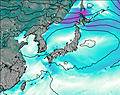
This table gives the weather forecast for Mount Tanigawa at the specific elevation of 1000 m. Our advanced weather models allow us to provide distinct weather forecasts for several elevations of Mount Tanigawa. To see the weather forecasts for the other elevations, use the tab navigation above the table. For a wider overview of the weather, consult the Weather Map of Japan.
Mount Tanigawa Photos
View all
Mikuni Mountains photos (5) |
Japanese Archipelago photos (284) |
photos from mountains in Japan (366) |
all photos
 Upload new photo
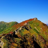

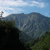
Okino-mimi
Oki Toma noMimi
twin peaks of Tanigawa dake in early autumn
Mount Tanigawa

