– Lat/Long: 53.78° S 71.02° W
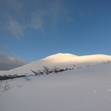
 Mount Tarn
Weather Forecast, ChileIssued: 2 am Sat 29 Mar Local TimeUpdates in: hr min sUpdate imminent
Mount Tarn Weather Forecast, Chile
Issued: 2 am Sat 29 Mar Local Time
Updates in:
Update imminent hr min s

Issued: 2 am Sat 29 Mar Local Time
Updates in:
Update imminent hr min s
Days 1–3 Weather SummaryMild at first with light rain (total 2mm) on Mon night followed by colder weather and light fall of snow, heaviest on Mon night. Freeze-thaw conditions (max 2°C on Mon night, min -3°C on Sun night). Winds increasing (fresh winds from the W on Sat night, gales from the W by Mon night). | Days 4–6 Weather SummaryMostly dry. Freeze-thaw conditions (max 3°C on Thu afternoon, min -4°C on Tue night). Winds decreasing (gales from the W on Tue morning, calm by Thu night). | Days 7–9 Weather SummaryLight rain (total 3mm), mostly falling on Sun night. Mild temperatures (max 8°C on Sat afternoon, min 3°C on Fri morning). Winds increasing (light winds from the NNW on Fri night, strong winds from the NNW by Sun night). | Days 10–12 Weather SummaryLight rain (total 5mm), mostly falling on Wed morning. Mild temperatures (max 8°C on Mon morning, min 1°C on Wed night). Mainly near gales. | |||||||||||||||||||||||||||||||||
Saturday 29 | Sunday 30 | Monday 31 | Tuesday 1 | Wednesday 2 | Thursday 3 | Friday 4 | Saturday 5 | Sunday 6 | Monday 7 | Tuesday 8 | Wednesday 9 | |||||||||||||||||||||||||
AM | PM | night | AM | PM | night | AM | PM | night | AM | PM | night | AM | PM | night | AM | PM | night | AM | PM | night | AM | PM | night | AM | PM | night | AM | PM | night | AM | PM | night | AM | PM | night | |
clear | clear | some clouds | snow shwrs | snow shwrs | snow shwrs | some clouds | cloudy | snow shwrs | clear | some clouds | clear | clear | clear | clear | clear | clear | clear | clear | clear | some clouds | some clouds | some clouds | some clouds | cloudy | rain shwrs | light rain | light rain | light rain | some clouds | cloudy | some clouds | cloudy | light rain | light rain | rain shwrs | |
km/h | ||||||||||||||||||||||||||||||||||||
 |  |  |  |  |  |  |  |  |  |  |  | |||||||||||||||||||||||||
— | — | — | 1.0 | 1.0 | 3 | — | — | 6 | — | — | — | — | — | — | — | — | — | — | — | — | — | — | — | — | — | — | — | — | — | — | — | — | — | — | — | |
— | — | — | — | — | — | — | — | 2 | — | — | — | — | — | — | — | — | — | — | — | — | — | — | — | — | 0.1 | 3 | 0.7 | 0.7 | — | — | — | — | 3 | 0.9 | 0.1 | |
max°C | -1 | 0 | 0 | -1 | -2 | -3 | -1 | 0 | 2 | -2 | -2 | -2 | -4 | -3 | -1 | 1 | 3 | 2 | 5 | 6 | 5 | 7 | 8 | 7 | 7 | 8 | 8 | 8 | 7 | 3 | 4 | 6 | 6 | 5 | 3 | 2 |
min°C | -2 | 0 | -2 | -1 | -2 | -3 | -3 | 0 | 0 | -2 | -2 | -4 | -4 | -3 | -3 | 0 | 3 | 2 | 3 | 5 | 4 | 6 | 7 | 6 | 5 | 7 | 7 | 7 | 4 | 2 | 3 | 5 | 5 | 4 | 2 | 1 |
-10 | -7 | -9 | -10 | -12 | -12 | -12 | -8 | -10 | -12 | -10 | -15 | -15 | -12 | -11 | -7 | -1 | 1 | 0 | 1 | 0 | 4 | 5 | 1 | 0 | 3 | 3 | 2 | -2 | -5 | -4 | 0 | -1 | 0 | -5 | -6 | |
500 | 850 | 550 | 700 | 600 | 400 | 500 | 800 | 1200 | 600 | 600 | 400 | 300 | 500 | 450 | 800 | 1350 | 2000 | 2650 | 3000 | 2850 | 2600 | 2550 | 2400 | 2750 | 2950 | 2650 | 2500 | 2050 | 1200 | 1350 | 1400 | 1850 | 1650 | 1300 | 1100 | |
Cloud base (m) | 350 | 350 | 500 | 150 | 200 | 200 | 400 | 550 | 50 | 100 | 350 | 250 | 250 | 350 | 600 | 400 | 550 | 450 | 400 | 6200 | 2350 | 2250 | 1750 | 1700 | 650 | 150 | 150 | 700 | 2050 | 1950 | 1600 | 350 | 150 | 650 | ||
8:02 | — | — | 8:03 | — | — | 8:04 | — | — | 8:07 | — | — | 8:08 | — | — | 8:11 | — | — | 8:12 | — | — | 8:14 | — | — | 8:15 | — | — | 8:18 | — | — | 8:19 | — | — | 8:22 | — | — | |
— | 7:34 | — | — | 7:31 | — | — | 7:29 | — | — | 7:27 | — | — | 7:23 | — | — | 7:22 | — | — | 7:19 | — | — | 7:16 | — | — | 7:15 | — | — | 7:12 | — | — | 7:09 | — | — | 7:07 | — | |
Mount Tarn Weather (Days 0-3):
The weather forecast for Mount Tarn is: Mild at first with light rain (total 2mm) on Mon night followed by colder weather and light fall of snow, heaviest on Mon night. Freeze-thaw conditions (max 2°C on Mon night, min -3°C on Sun night). Winds increasing (fresh winds from the W on Sat night, gales from the W by Mon night).
Mount Tarn Weather (Days 3-6):
Mostly dry. Freeze-thaw conditions (max 3°C on Thu afternoon, min -4°C on Tue night). Winds decreasing (gales from the W on Tue morning, calm by Thu night).
Mount Tarn Weather (Days 6-9):
Light rain (total 3mm), mostly falling on Sun night. Mild temperatures (max 8°C on Sat afternoon, min 3°C on Fri morning). Winds increasing (light winds from the NNW on Fri night, strong winds from the NNW by Sun night).
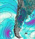
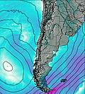
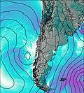
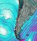
This table gives the weather forecast for Mount Tarn at the specific elevation of 825 m. Our advanced weather models allow us to provide distinct weather forecasts for several elevations of Mount Tarn. To see the weather forecasts for the other elevations, use the tab navigation above the table. For a wider overview of the weather, consult the Weather Map of Chile.
| Weather Station | Temp. | Weather | Wind | Gusts | Cloud / Visibility |
|---|---|---|---|---|---|
Punta Arenas Unidad Aeropolicial | |||||
Instituto de la Patagonia (Jorge Schytte) | |||||
Magallanes Villa Tehuelche | |||||
Ushuaia Naval Base Airport | |||||
Rio Grande Airport | |||||
Puerto Williams | |||||
Rio Gallegos Airport | |||||
Aeropuerto Internacional de El Calafate Airport |
* NOTE: not all weather observatories update at the same frequency which is the reason why some locations may show data from stations that are further away than known closer ones.
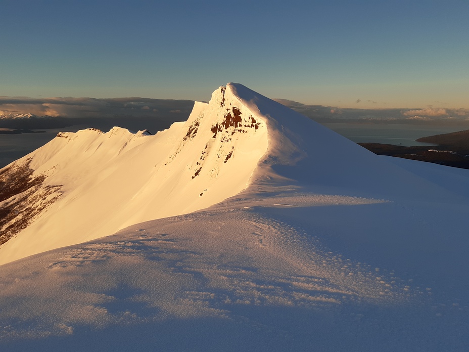
Mount Tarn Photos
View all
Patagonia photos (158) |
Andes photos (970) |
photos from mountains in Chile (457) |
all photos
 Upload new photo
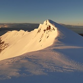
Amanecer Monte Tarn
Monte Tarn desde el Plateau

