– Lat/Long: 51.38° N 123.86° W
 Mount Tatlow
Weather Forecast, CanadaIssued: 4 am Mon 31 Mar Local TimeUpdates in: hr min sUpdate imminent
Mount Tatlow Weather Forecast, Canada
Issued: 4 am Mon 31 Mar Local Time
Updates in:
Update imminent hr min s

Issued: 4 am Mon 31 Mar Local Time
Updates in:
Update imminent hr min s
Days 1–3 Weather SummaryA moderate fall of snow, heaviest on Tue afternoon. Temperatures will be well below freezing (max -6°C on Mon afternoon, min -10°C on Tue night). Wind will be generally light. | Days 4–6 Weather SummaryMostly dry. Freeze-thaw conditions (max 4°C on Sat afternoon, min -8°C on Thu morning). Wind will be generally light. | Days 7–9 Weather SummaryA dusting of new snow. Freeze-thaw conditions (max 5°C on Sun afternoon, min -7°C on Mon night). Winds decreasing (strong winds from the SSW on Sun night, light winds from the S by Tue afternoon). | Days 10–12 Weather SummaryA dusting of new snow. Temperatures will be below freezing (max -2°C on Wed morning, min -10°C on Fri night). Winds decreasing (strong winds from the SSW on Wed night, light winds from the S by Fri morning). | |||||||||||||||||||||||||||||||||
Monday 31 | Tuesday 1 | Wednesday 2 | Thursday 3 | Friday 4 | Saturday 5 | Sunday 6 | Monday 7 | Tuesday 8 | Wednesday 9 | Thursday 10 | Friday 11 | |||||||||||||||||||||||||
AM | PM | night | AM | PM | night | AM | PM | night | AM | PM | night | AM | PM | night | AM | PM | night | AM | PM | night | AM | PM | night | AM | PM | night | AM | PM | night | AM | PM | night | AM | PM | night | |
cloudy | light snow | light snow | cloudy | mod. snow | mod. snow | some clouds | some clouds | some clouds | clear | clear | some clouds | some clouds | clear | some clouds | cloudy | clear | some clouds | some clouds | some clouds | clear | snow shwrs | clear | some clouds | some clouds | cloudy | some clouds | some clouds | some clouds | some clouds | snow shwrs | snow shwrs | clear | some clouds | some clouds | some clouds | |
km/h | ||||||||||||||||||||||||||||||||||||
 |  |  |  |  |  |  |  |  |  |  |  | |||||||||||||||||||||||||
— | 1.0 | 1.0 | — | 6 | 6 | — | — | — | — | — | — | — | — | — | — | — | — | — | — | — | 1.0 | — | — | — | — | — | — | — | — | 1.0 | 1.0 | — | — | — | — | |
— | — | — | — | — | — | — | — | — | — | — | — | — | — | — | — | — | — | — | — | — | — | — | — | — | — | — | — | — | — | — | — | — | — | — | — | |
max°C | -7 | -6 | -7 | -8 | -7 | -8 | -9 | -8 | -8 | -7 | -5 | -4 | -1 | 0 | -1 | 2 | 4 | 2 | 4 | 5 | 1 | -3 | -4 | -5 | -4 | -2 | -3 | -2 | -2 | -2 | -3 | -4 | -6 | -8 | -6 | -7 |
min°C | -7 | -6 | -8 | -8 | -8 | -10 | -10 | -8 | -9 | -8 | -6 | -5 | -3 | 0 | -1 | 0 | 3 | 1 | 2 | 4 | -3 | -4 | -5 | -7 | -7 | -3 | -5 | -4 | -2 | -3 | -4 | -4 | -9 | -8 | -6 | -10 |
-12 | -12 | -11 | -8 | -11 | -14 | -10 | -11 | -14 | -14 | -10 | -9 | -5 | 0 | -4 | -4 | 0 | -4 | -3 | -2 | -11 | -12 | -13 | -16 | -15 | -8 | -11 | -11 | -8 | -12 | -11 | -11 | -14 | -12 | -9 | -15 | |
1500 | 1700 | 1150 | 1500 | 1500 | 800 | 1300 | 1650 | 800 | 1650 | 1950 | 1400 | 2350 | 2500 | 1550 | 2950 | 3150 | 3250 | 3250 | 3000 | 2000 | 2000 | 2000 | 1500 | 1900 | 2200 | 1550 | 2200 | 2300 | 1800 | 1950 | 2000 | 1100 | 1600 | 1850 | 1050 | |
Cloud base (m) | 1600 | 1600 | 1600 | 1600 | 1600 | 1600 | 1600 | 1950 | 1600 | 1700 | 2150 | 1600 | 1550 | 6200 | 4500 | 6150 | 8700 | 1650 | 1600 | 6600 | 2600 | 1600 | 1650 | 5100 | 1600 | 1850 | 1600 | 1900 | 2700 | 2100 | ||||||
6:52 | — | — | 6:50 | — | — | 6:48 | — | — | 6:47 | — | — | 6:43 | — | — | 6:41 | — | — | 6:39 | — | — | 6:37 | — | — | 6:35 | — | — | 6:33 | — | — | 6:31 | — | — | 6:28 | — | — | |
— | 7:45 | — | — | 7:47 | — | — | 7:49 | — | — | 7:51 | — | — | 7:52 | — | — | 7:53 | — | — | 7:55 | — | — | 7:58 | — | — | 7:59 | — | — | — | 8:00 | — | — | 8:02 | — | — | 8:04 | |
Mount Tatlow Weather (Days 0-3):
The weather forecast for Mount Tatlow is: A moderate fall of snow, heaviest on Tue afternoon. Temperatures will be well below freezing (max -6°C on Mon afternoon, min -10°C on Tue night). Wind will be generally light.
Mount Tatlow Weather (Days 3-6):
Mostly dry. Freeze-thaw conditions (max 4°C on Sat afternoon, min -8°C on Thu morning). Wind will be generally light.
Mount Tatlow Weather (Days 6-9):
A dusting of new snow. Freeze-thaw conditions (max 5°C on Sun afternoon, min -7°C on Mon night). Winds decreasing (strong winds from the SSW on Sun night, light winds from the S by Tue afternoon).
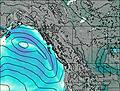
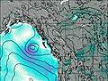
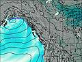
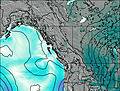
This table gives the weather forecast for Mount Tatlow at the specific elevation of 2500 m. Our advanced weather models allow us to provide distinct weather forecasts for several elevations of Mount Tatlow. To see the weather forecasts for the other elevations, use the tab navigation above the table. For a wider overview of the weather, consult the Weather Map of British-Columbia.
| Weather Station | Temp. | Weather | Wind | Gusts | Cloud / Visibility |
|---|---|---|---|---|---|
Tatlayoko Lake Rcs- BC | |||||
Puntzi Mountain (Aut)- BC | |||||
Pemberton Airport Cs- BC | |||||
Williams Lake Airport | |||||
Williams Lake A- BC |
* NOTE: not all weather observatories update at the same frequency which is the reason why some locations may show data from stations that are further away than known closer ones.
Mount Tatlow Photos
View all
British Columbia Coast Ranges photos (58) |
Pacific Coast Ranges photos (999) |
photos from mountains in Canada (440) |
all photos
 Upload new photo
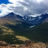
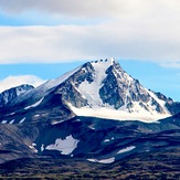
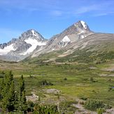
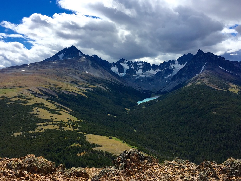
Mt Talow 3063m
Mt Tatlow 3063m
Mt Tatlow

