
– Lat/Long: 41.86° S 146.00° E
 Mount Thetis
Weather Forecast, AustraliaIssued: 3 pm Fri 09 May Local TimeUpdates in: hr min sUpdate imminent
Issued: 3 pm Fri 09 May Local Time
Updates in:
Update imminent hr min s

Issued: 3 pm Fri 09 May Local Time
Updates in:
Update imminent hr min s
Days 1–4 Weather SummaryMostly dry. Mild temperatures (max 7°C on Sat night, min 2°C on Fri afternoon). Winds increasing (light winds from the WNW on Sat afternoon, near gales from the W by Sun night). | Days 5–7 Weather SummaryMostly dry. Freeze-thaw conditions (max 6°C on Mon night, min -1°C on Tue night). Winds increasing (light winds from the WNW on Mon night, near gales from the WNW by Tue afternoon). | ||||||||||||||||
Fri 9 | Saturday 10 | Sunday 11 | Monday 12 | Tuesday 13 | Wednesday 14 | ||||||||||||
PM | night | AM | PM | night | AM | PM | night | AM | PM | night | AM | PM | night | AM | PM | night | |
light rain | rain shwrs | some clouds | cloudy | clear | clear | some clouds | clear | light rain | rain shwrs | clear | some clouds | light rain | light rain | some clouds | cloudy | light rain | |
km/h | |||||||||||||||||
 |  |  |  |  |  | ||||||||||||
— | — | — | — | — | — | — | — | — | — | — | — | — | — | — | — | — | |
0.3 | 0.2 | — | — | — | — | — | — | 0.2 | 0.2 | — | — | 0.2 | 0.3 | — | — | 0.1 | |
max°C | 2 | 2 | 3 | 5 | 7 | 6 | 6 | 5 | 5 | 4 | 6 | 4 | 3 | 3 | 0 | 1 | 2 |
min°C | 2 | 2 | 3 | 3 | 6 | 6 | 6 | 4 | 5 | 3 | 5 | 3 | 2 | -1 | -1 | 0 | 1 |
-4 | -4 | -2 | 0 | 1 | 1 | 2 | -3 | -1 | -1 | 2 | -2 | -4 | -8 | -8 | -6 | -4 | |
3850 | 3600 | 3400 | 3400 | 3300 | 3100 | 3050 | 2550 | 3250 | 3200 | 3000 | 3100 | 2950 | 2150 | 1350 | 1600 | 2450 | |
Cloud base (m) | 800 | 750 | 900 | 900 | 8050 | 8150 | 800 | 650 | 650 | 650 | 700 | 750 | 650 | ||||
— | — | 7:11 | — | — | 7:13 | — | — | 7:13 | — | — | 7:15 | — | — | 7:16 | — | — | |
5:12 | — | — | 5:10 | — | — | 5:09 | — | — | 5:08 | — | — | 5:07 | — | — | 5:07 | — | |
Loading...
Mount Thetis Weather (Days 0-3):
The weather forecast for Mount Thetis is: Mostly dry. Mild temperatures (max 7°C on Sat night, min 2°C on Fri afternoon). Winds increasing (light winds from the WNW on Sat afternoon, near gales from the W by Sun night).
Mount Thetis Weather (Days 3-6):
Mostly dry. Freeze-thaw conditions (max 6°C on Mon night, min -1°C on Tue night). Winds increasing (light winds from the WNW on Mon night, near gales from the WNW by Tue afternoon).
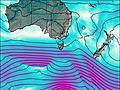
This table gives the weather forecast for Mount Thetis at the specific elevation of 1482 m. Our advanced weather models allow us to provide distinct weather forecasts for several elevations of Mount Thetis. To see the weather forecasts for the other elevations, use the tab navigation above the table. For a wider overview of the weather, consult the Weather Map of Tasmania.
| Weather Station | Temp. | Weather | Wind | Gusts | Cloud / Visibility |
|---|---|---|---|---|---|
Mount Read | |||||
SheffieldSchoolFarm | |||||
Strahan Aerodrome | |||||
CapeSorell | |||||
DevonportAirport | |||||
Ouse Fire Station | |||||
Burnie Ntc Aws |
* NOTE: not all weather observatories update at the same frequency which is the reason why some locations may show data from stations that are further away than known closer ones.