
– Lat/Long: 44.60° S 168.01° E
 Mount Tutoko (Darran Mountains)
Weather Forecast, New ZealandIssued: 11 pm Wed 16 Apr Local TimeUpdates in: hr min sUpdate imminent
Mount Tutoko (Darran Mountains) Weather Forecast, New Zealand
Issued: 11 pm Wed 16 Apr Local Time
Updates in:
Update imminent hr min s

Issued: 11 pm Wed 16 Apr Local Time
Updates in:
Update imminent hr min s
Days 1–4 Weather SummaryHeavy rain (total 20mm), heaviest during Sat morning. Temperatures will be slightly above freezing (max 4°C on Wed night, min 2°C on Thu night). Winds increasing (light winds from the ENE on Thu morning, gales from the NNE by Fri night). | Days 5–7 Weather SummaryHeavy rain (total 23mm), heaviest during Sat night. Temperatures will be slightly above freezing (max 4°C on Sat night, min 1°C on Tue afternoon). Winds decreasing (strong winds from the NNE on Sat night, calm by Mon afternoon). | ||||||||||||||||||
Thursday 17 | Friday 18 | Saturday 19 | Sunday 20 | Monday 21 | Tuesday 22 | ||||||||||||||
night | AM | PM | night | AM | PM | night | AM | PM | night | AM | PM | night | AM | PM | night | AM | PM | night | |
some clouds | cloudy | cloudy | cloudy | light rain | mod. rain | mod. rain | mod. rain | rain shwrs | rain shwrs | light rain | light rain | light rain | light rain | cloudy | some clouds | some clouds | some clouds | clear | |
km/h | |||||||||||||||||||
 |  |  |  |  |  |  | |||||||||||||
— | — | — | — | — | — | — | — | — | — | — | — | — | — | — | — | — | — | — | |
— | — | — | — | 1.1 | 6 | 6 | 6 | 0.6 | 14 | 5 | 3 | 0.7 | 0.2 | — | — | — | — | — | |
max°C | 4 | 4 | 4 | 3 | 4 | 3 | 4 | 4 | 3 | 4 | 3 | 2 | 3 | 3 | 3 | 3 | 2 | 2 | 2 |
min°C | 3 | 3 | 3 | 2 | 3 | 2 | 3 | 3 | 3 | 3 | 3 | 2 | 3 | 3 | 3 | 3 | 2 | 1 | 1 |
0 | 1 | -1 | -2 | -3 | -4 | -5 | -4 | -4 | -3 | -2 | -3 | -2 | 3 | 3 | 1 | 0 | -3 | -3 | |
3350 | 3400 | 3450 | 3200 | 3400 | 3250 | 3350 | 3350 | 3250 | 3350 | 3250 | 3150 | 3250 | 3200 | 3150 | 3200 | 3050 | 3050 | 3050 | |
Cloud base (m) | 6950 | 5900 | 5000 | 2850 | 750 | 450 | 750 | 400 | 550 | 2150 | 400 | 400 | 1850 | 2100 | 1900 | 2500 | 2950 | 2850 | 850 |
— | 7:22 | — | — | 7:24 | — | — | 7:26 | — | — | 7:26 | — | — | 7:28 | — | — | 7:28 | — | — | |
— | — | 6:10 | — | — | 6:08 | — | — | 6:07 | — | — | 6:06 | — | — | 6:04 | — | — | 6:01 | — | |
Loading...
Mount Tutoko (Darran Mountains) Weather (Days 0-3):
The weather forecast for Mount Tutoko (Darran Mountains) is: Heavy rain (total 20mm), heaviest during Sat morning. Temperatures will be slightly above freezing (max 4°C on Wed night, min 2°C on Thu night). Winds increasing (light winds from the ENE on Thu morning, gales from the NNE by Fri night).
Mount Tutoko (Darran Mountains) Weather (Days 3-6):
Heavy rain (total 23mm), heaviest during Sat night. Temperatures will be slightly above freezing (max 4°C on Sat night, min 1°C on Tue afternoon). Winds decreasing (strong winds from the NNE on Sat night, calm by Mon afternoon).
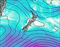
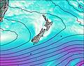
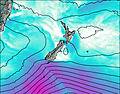
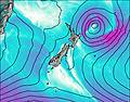
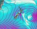
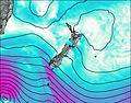
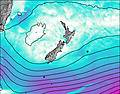
This table gives the weather forecast for Mount Tutoko (Darran Mountains) at the specific elevation of 2723 m. Our advanced weather models allow us to provide distinct weather forecasts for several elevations of Mount Tutoko (Darran Mountains). To see the weather forecasts for the other elevations, use the tab navigation above the table. For a wider overview of the weather, consult the Weather Map of New Zealand.
| Weather Station | Temp. | Weather | Wind | Gusts | Cloud / Visibility |
|---|---|---|---|---|---|
Glenorchy | |||||
Coronet Peak Summit | |||||
Coronet Peak Tandems | |||||
treblecone | |||||
Rocky Gully | |||||
Skyline Gondola | |||||
Flightpark | |||||
QueenstownAeroAws | |||||
* NOTE: not all weather observatories update at the same frequency which is the reason why some locations may show data from stations that are further away than known closer ones.

