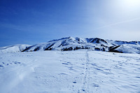
I climbed Yakushidake last year in mid August and will climb again in a few weeks. The climb is listed online as 8hr 10min to the top and a 5hr 30min descent which I would say is pretty accurate. Also don't forget to register your climb. If you've never climbed in Japan, you have to fill out a "Climbing Plan" (登山計画書). This is something you fill out so that the proper authorities know where to start looking if you go missing. You can fill it out using apps/websites like Compass (コンパス) or YAMAP.
Other approved methods are listed here on the prefectural police website:
https://police.pref.toyama.jp/6135/tetsuzuki/tozan/6-10.html
I use YAMAP and think it works well. I think it's only available in Japanese but even if you use another method to register your climb, YAMAP is worth a download cause it still has some useful information/maps about the mountain/trail/conditions. You can also see pictures other climbers have taken.
The trailhead is at Oritate (折立) and I recommend going by car (free parking with space for ~300 cars), though bus will also get you where you need to going, albeit only if you're good at managing your time. If I remember correctly, the bus only came once a day. This is a problem if you stay/camp near the top and then have to get back down before noon. It is doable but I was literally running down the mountain when I took the bus last year. Also if you don't reserve your bus ticket early enough, seats may fill up quickly, especially on long holidays/weekends and if you're departing from a large(r) station (like Toyama Station). This happened to me and I ended up reserving my ticket to depart from another bus stop and taking a train there before getting a direct shot to the trailhead. Inconvenient, yes, but doable.
I stayed at the mountain hut called "Yakushidake Sansou" (薬師岳山荘) for one night. It's near the top (about a 1.5-2 hour trek) so you can easily make it in time to watch the sunrise if you leave a bit early. It's an absolutely beautiful 360 panoramic view. You can also see the "Japanese Matterhorn", Yarigatake (槍ヶ岳) on your journey back down too.
There's another campground/lodge about 2 hours lower than Yakushidake Sansou called Tarodaira Goya (太郎平小屋) but if you are going by bus and aiming for only an overnight on the mountain, I would say it would be nearly impossible to get from that lodge to the top and then all the way back down in time to catch the bus.
Some of the trail is a bit not well marked but just keep your eyes out for the pink plastic ties that are on branches. Follow the "O" spray paint on rocks and you will be fine. Overall it's a really quite a safe climb and other climbers were really friendly to me. I am a woman and I went solo, encountering no difficulties or weirdos. However, I definitely recommend going with some friends in case of accidents/wildlife. I took a gnarly fall on some rocks on the way down and even though the trail is pretty good, the footing in some places is hecka sketchy, especially after rainfall. That or, just don't be in a rush trying to marathon the downward stretch trying to catch a bus.
Also there was a bear on the trail on the way up so I definitely recommend going in a group or at least with one other climber so you make enough noise and reduce the chances of unexpected encounters with wildlife. People eat/rest at the benches at Triangulation Point (三角点ベンチ) and about 10 minutes down from there was where the bear encounter had been. So as with any other trail, if you eat, keep the crumbs to a minimum and don't leave behind garbage.
Bring enough water as water at the hut is quite expensive (like 600 yen per 600ml bottle). There is also a vending machine near the trailhead and (supposedly) a water refill station there too. I couldn't find the water refill station though so I ended up topping off using the vending machine before I started out.
Bring a headlamp for early dawn climbing. Also bring your rain gear. Rain comes out of nowhere. Temperatures vary a bit (what's 32 C at the trailhead might be 15 C at the top) so check the weather and dress in layers.
Have fun! Yakushidake is worth the climb, crappy bus schedule and all lol.


 Like us
 Follow us
 Follow us