– Lat/Long: 38.28° N 75.12° E
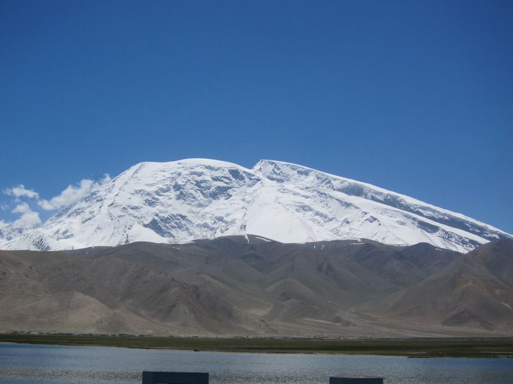
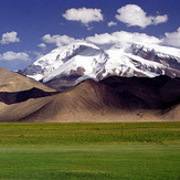
 Muztagh Ata
Weather Forecast, ChinaIssued: 4 pm Sat 19 Apr Local TimeUpdates in: hr min sUpdate imminent
Muztagh Ata Weather Forecast, China
Issued: 4 pm Sat 19 Apr Local Time
Updates in:
Update imminent hr min s

Issued: 4 pm Sat 19 Apr Local Time
Updates in:
Update imminent hr min s
Days 1–4 Weather SummaryA heavy fall of snow, heaviest during Sun morning. Extremely cold (max -29°C on Sat afternoon, min -31°C on Sun morning). Winds decreasing (extremely windy from the SW on Sat afternoon, strong winds from the SW by Sun night). | Days 5–7 Weather SummaryMostly dry. Extremely cold (max -29°C on Thu night, min -32°C on Wed morning). Winds decreasing (gales from the WSW on Tue night, fresh winds from the W by Thu night). | ||||||||||||||||
Sat 19 | Sunday 20 | Monday 21 | Tuesday 22 | Wednesday 23 | Thursday 24 | ||||||||||||
PM | night | AM | PM | night | AM | PM | night | AM | PM | night | AM | PM | night | AM | PM | night | |
snow shwrs | light snow | light snow | light snow | snow shwrs | some clouds | snow shwrs | snow shwrs | clear | some clouds | clear | clear | clear | some clouds | some clouds | clear | some clouds | |
km/h | |||||||||||||||||
 |  |  |  |  |  | ||||||||||||
2.0 | 5 | 4 | 3 | 2.0 | — | 4 | 1.0 | — | — | — | — | — | — | — | — | — | |
— | — | — | — | — | — | — | — | — | — | — | — | — | — | — | — | — | |
max°C | -29 | -29 | -30 | -30 | -29 | -31 | -30 | -30 | -30 | -31 | -30 | -31 | -30 | -31 | -32 | -31 | -29 |
min°C | -29 | -30 | -31 | -30 | -30 | -31 | -30 | -31 | -31 | -31 | -31 | -32 | -31 | -31 | -32 | -31 | -30 |
-54 | -51 | -53 | -52 | -53 | -52 | -51 | -52 | -52 | -52 | -53 | -54 | -51 | -51 | -52 | -50 | -46 | |
3900 | 3300 | 3350 | 3550 | 3200 | 3600 | 3850 | 3100 | 3700 | 3800 | 3150 | 3700 | 3750 | 3150 | 3650 | 3750 | 3300 | |
Cloud base (m) | 5650 | 5850 | 4700 | 5500 | 4800 | 4900 | 6050 | 6450 | 8550 | 8050 | 7550 | 6900 | |||||
— | — | 5:16 | — | — | 5:16 | — | — | 5:13 | — | — | 5:13 | — | — | 5:11 | — | — | |
6:38 | — | — | 6:39 | — | — | 6:40 | — | — | 6:42 | — | — | 6:43 | — | — | 6:44 | — | |
Loading...
Muztagh Ata Weather (Days 0-3):
The weather forecast for Muztagh Ata is: A heavy fall of snow, heaviest during Sun morning. Extremely cold (max -29°C on Sat afternoon, min -31°C on Sun morning). Winds decreasing (extremely windy from the SW on Sat afternoon, strong winds from the SW by Sun night).
Muztagh Ata Weather (Days 3-6):
Mostly dry. Extremely cold (max -29°C on Thu night, min -32°C on Wed morning). Winds decreasing (gales from the WSW on Tue night, fresh winds from the W by Thu night).
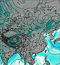
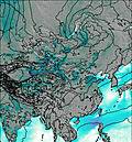
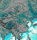
This table gives the weather forecast for Muztagh Ata at the specific elevation of 7546 m. Our advanced weather models allow us to provide distinct weather forecasts for several elevations of Muztagh Ata. To see the weather forecasts for the other elevations, use the tab navigation above the table. For a wider overview of the weather, consult the Weather Map of China.
| Weather Station | Temp. | Weather | Wind | Gusts | Cloud / Visibility |
|---|---|---|---|---|---|
Guma (Goma) Tow / ishan ( 固玛镇) | |||||
Kara Suu | |||||
Dzhalal-Abad | |||||
Naryn | |||||
Andizan | |||||
Andizan | |||||
Fergana Airport | |||||
Fergana Airport |
* NOTE: not all weather observatories update at the same frequency which is the reason why some locations may show data from stations that are further away than known closer ones.
Muztagh Ata Photos
View all
Pamir photos (11) |
Central Asia Ranges photos (121) |
photos from mountains in China (81) |
all photos
 Upload new photo
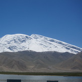
Muztagh Ata 7546 m, Top right
Muztagh Ata

