
– Lat/Long: 37.98° N 119.31° W
 North Peak
Weather Forecast, United StatesIssued: 3 am Sun 14 Dec Local TimeUpdates in: hr min sUpdate imminent
Issued: 3 am Sun 14 Dec Local Time
Updates in:
Update imminent hr min s

Issued: 3 am Sun 14 Dec Local Time
Updates in:
Update imminent hr min s
Days 1–3 Weather SummaryA dusting of new snow. Freeze-thaw conditions (max 6°C on Sun night, min 0°C on Tue night). Winds increasing (calm on Sun night, strong winds from the WSW by Tue night). | Days 4–6 Weather SummaryA dusting of new snow. Freeze-thaw conditions (max 4°C on Wed afternoon, min -2°C on Fri night). Winds increasing (light winds from the W on Wed afternoon, fresh winds from the SW by Fri afternoon). | |||||||||||||||||
Sunday 14 | Monday 15 | Tuesday 16 | Wednesday 17 | Thursday 18 | Friday 19 | |||||||||||||
AM | PM | night | AM | PM | night | AM | PM | night | AM | PM | night | AM | PM | night | AM | PM | night | |
clear | clear | clear | clear | some clouds | some clouds | some clouds | cloudy | light snow | some clouds | clear | clear | some clouds | some clouds | clear | clear | some clouds | snow shwrs | |
km/h | ||||||||||||||||||
 |  |  |  |  |  | |||||||||||||
— | — | — | — | — | — | — | — | 1 | — | — | — | — | — | — | — | — | 2 | |
— | — | — | — | — | — | — | — | — | — | — | — | — | — | — | — | — | — | |
max°C | 5 | 5 | 6 | 6 | 6 | 5 | 5 | 3 | 2 | 1 | 4 | 4 | 4 | 3 | 2 | 2 | 1 | 0 |
min°C | 4 | 4 | 4 | 6 | 6 | 4 | 5 | 1 | 0 | 0 | 2 | 3 | 4 | 3 | 0 | 1 | 0 | -2 |
2 | 3 | 4 | 4 | 4 | 1 | 2 | -5 | -7 | -7 | -2 | 0 | 0 | -1 | -7 | -6 | -7 | -8 | |
3600 | 3700 | 3800 | 4050 | 3950 | 3850 | 3750 | 3500 | 3250 | 3000 | 3450 | 3600 | 3550 | 3500 | 3350 | 3150 | 3100 | 2800 | |
Cloud base (m) | 6950 | 6750 | 6200 | 6550 | 3150 | 2850 | 2900 | 3500 | 3600 | 9550 | 2850 | |||||||
7:05 | — | — | 7:05 | — | — | 7:05 | — | — | 7:07 | — | — | 7:07 | — | — | 7:07 | — | — | |
— | 4:37 | — | — | 4:37 | — | — | 4:38 | — | — | 4:38 | — | — | 4:39 | — | — | 4:39 | — | |
Loading...
North Peak Weather (Days 0-3):
The weather forecast for North Peak is: A dusting of new snow. Freeze-thaw conditions (max 6°C on Sun night, min 0°C on Tue night). Winds increasing (calm on Sun night, strong winds from the WSW by Tue night).
North Peak Weather (Days 3-6):
A dusting of new snow. Freeze-thaw conditions (max 4°C on Wed afternoon, min -2°C on Fri night). Winds increasing (light winds from the W on Wed afternoon, fresh winds from the SW by Fri afternoon).
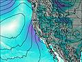
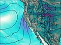
This table gives the weather forecast for North Peak at the specific elevation of 3000 m. Our advanced weather models allow us to provide distinct weather forecasts for several elevations of North Peak. To see the weather forecasts for the other elevations, use the tab navigation above the table. For a wider overview of the weather, consult the Weather Map of California.
| Weather Station | Temp. | Weather | Wind | Gusts | Cloud / Visibility |
|---|---|---|---|---|---|
Bishop Airport | |||||
South Lake Tahoe Airport | |||||
San Andreas Airport (California) | |||||
Carson City Airport |
* NOTE: not all weather observatories update at the same frequency which is the reason why some locations may show data from stations that are further away than known closer ones.