
– Lat/Long: 30.39° N 90.56° E
 Nyainqêntanglha Peak or Nyainqêntanglha Feng (念青唐古拉峰) (Nyainqentanglha Peak or Nyainqentanglha Feng)
Weather Forecast, ChinaIssued: 7 pm Sun 14 Dec Local TimeUpdates in: hr min sUpdate imminent
Issued: 7 pm Sun 14 Dec Local Time
Updates in:
Update imminent hr min s

Issued: 7 pm Sun 14 Dec Local Time
Updates in:
Update imminent hr min s
Days 1–4 Weather SummaryA dusting of new snow. Extremely cold (max -24°C on Sun night, min -29°C on Wed morning). Winds increasing (moderate winds from the WNW on Mon night, gales from the NNW by Wed afternoon). | Days 5–7 Weather SummaryMostly dry. Extremely cold (max -20°C on Sat afternoon, min -25°C on Wed night). Winds increasing (fresh winds from the NNW on Wed night, severe gales from the WNW by Sat afternoon). | ||||||||||||||||||
Monday 15 | Tuesday 16 | Wednesday 17 | Thursday 18 | Friday 19 | Saturday 20 | ||||||||||||||
night | AM | PM | night | AM | PM | night | AM | PM | night | AM | PM | night | AM | PM | night | AM | PM | night | |
some clouds | clear | clear | some clouds | snow shwrs | some clouds | some clouds | some clouds | clear | clear | some clouds | clear | some clouds | clear | some clouds | some clouds | clear | clear | clear | |
km/h | |||||||||||||||||||
 |  |  |  |  |  |  | |||||||||||||
— | — | — | — | 1 | — | — | — | — | — | — | — | — | — | — | — | — | — | — | |
— | — | — | — | — | — | — | — | — | — | — | — | — | — | — | — | — | — | — | |
max°C | -24 | -26 | -25 | -25 | -27 | -27 | -27 | -28 | -25 | -24 | -24 | -22 | -23 | -23 | -23 | -23 | -22 | -20 | -19 |
min°C | -26 | -27 | -25 | -26 | -27 | -27 | -28 | -29 | -26 | -25 | -24 | -24 | -23 | -24 | -23 | -23 | -22 | -21 | -19 |
-42 | -44 | -42 | -40 | -43 | -43 | -47 | -48 | -46 | -43 | -43 | -42 | -40 | -42 | -41 | -42 | -40 | -38 | -36 | |
3600 | 3700 | 3900 | 3500 | 3550 | 3750 | 3450 | 3500 | 3700 | 3350 | 3700 | 4200 | 3900 | 4050 | 4250 | 3800 | 4100 | 4450 | 4250 | |
Cloud base (m) | 7000 | 7050 | 6600 | 6900 | 6800 | 6400 | 6350 | 6200 | 8750 | 7950 | 9300 | 8300 | 7050 | ||||||
— | 8:45 | — | — | 8:47 | — | — | 8:47 | — | — | 8:48 | — | — | 8:48 | — | — | 8:48 | — | — | |
— | — | 6:58 | — | — | 6:59 | — | — | 6:59 | — | — | 6:59 | — | — | 7:00 | — | — | 7:00 | — | |
Loading...
Nyainqêntanglha Peak or Nyainqêntanglha Feng (念青唐古拉峰) Weather (Days 0-3):
The weather forecast for Nyainqêntanglha Peak or Nyainqêntanglha Feng (念青唐古拉峰) is: A dusting of new snow. Extremely cold (max -24°C on Sun night, min -29°C on Wed morning). Winds increasing (moderate winds from the WNW on Mon night, gales from the NNW by Wed afternoon).
Nyainqêntanglha Peak or Nyainqêntanglha Feng (念青唐古拉峰) Weather (Days 3-6):
Mostly dry. Extremely cold (max -20°C on Sat afternoon, min -25°C on Wed night). Winds increasing (fresh winds from the NNW on Wed night, severe gales from the WNW by Sat afternoon).
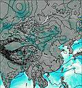
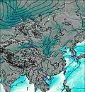
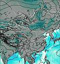
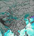
This table gives the weather forecast for Nyainqêntanglha Peak or Nyainqêntanglha Feng (念青唐古拉峰) at the specific elevation of 7162 m. Our advanced weather models allow us to provide distinct weather forecasts for several elevations of Nyainqêntanglha Peak or Nyainqêntanglha Feng (念青唐古拉峰). To see the weather forecasts for the other elevations, use the tab navigation above the table. For a wider overview of the weather, consult the Weather Map of China.
| Weather Station | Temp. | Weather | Wind | Gusts | Cloud / Visibility |
|---|---|---|---|---|---|
Nagchukha or Nagqu ( 那曲镇) | |||||
Tingri | |||||
Pakyong Airport- Pakyong | |||||
Tuotuohe | |||||
* NOTE: not all weather observatories update at the same frequency which is the reason why some locations may show data from stations that are further away than known closer ones.