
– Lat/Long: 36.49° N 74.59° E
 Passu Sar
Weather Forecast, PakistanIssued: 4 am Mon 31 Mar Local TimeUpdates in: hr min sUpdate imminent
Passu Sar Weather Forecast, Pakistan
Issued: 4 am Mon 31 Mar Local Time
Updates in:
Update imminent hr min s

Issued: 4 am Mon 31 Mar Local Time
Updates in:
Update imminent hr min s
Days 1–3 Weather SummaryMostly dry. Extremely cold (max -25°C on Tue morning, min -27°C on Mon morning). Wind will be generally light. | Days 4–6 Weather SummaryA dusting of new snow. Extremely cold (max -19°C on Sat morning, min -25°C on Thu morning). Mainly strong winds. | Days 7–9 Weather SummaryMostly dry. Extremely cold (max -15°C on Tue afternoon, min -20°C on Sun morning). Wind will be generally light. | Days 10–12 Weather SummaryA dusting of new snow. Extremely cold (max -16°C on Wed morning, min -19°C on Wed night). Wind will be generally light. | |||||||||||||||||||||||||||||||||
Monday 31 | Tuesday 1 | Wednesday 2 | Thursday 3 | Friday 4 | Saturday 5 | Sunday 6 | Monday 7 | Tuesday 8 | Wednesday 9 | Thursday 10 | Friday 11 | |||||||||||||||||||||||||
AM | PM | night | AM | PM | night | AM | PM | night | AM | PM | night | AM | PM | night | AM | PM | night | AM | PM | night | AM | PM | night | AM | PM | night | AM | PM | night | AM | PM | night | AM | PM | night | |
some clouds | clear | clear | clear | clear | clear | clear | clear | some clouds | some clouds | cloudy | snow shwrs | some clouds | clear | clear | some clouds | some clouds | clear | clear | some clouds | clear | clear | clear | some clouds | clear | clear | some clouds | cloudy | some clouds | some clouds | some clouds | snow shwrs | clear | clear | clear | clear | |
km/h | ||||||||||||||||||||||||||||||||||||
 |  |  |  |  |  |  |  |  |  |  |  | |||||||||||||||||||||||||
— | — | — | — | — | — | — | — | — | — | — | 1.0 | — | — | — | — | — | — | — | — | — | — | — | — | — | — | — | — | — | — | — | 1.0 | — | — | — | — | |
— | — | — | — | — | — | — | — | — | — | — | — | — | — | — | — | — | — | — | — | — | — | — | — | — | — | — | — | — | — | — | — | — | — | — | — | |
max°C | -26 | -26 | -26 | -25 | -25 | -26 | -26 | -25 | -25 | -24 | -23 | -23 | -21 | -20 | -20 | -19 | -20 | -21 | -19 | -18 | -19 | -17 | -16 | -17 | -16 | -15 | -16 | -16 | -16 | -17 | -17 | -17 | -18 | -18 | -17 | -18 |
min°C | -27 | -26 | -27 | -27 | -25 | -27 | -26 | -25 | -26 | -25 | -24 | -25 | -22 | -20 | -20 | -20 | -20 | -21 | -20 | -18 | -19 | -18 | -17 | -18 | -18 | -15 | -17 | -17 | -16 | -19 | -18 | -17 | -19 | -19 | -18 | -19 |
-38 | -37 | -36 | -36 | -25 | -33 | -33 | -34 | -36 | -37 | -40 | -34 | -35 | -30 | -29 | -31 | -30 | -33 | -32 | -26 | -29 | -24 | -24 | -27 | -25 | -21 | -24 | -26 | -26 | -28 | -26 | -23 | -19 | -19 | -24 | -19 | |
2700 | 2800 | 1700 | 2850 | 2950 | 1850 | 2900 | 2950 | 1900 | 3000 | 3100 | 2450 | 3200 | 3350 | 2350 | 3400 | 3550 | 2650 | 3650 | 3800 | 2950 | 3900 | 4000 | 3100 | 4000 | 4100 | 3350 | 4000 | 4050 | 3300 | 3950 | 4050 | 3250 | 3950 | 4100 | 3300 | |
Cloud base (m) | 4950 | 4900 | 5150 | 8950 | 6800 | 5550 | 5000 | 4950 | 4950 | 5050 | 6850 | 5450 | 5050 | 9650 | 8000 | 6900 | 5950 | 4950 | 4950 | 4950 | 5250 | 5250 | ||||||||||||||
5:48 | — | — | 5:48 | — | — | 5:46 | — | — | 5:45 | — | — | 5:43 | — | — | 5:41 | — | — | 5:41 | — | — | 5:39 | — | — | 5:37 | — | — | 5:35 | — | — | 5:35 | — | — | 5:33 | — | — | |
— | 6:22 | — | — | 6:22 | — | — | 6:23 | — | — | 6:24 | — | — | 6:25 | — | — | 6:25 | — | — | 6:27 | — | — | 6:28 | — | — | 6:29 | — | — | 6:30 | — | — | 6:30 | — | — | 6:31 | — | |
Passu Sar Weather (Days 0-3):
The weather forecast for Passu Sar is: Mostly dry. Extremely cold (max -25°C on Tue morning, min -27°C on Mon morning). Wind will be generally light.
Passu Sar Weather (Days 3-6):
A dusting of new snow. Extremely cold (max -19°C on Sat morning, min -25°C on Thu morning). Mainly strong winds.
Passu Sar Weather (Days 6-9):
Mostly dry. Extremely cold (max -15°C on Tue afternoon, min -20°C on Sun morning). Wind will be generally light.
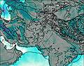
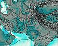
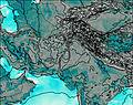
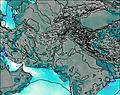
This table gives the weather forecast for Passu Sar at the specific elevation of 6500 m. Our advanced weather models allow us to provide distinct weather forecasts for several elevations of Passu Sar. To see the weather forecasts for the other elevations, use the tab navigation above the table. For a wider overview of the weather, consult the Weather Map of Pakistan.
Passu Sar Photos
View all
Karakoram photos (41) |
Greater Himalaya photos (215) |
photos from mountains in Pakistan (86) |
all photos
 Upload new photo
Passu Sar

