– Lat/Long: 40.85° N 3.95° W

SpMount Peñalara – Climbing, Hiking & Mountaineering information

Placeholder

Mount Peñalara mountain guide

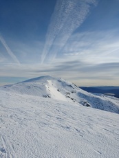
Peñalara, Mount Peñalara photo

Mount Peñalara

Photo credit: Isabel

Summer snowpack in Peñalara, July 2013, Mount Peñalara photo

Mount Peñalara

Photo credit: Carlos Pachon

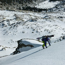
peñalara, Mount Peñalara photo

Mount Peñalara

Photo credit: juan villegas

Vista panorámica desde Peñalara, Mount Peñalara photo

Mount Peñalara

Photo credit: Sergi Fernández at SRF GraphArts

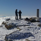
Peñalara summit, Mount Peñalara photo

Mount Peñalara

Photo credit: daniel

  • Elevation: 2428 m
  • Difficulty: Walk up
  • Best months to climb: April, May
  • Convenient center: Segovia

Mount Peñalara Climbing Notes

sergio from SPAIN writes:

Mount Peñalara is the highest elevation of Madrid and Segovia provinces. Very crowded on weekends the mountain offers since an easy walk to the summit to climbing walls. And in winter is posible to practice ice climbing and make some beautiful and easy alpine routs!

I recommend the "integral of Peñalara".In this route you wiill see the Peñalara's lake, the summit, Claveles crag (wacht out in winter), los Pájaros' lake and cincolagunas.

2010-04-22

Click here to submit your own climbing note for Mount Peñalara

Mount Peñalara Location Map

Select Mount Peñalara Location Map Detail:


Latest Gallery Images for Mount Peñalara

visit the
gallery
or click to view
Up Ruau line in PeñalaraView from Penalara summitMount PeñalaraView from the Refugio Zabala

Upload your photo of Mount Peñalara

Select a mountain summit from the menu
Select a Mountain Summit
Surf breaks located close to Mount Peñalara Mountain peaks around Mount Peñalara Roads and rivers around Mount Peñalara

Use this relief map to navigate to mountain peaks in the area of Mount Peñalara.

10 other mountain peaks closest to Mount Peñalara:

1. La Najarra (2105 m) 11.0 km
2. Abantos (1754 m) 31.1 km
3. Bikepark Tres Cantos (720 m) 33.8 km
4. La Pinilla Bikepark (2092 m) 55.6 km
5. Ocejon (2048 m) 64.9 km
6. Canchal de la Ceja (2428 m) 66.8 km
7. Pico Almanzor (2592 m) 132.3 km
8. Pico Urbión (2228 m) 158.2 km
9. Calvitero (2405 m) 161.4 km
10. Puig de Randa (543 m) 170.6 km