– Lat/Long: 45.98° N 7.65° E
 Pic Tyndall – Climbing, Hiking & Mountaineering information

Pic Tyndall guide
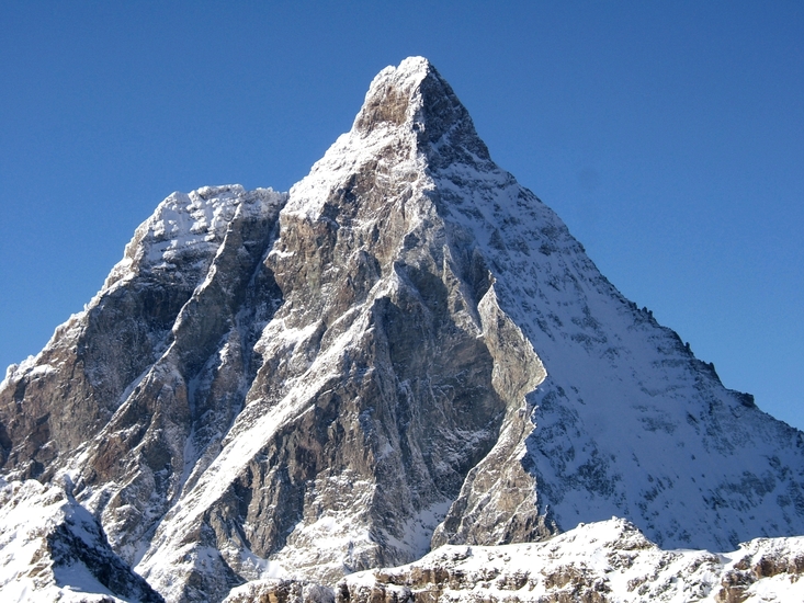
- Elevation: 13915 ft
- Difficulty:
- Best months to climb:
- Convenient center:
Pic Tyndall Climbing NotesBe the first to submit your climbing note! Please submit any useful information about climbing Pic Tyndall that may be useful to other climbers. Consider things such as access and accommodation at the base of Pic Tyndall, as well as the logistics of climbing to the summit. |

| Select a
mountain summit from the menu |
||
|
Select a Mountain Summit
|
||


Use this relief map to navigate to mountain peaks in the area of Pic Tyndall.
10 other mountain peaks closest to Pic Tyndall:
| 1. | Matterhorn (14692 ft) | 0.2 miles |
| 2. | Picco Muzio (13738 ft) | 0.3 miles |
| 3. | Dent d' Hérens (13685 ft) | 2.2 miles |
| 4. | Furgghorn (11323 ft) | 2.7 miles |
| 5. | Wandfluehorn (11776 ft) | 3.1 miles |
| 6. | Theodulhorn (11382 ft) | 3.2 miles |
| 7. | Trockener Steg (9643 ft) | 3.3 miles |
| 8. | Tête de Valpelline (12461 ft) | 3.5 miles |
| 9. | Pointe de Zinal (12432 ft) | 3.8 miles |
| 10. | Tete Blanche (11251 ft) | 3.9 miles |

