– Lat/Long: 49.44° N 57.92° W
 Pic a Tenerife
Weather Forecast, CanadaIssued: 8 pm Tue 22 Apr Local TimeUpdates in: hr min sUpdate imminent
Pic a Tenerife Weather Forecast, Canada
Issued: 8 pm Tue 22 Apr Local Time
Updates in:
Update imminent hr min s

Issued: 8 pm Tue 22 Apr Local Time
Updates in:
Update imminent hr min s
Days 1–4 Weather SummaryMostly dry. Freeze-thaw conditions (max 4°C on Wed afternoon, min -2°C on Wed night). Wind will be generally light. | Days 5–7 Weather SummarySome drizzle, heaviest during Mon afternoon. Freeze-thaw conditions (max 4°C on Mon morning, min -1°C on Fri night). Winds increasing (calm on Sat morning, fresh winds from the ENE by Sun afternoon). | ||||||||||||||||||
Wednesday 23 | Thursday 24 | Friday 25 | Saturday 26 | Sunday 27 | Monday 28 | ||||||||||||||
night | AM | PM | night | AM | PM | night | AM | PM | night | AM | PM | night | AM | PM | night | AM | PM | night | |
some clouds | cloudy | light rain | cloudy | some clouds | clear | some clouds | cloudy | cloudy | some clouds | some clouds | cloudy | cloudy | cloudy | some clouds | some clouds | some clouds | light rain | light snow | |
km/h | |||||||||||||||||||
 |  |  |  |  |  |  | |||||||||||||
— | — | — | — | — | — | — | — | — | — | — | — | — | — | — | — | — | — | 1.0 | |
— | — | 0.1 | — | — | — | — | — | — | — | — | — | — | — | — | — | — | 1.0 | 0.7 | |
max°C | 0 | 3 | 4 | 1 | 3 | 4 | 0 | 3 | 3 | 0 | 2 | 3 | 1 | 2 | 3 | 2 | 4 | 4 | 2 |
min°C | -1 | 2 | 2 | -2 | 1 | 3 | -1 | 2 | 2 | -1 | 1 | 3 | 0 | 1 | 3 | -1 | 1 | 3 | -1 |
-1 | -1 | -3 | -7 | -3 | 1 | -1 | 0 | -1 | -4 | 1 | 1 | -5 | -5 | -3 | -7 | -4 | -3 | -6 | |
450 | 850 | 950 | 400 | 700 | 950 | 550 | 850 | 900 | 400 | 700 | 950 | 750 | 750 | 1050 | 800 | 800 | 1100 | 950 | |
Cloud base (m) | 250 | 2600 | 2250 | 200 | 550 | 2200 | 4550 | 3150 | 2950 | 2400 | 250 | 400 | 200 | 200 | 200 | 750 | 250 | 500 | 200 |
— | 6:15 | — | — | 6:13 | — | — | 6:11 | — | — | 6:09 | — | — | 6:07 | — | — | 6:05 | — | — | |
— | — | 8:25 | — | — | 8:27 | — | — | 8:29 | — | — | 8:30 | — | — | 8:31 | — | — | 8:32 | — | |
Loading...
Pic a Tenerife Weather (Days 0-3):
The weather forecast for Pic a Tenerife is: Mostly dry. Freeze-thaw conditions (max 4°C on Wed afternoon, min -2°C on Wed night). Wind will be generally light.
Pic a Tenerife Weather (Days 3-6):
Some drizzle, heaviest during Mon afternoon. Freeze-thaw conditions (max 4°C on Mon morning, min -1°C on Fri night). Winds increasing (calm on Sat morning, fresh winds from the ENE by Sun afternoon).
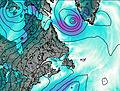
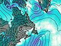
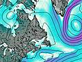
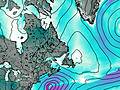
This table gives the weather forecast for Pic a Tenerife at the specific elevation of 545 m. Our advanced weather models allow us to provide distinct weather forecasts for several elevations of Pic a Tenerife. To see the weather forecasts for the other elevations, use the tab navigation above the table. For a wider overview of the weather, consult the Weather Map of Newfoundland.
| Weather Station | Temp. | Weather | Wind | Gusts | Cloud / Visibility |
|---|---|---|---|---|---|
Rocky Harbour- Nfld | |||||
Deer Lake Airport | |||||
Stephenville Rcs- Nfld | |||||
Stephenville Airport | |||||
Badger(Aut)-Nfld | |||||
Chevery Airport | |||||
Chevery-Que |
* NOTE: not all weather observatories update at the same frequency which is the reason why some locations may show data from stations that are further away than known closer ones.
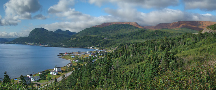
Pic a Tenerife Photos
View all
Appalachians photos (861) |
photos from mountains in Canada (441) |
all photos
 Upload new photo
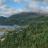
Pic a Tenerife

