Ashley from UNITED KINGDOM writes:
El Teide, 23/24 October 2013
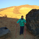
Two walkers, Ashley (male, 48) and son, George (17)
Walk to peak, with a night at Refugio de Altavista.
NB Shorts OK with plenty of layers up top. WEAR GLOVES!!
14:50 Start walk from car park of cable car (Teleferico) along TF-21 in the direction (East) of Montana Blanca car park. Temperature 23c. Intention is to have car convenient when coming down by cable car. NB Montana Blanca car park is small. Cars parked outside official spaces are targeted by police.
15:20 arr. Montana Blanca car park. Start along La Rambleta (North) towards Refugio de Altavista. The path is a 4WD track and well signposted. (Montana Blanca to cable car top station is 8.3km, climb 1350m.) Easy walking. Martian landscape. Fields of pumice. Teide eggs impressive.
[16:30 Optional: Take detour (left) to peak of Montana Blanca, 25 mins round trip. Very windy - a sign of things to come! Easy walking except for the high wind.
Break
17:05 recommence walk up to Refugio. This is the end of the 4WD track. Hard walking. Again, well signposted. Feel mild effect of altitude: fatigue. 15 seconds rests recharge the legs!! Pulse 128 (normal, 60); George 128 (from 82).
18:30 arr. Refugio (alt. 3270m).
Night: Chocolate and drinks in vending machines expensive (2/3 euros); Wifi available but charged for. Rooms sleep 6-10. First come first served. Comfortable, heated, but no ventilation so stuffy. Pulse raised (86 from usual 60; George 112 from 82). Lights out 22:30. No sleep.
04:30 rise to take the air! Chess with George. Porridge.
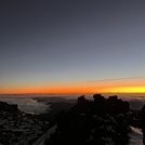
06:25 begin ascent in dark, torch helpful but moonlight sufficient. Moderate difficulty.
07:10 arr. top cable car, Mirador de la Fortaleza (alt. 3537m)
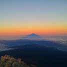
07:50. arr. peak (alt. 3700m). 60 mph winds, brutal, minus 6 wind chill. Walking/scrambling very hard due to wind that will flatten you, and which puts off most. Not for the faint hearted. Hanging onto chains at summit! Fumeroles/vents hot enough to make you pull your hand away. Hands cold and swollen from altitude. Views outstanding and worthwhile. Stunning.
15 min break. Very cold – too cold to loiter.
08:05 begin descent.
08:20 arr. back at top cable car station where it is confirmed that the cable is not running today.
08:20 leave cable car and return down track in direction of Refugio.
09:15 arr. Refugio. Closed, but take break.
09:30 leave Refugio.
11:15 arr. Montana Blanca car park
11:40 arr. Teleferico car park.
In short, from Montana Blanca car park to Refugio can be done in under three hours; from Refugio to peak, another 75 mins. From the peak to the car park, approx. 3 hours. Times might be reduced slightly (if two 17 year olds!) but more likely to take longer. However you do it, do it.
2013-10-28 |




 Like us
 Follow us
 Follow us