– Lat/Long: 46.22° N 10.67° E
 Presanella – Climbing, Hiking & Mountaineering information
Presanella – Climbing, Hiking & Mountaineering information
Presanella guide
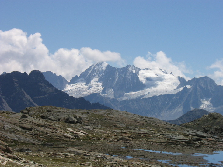
- Elevation: 3558 m
- Difficulty: Basic Snow and Ice Climb
- Best months to climb: June, July, August
- Convenient center: vermiglio ,val di sole
Presanella Climbing NotesBe the first to submit your climbing note! Please submit any useful information about climbing Presanella that may be useful to other climbers. Consider things such as access and accommodation at the base of Presanella, as well as the logistics of climbing to the summit. |

| Select a
mountain summit from the menu |
||
|
Select a Mountain Summit
|
||


Use this relief map to navigate to mountain peaks in the area of Presanella.
10 other mountain peaks closest to Presanella:
| 1. | Scarpaco (3252 m) | 3.7 km |
| 2. | Madonna di Campiglio Bike Land (2087 m) | 11.0 km |
| 3. | Brenta Bike Park (2072 m) | 11.4 km |
| 4. | Care Alto (3465 m) | 12.3 km |
| 5. | Passo del Tonale Bike AREA (2492 m) | 12.4 km |
| 6. | Adamello (3554 m) | 14.8 km |
| 7. | Cima Tosa (3173 m) | 16.6 km |
| 8. | Val di Sole Bike Land (2608 m) | 16.7 km |
| 9. | Campanile Basso or Guglia di Brenta (2877 m) | 18.6 km |
| 10. | Punta San Matteo (3678 m) | 19.5 km |

