– Lat/Long: 48.14° N 121.37° W
 Pugh
Pugh
Weather Forecast, United StatesIssued: 10 pm Sat 10 May Local TimeUpdates in: hr min sUpdate imminent
Issued: 10 pm Sat 10 May Local Time
Updates in:
Update imminent hr min s

Issued: 10 pm Sat 10 May Local Time
Updates in:
Update imminent hr min s
Days 1–4 Weather SummaryA heavy fall of snow, heaviest during Sun night. Temperatures will be below freezing (max 0°C on Sat night, min -4°C on Sun night). Wind will be generally light. | Days 5–7 Weather SummaryA dusting of new snow. Temperatures will be below freezing (max 0°C on Fri afternoon, min -2°C on Tue night). Wind will be generally light. | ||||||||||||||||||
Sunday 11 | Monday 12 | Tuesday 13 | Wednesday 14 | Thursday 15 | Friday 16 | ||||||||||||||
night | AM | PM | night | AM | PM | night | AM | PM | night | AM | PM | night | AM | PM | night | AM | PM | night | |
some clouds | cloudy | light snow | light snow | light snow | light snow | light snow | light snow | cloudy | light snow | light snow | cloudy | cloudy | cloudy | cloudy | cloudy | cloudy | cloudy | cloudy | |
km/h | |||||||||||||||||||
 |  |  |  |  |  |  | |||||||||||||
— | — | 2.0 | 5 | 4 | 3 | 5 | 1.0 | — | 2.0 | 1.0 | — | — | — | — | — | — | — | — | |
— | — | — | — | — | — | — | — | — | — | — | — | — | — | — | — | — | — | — | |
max°C | 0 | -2 | -1 | -3 | -4 | -4 | -2 | -1 | 0 | -1 | -2 | -1 | -1 | -1 | -1 | -2 | -2 | 0 | 1 |
min°C | -1 | -2 | -2 | -4 | -4 | -4 | -3 | -1 | 0 | -2 | -2 | -1 | -1 | -1 | -2 | -2 | -2 | 0 | 0 |
-6 | -5 | -2 | -8 | -9 | -10 | -8 | -6 | -3 | -8 | -5 | -4 | -6 | -1 | -7 | -8 | -8 | -5 | -3 | |
2050 | 1950 | 1950 | 1550 | 1400 | 1400 | 1500 | 1800 | 2100 | 1900 | 1850 | 1900 | 1900 | 1750 | 1900 | 1750 | 1800 | 2200 | 2300 | |
Cloud base (m) | 1900 | 1850 | 2000 | 800 | 800 | 800 | 800 | 800 | 800 | 850 | 800 | 800 | 950 | 850 | 850 | 800 | 800 | 850 | 1550 |
— | 5:31 | — | — | 5:30 | — | — | 5:28 | — | — | 5:28 | — | — | 5:26 | — | — | 5:24 | — | — | |
— | — | — | 8:31 | — | — | 8:32 | — | — | 8:35 | — | — | 8:36 | — | — | 8:37 | — | — | 8:38 | |
Loading...
Pugh Weather (Days 0-3):
The weather forecast for Pugh is: A heavy fall of snow, heaviest during Sun night. Temperatures will be below freezing (max 0°C on Sat night, min -4°C on Sun night). Wind will be generally light.
Pugh Weather (Days 3-6):
A dusting of new snow. Temperatures will be below freezing (max 0°C on Fri afternoon, min -2°C on Tue night). Wind will be generally light.
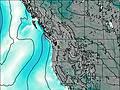
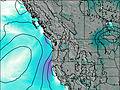
This table gives the weather forecast for Pugh at the specific elevation of 2195 m. Our advanced weather models allow us to provide distinct weather forecasts for several elevations of Pugh. To see the weather forecasts for the other elevations, use the tab navigation above the table. For a wider overview of the weather, consult the Weather Map of Washington.
| Weather Station | Temp. | Weather | Wind | Gusts | Cloud / Visibility |
|---|---|---|---|---|---|
BUOY-PBFW1 | |||||
OLF COUPEVILLE (WA) | |||||
* NOTE: not all weather observatories update at the same frequency which is the reason why some locations may show data from stations that are further away than known closer ones.
Pugh Photos
View all
Cascade Range photos (427) |
Pacific Coast Ranges photos (1002) |
photos from mountains in United States (2895) |
all photos
 Upload new photo
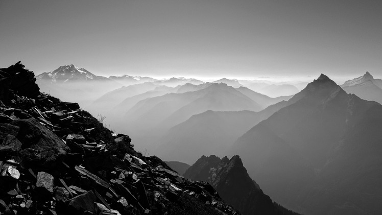
Glacier Peak, Mount Pugh and Sloan Peak from White Chuck Mountain.