
– Lat/Long: 2.32° N 76.40° W
 Puracé
Weather Forecast, ColombiaIssued: 12 am Sat 19 Apr Local TimeUpdates in: hr min sUpdate imminent
Puracé Weather Forecast, Colombia
Issued: 12 am Sat 19 Apr Local Time
Updates in:
Update imminent hr min s

Issued: 12 am Sat 19 Apr Local Time
Updates in:
Update imminent hr min s
Days 1–4 Weather SummaryMild with light rain (total 4mm) on Sat afternoon Becoming colder with a light covering of snow, mostly falling on Mon afternoon. Freeze-thaw conditions (max 3°C on Sat morning, min 0°C on Sun night). Wind will be generally light. | Days 5–7 Weather SummaryA heavy fall of snow, heaviest during Tue afternoon. Becoming milder with light rain (total 5mm) on Thu morning. Freeze-thaw conditions (max 3°C on Tue morning, min 0°C on Mon night). Wind will be generally light. | ||||||||||||||||||
Saturday 19 | Sunday 20 | Monday 21 | Tuesday 22 | Wednesday 23 | Thursday 24 | ||||||||||||||
night | AM | PM | night | AM | PM | night | AM | PM | night | AM | PM | night | AM | PM | night | AM | PM | night | |
clear | rain shwrs | risk tstorm | snow shwrs | some clouds | snow shwrs | some clouds | snow shwrs | snow shwrs | some clouds | snow shwrs | snow shwrs | light snow | snow shwrs | snow shwrs | snow shwrs | risk tstorm | light snow | mod. snow | |
km/h | |||||||||||||||||||
 |  |  |  |  |  |  | |||||||||||||
— | — | — | 1.0 | — | 1.0 | — | 1.0 | 2.0 | — | 1.0 | 5 | 4 | 1.0 | 3 | 1.0 | — | 5 | 8 | |
— | 1.5 | 3 | — | — | — | — | — | — | — | 0.3 | — | — | 1.7 | — | — | 3 | — | — | |
max°C | 2 | 3 | 3 | 1 | 1 | 2 | 1 | 2 | 1 | 2 | 3 | 2 | 1 | 2 | 2 | 1 | 2 | 2 | 1 |
min°C | 1 | 3 | 2 | 1 | 1 | 2 | 0 | 1 | 1 | 0 | 2 | 2 | 1 | 1 | 2 | 1 | 2 | 2 | 1 |
-4 | -2 | -2 | -3 | -2 | 0 | -2 | 0 | 0 | -3 | 0 | 1 | 1 | -2 | 1 | 0 | -1 | 2 | 0 | |
4900 | 5150 | 5100 | 4950 | 4900 | 5000 | 4750 | 4950 | 4900 | 4850 | 5050 | 4950 | 4800 | 4850 | 4950 | 4750 | 5000 | 5000 | 4850 | |
Cloud base (m) | 3450 | 2900 | 3050 | 2800 | 2900 | 3050 | 4500 | 2750 | 2800 | 2800 | 3000 | 3050 | 3100 | 2800 | |||||
— | 5:58 | — | — | 5:58 | — | — | 5:58 | — | — | 5:58 | — | — | 5:58 | — | — | 5:58 | — | — | |
— | — | 6:08 | — | — | 6:08 | — | — | 6:08 | — | — | 6:08 | — | — | 6:08 | — | — | 6:08 | — | |
Loading...
Puracé Weather (Days 0-3):
The weather forecast for Puracé is: Mild with light rain (total 4mm) on Sat afternoon Becoming colder with a light covering of snow, mostly falling on Mon afternoon. Freeze-thaw conditions (max 3°C on Sat morning, min 0°C on Sun night). Wind will be generally light.
Puracé Weather (Days 3-6):
A heavy fall of snow, heaviest during Tue afternoon. Becoming milder with light rain (total 5mm) on Thu morning. Freeze-thaw conditions (max 3°C on Tue morning, min 0°C on Mon night). Wind will be generally light.
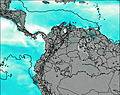
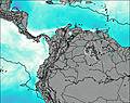
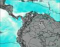
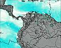
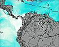
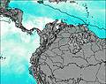
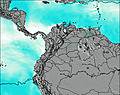
This table gives the weather forecast for Puracé at the specific elevation of 4650 m. Our advanced weather models allow us to provide distinct weather forecasts for several elevations of Puracé. To see the weather forecasts for the other elevations, use the tab navigation above the table. For a wider overview of the weather, consult the Weather Map of Colombia.
| Weather Station | Temp. | Weather | Wind | Gusts | Cloud / Visibility |
|---|---|---|---|---|---|
Popaya / uillerm | |||||
thunderstorm affecting Morelia | |||||
Florenci / apito | |||||
Cal / lfonso Bonilla Aragón International Airport | |||||
Pasto-Antonio Nariño Airport | |||||
Neiva Huil / enito Salas Airport | |||||
lightning 28km N of Payan | |||||
lightning 64km E of Rivera | |||||
Puerto Asis |
* NOTE: not all weather observatories update at the same frequency which is the reason why some locations may show data from stations that are further away than known closer ones.

