– Lat/Long: 39.14° N 77.84° W
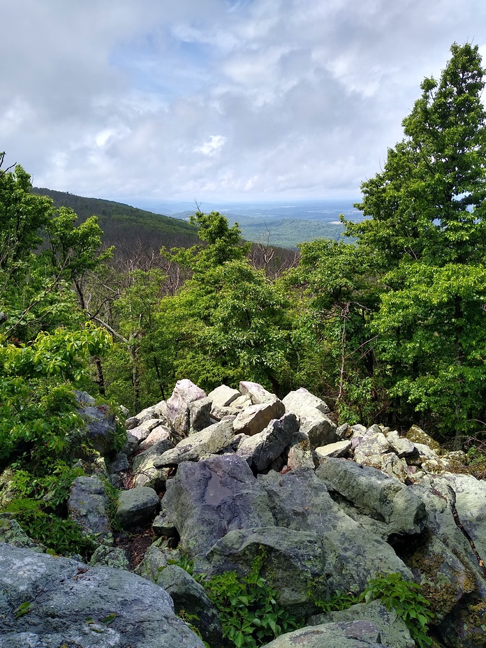
 Raven Rocks
Weather Forecast, United StatesIssued: 7 pm Tue 15 Apr Local TimeUpdates in: hr min sUpdate imminent
Raven Rocks Weather Forecast, United States
Issued: 7 pm Tue 15 Apr Local Time
Updates in:
Update imminent hr min s

Issued: 7 pm Tue 15 Apr Local Time
Updates in:
Update imminent hr min s
Days 1–4 Weather SummaryMostly dry. Warm (max 22°C on Fri afternoon, min 1°C on Wed night). Winds decreasing (strong winds from the WNW on Tue night, calm by Thu night). | Days 5–7 Weather SummaryModerate rain (total 12mm), heaviest on Mon morning. Warm (max 24°C on Sat afternoon, min 7°C on Mon morning). Winds decreasing (fresh winds from the SW on Fri night, light winds from the ESE by Mon afternoon). | ||||||||||||||||||
Wednesday 16 | Thursday 17 | Friday 18 | Saturday 19 | Sunday 20 | Monday 21 | ||||||||||||||
night | AM | PM | night | AM | PM | night | AM | PM | night | AM | PM | night | AM | PM | night | AM | PM | night | |
some clouds | some clouds | some clouds | clear | clear | clear | some clouds | cloudy | clear | some clouds | cloudy | some clouds | cloudy | cloudy | some clouds | risk tstorm | light rain | light rain | light rain | |
km/h | |||||||||||||||||||
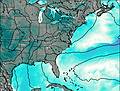 | 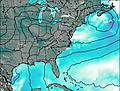 | 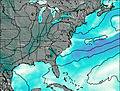 |  |  |  |  | |||||||||||||
— | — | — | — | — | — | — | — | — | — | — | — | — | — | — | — | — | — | — | |
— | — | — | — | — | — | — | — | — | — | — | — | — | — | — | 4 | 4 | 4 | 0.8 | |
max°C | 6 | 6 | 9 | 6 | 7 | 14 | 11 | 14 | 22 | 20 | 20 | 24 | 22 | 20 | 24 | 20 | 8 | 8 | 8 |
min°C | 3 | 3 | 7 | 1 | 3 | 11 | 8 | 9 | 19 | 15 | 16 | 23 | 18 | 17 | 23 | 9 | 7 | 8 | 7 |
-3 | -3 | 2 | -3 | 0 | 10 | 7 | 8 | 18 | 13 | 15 | 23 | 17 | 16 | 23 | 8 | 6 | 6 | 6 | |
850 | 1000 | 1350 | 800 | 1300 | 2450 | 2850 | 3300 | 4000 | 4200 | 4150 | 4050 | 4050 | 3850 | 3450 | 3400 | 3300 | 3300 | 2850 | |
Cloud base (m) | 450 | 650 | 1700 | 9100 | 6450 | 1850 | 9250 | 5500 | 2300 | 6250 | 6850 | 1800 | 700 | 150 | 150 | 150 | |||
— | 6:33 | — | — | 6:31 | — | — | 6:30 | — | — | 6:28 | — | — | 6:28 | — | — | 6:26 | — | — | |
— | — | 7:49 | — | — | 7:50 | — | — | 7:51 | — | — | 7:52 | — | — | 7:52 | — | — | 7:53 | — | |
Loading...
Raven Rocks Weather (Days 0-3):
The weather forecast for Raven Rocks is: Mostly dry. Warm (max 22°C on Fri afternoon, min 1°C on Wed night). Winds decreasing (strong winds from the WNW on Tue night, calm by Thu night).
Raven Rocks Weather (Days 3-6):
Moderate rain (total 12mm), heaviest on Mon morning. Warm (max 24°C on Sat afternoon, min 7°C on Mon morning). Winds decreasing (fresh winds from the SW on Fri night, light winds from the ESE by Mon afternoon).
This table gives the weather forecast for Raven Rocks at the specific elevation of 443 m. Our advanced weather models allow us to provide distinct weather forecasts for several elevations of Raven Rocks. To see the weather forecasts for the other elevations, use the tab navigation above the table. For a wider overview of the weather, consult the Weather Map of Virginia.
| Weather Station | Temp. | Weather | Wind | Gusts | Cloud / Visibility |
|---|---|---|---|---|---|
Winchester Regional Airport | |||||
* NOTE: not all weather observatories update at the same frequency which is the reason why some locations may show data from stations that are further away than known closer ones.
Raven Rocks Photos
View all
Blue Ridge Mountains photos (161) |
Appalachians photos (861) |
photos from mountains in United States (2882) |
all photos
 Upload new photo
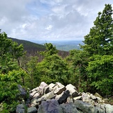
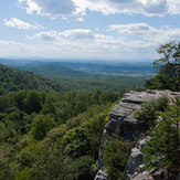
Raven Rocks on the Appalachian Trail
Raven Rocks

