– Lat/Long: 52.84° N 4.00° W
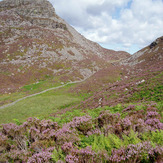
 Rhinog Fawr
Weather Forecast, United KingdomIssued: 6 pm Mon 31 Mar Local TimeUpdates in: hr min sUpdate imminent
Rhinog Fawr Weather Forecast, United Kingdom
Issued: 6 pm Mon 31 Mar Local Time
Updates in:
Update imminent hr min s

Issued: 6 pm Mon 31 Mar Local Time
Updates in:
Update imminent hr min s
Days 1–4 Weather SummaryMostly dry. Very mild (max 15°C on Mon afternoon, min 3°C on Tue night). Wind will be generally light. | Days 5–7 Weather SummaryMostly dry. Very mild (max 16°C on Fri afternoon, min 4°C on Sat night). Wind will be generally light. | Days 8–10 Weather SummaryMostly dry. Very mild (max 17°C on Mon afternoon, min 7°C on Sun night). Wind will be generally light. | Days 11–13 Weather SummaryMostly dry. Very mild (max 16°C on Wed afternoon, min 7°C on Wed night). Wind will be generally light. | |||||||||||||||||||||||||||||||||
Mon 31 | Tuesday 1 | Wednesday 2 | Thursday 3 | Friday 4 | Saturday 5 | Sunday 6 | Monday 7 | Tuesday 8 | Wednesday 9 | Thursday 10 | Friday 11 | Sat 12 | ||||||||||||||||||||||||
PM | night | AM | PM | night | AM | PM | night | AM | PM | night | AM | PM | night | AM | PM | night | AM | PM | night | AM | PM | night | AM | PM | night | AM | PM | night | AM | PM | night | AM | PM | night | AM | |
cloudy | some clouds | some clouds | clear | clear | clear | clear | some clouds | some clouds | cloudy | rain shwrs | light rain | cloudy | some clouds | clear | clear | clear | clear | clear | clear | clear | clear | clear | clear | clear | some clouds | cloudy | clear | clear | clear | clear | clear | clear | clear | clear | clear | |
km/h | ||||||||||||||||||||||||||||||||||||
 |  |  |  |  |  |  |  |  |  |  |  |  | ||||||||||||||||||||||||
— | — | — | — | — | — | — | — | — | — | — | — | — | — | — | — | — | — | — | — | — | — | — | — | — | — | — | — | — | — | — | — | — | — | — | — | |
— | — | — | — | — | — | — | — | — | — | 0.4 | 0.1 | — | — | — | — | — | — | — | — | — | — | — | — | — | — | — | — | — | — | — | — | — | — | — | — | |
max°C | 15 | 11 | 12 | 13 | 8 | 12 | 14 | 8 | 15 | 15 | 13 | 14 | 16 | 11 | 13 | 15 | 8 | 14 | 16 | 11 | 16 | 17 | 11 | 16 | 17 | 11 | 14 | 16 | 11 | 14 | 16 | 11 | 13 | 14 | 11 | 16 |
min°C | 14 | 6 | 9 | 11 | 3 | 9 | 12 | 6 | 11 | 14 | 9 | 12 | 14 | 5 | 9 | 13 | 4 | 9 | 15 | 7 | 12 | 15 | 8 | 12 | 15 | 7 | 11 | 15 | 7 | 11 | 14 | 9 | 12 | 13 | 9 | 14 |
14 | 4 | 7 | 9 | 0 | 7 | 10 | 4 | 10 | 12 | 7 | 11 | 13 | 2 | 7 | 12 | 1 | 7 | 15 | 5 | 12 | 15 | 6 | 11 | 14 | 4 | 9 | 14 | 5 | 11 | 14 | 9 | 12 | 13 | 8 | 14 | |
3300 | 3350 | 3300 | 3250 | 3200 | 2950 | 2400 | 2200 | 2050 | 2200 | 2500 | 2450 | 2600 | 2900 | 2850 | 2900 | 2950 | 3150 | 3050 | 3050 | 3100 | 3250 | 3250 | 3200 | 3250 | 3100 | 2900 | 2850 | 2850 | 2800 | 2900 | 3100 | 3100 | 3150 | 3050 | 2850 | |
Cloud base (m) | 950 | 7000 | 8650 | 1600 | 3150 | 300 | 650 | 3250 | 3000 | 8900 | 9350 | 9450 | 9350 | 6700 | 8850 | 8450 | 8500 | 8550 | 8700 | 8950 | ||||||||||||||||
— | — | 6:50 | — | — | 6:48 | — | — | 6:46 | — | — | 6:43 | — | — | 6:41 | — | — | 6:39 | — | — | 6:37 | — | — | 6:35 | — | — | 6:31 | — | — | 6:30 | — | — | 6:28 | — | — | 6:24 | |
7:46 | — | — | 7:49 | — | — | 7:51 | — | — | 7:52 | — | — | 7:53 | — | — | 7:55 | — | — | 7:58 | — | — | 8:00 | — | — | 8:01 | — | — | 8:02 | — | — | 8:05 | — | — | 8:07 | — | — | |
Rhinog Fawr Weather (Days 0-3):
The weather forecast for Rhinog Fawr is: Mostly dry. Very mild (max 15°C on Mon afternoon, min 3°C on Tue night). Wind will be generally light.
Rhinog Fawr Weather (Days 3-6):
Mostly dry. Very mild (max 16°C on Fri afternoon, min 4°C on Sat night). Wind will be generally light.
Rhinog Fawr Weather (Days 6-9):
Mostly dry. Very mild (max 17°C on Mon afternoon, min 7°C on Sun night). Wind will be generally light.
This table gives the weather forecast for Rhinog Fawr at the specific elevation of 0 m. Our advanced weather models allow us to provide distinct weather forecasts for several elevations of Rhinog Fawr. To see the weather forecasts for the other elevations, use the tab navigation above the table. For a wider overview of the weather, consult the Weather Map of United Kingdom.
| Weather Station | Temp. | Weather | Wind | Gusts | Cloud / Visibility |
|---|---|---|---|---|---|
CapelCurigNO 3 | |||||
Caernarfon Airport | |||||
LakeVyrnwyNO 2 | |||||
* NOTE: not all weather observatories update at the same frequency which is the reason why some locations may show data from stations that are further away than known closer ones.
Rhinog Fawr Photos
View all
Snowdonia photos (175) |
Cambrian Mountains photos (325) |
photos from mountains in United Kingdom (1944) |
all photos
 Upload new photo
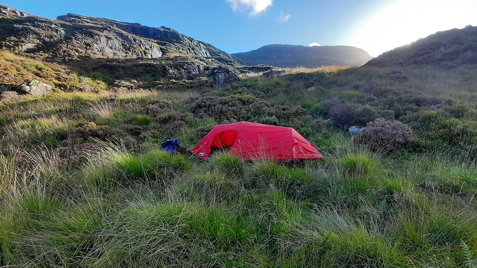
Camping on Rhinog Fawr
Roman Steps
Roman Steps
Rhinog Fawr
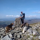
Rhinog Fawr Summit

