
– Lat/Long: 6.49° N 72.30° W
 Ritacuba Blanco
Weather Forecast, ColombiaIssued: 12 pm Fri 18 Apr Local TimeUpdates in: hr min sUpdate imminent
Ritacuba Blanco Weather Forecast, Colombia
Issued: 12 pm Fri 18 Apr Local Time
Updates in:
Update imminent hr min s

Issued: 12 pm Fri 18 Apr Local Time
Updates in:
Update imminent hr min s
Days 1–3 Weather SummaryHeavy rain (total 21mm), heaviest during Sun afternoon. Very mild (max 17°C on Fri morning, min 13°C on Sat night). Wind will be generally light. | Days 4–6 Weather SummaryHeavy rain (total 92mm), heaviest during Wed night. Very mild (max 16°C on Mon morning, min 12°C on Wed night). Wind will be generally light. | |||||||||||||||||
Friday 18 | Saturday 19 | Sunday 20 | Monday 21 | Tuesday 22 | Wednesday 23 | |||||||||||||
AM | PM | night | AM | PM | night | AM | PM | night | AM | PM | night | AM | PM | night | AM | PM | night | |
risk tstorm | rain shwrs | rain shwrs | light rain | rain shwrs | rain shwrs | light rain | mod. rain | rain shwrs | light rain | risk tstorm | mod. rain | light rain | mod. rain | heavy rain | light rain | risk tstorm | rain shwrs | |
km/h | ||||||||||||||||||
 |  |  |  |  |  | |||||||||||||
— | — | — | — | — | — | — | — | — | — | — | — | — | — | — | — | — | — | |
1.4 | 3 | 0.5 | 4 | 2 | 0.3 | 3 | 6 | 1.1 | 1.8 | 13 | 8 | 3 | 7 | 24 | 2 | 5 | 29 | |
max°C | 17 | 17 | 15 | 16 | 16 | 14 | 16 | 16 | 15 | 16 | 16 | 14 | 16 | 16 | 15 | 16 | 16 | 15 |
min°C | 17 | 15 | 14 | 15 | 15 | 13 | 16 | 15 | 14 | 16 | 15 | 14 | 15 | 15 | 13 | 16 | 15 | 12 |
17 | 15 | 14 | 15 | 15 | 13 | 16 | 15 | 14 | 16 | 15 | 14 | 15 | 15 | 13 | 16 | 15 | 12 | |
5250 | 5200 | 4950 | 5050 | 5100 | 5000 | 5150 | 5100 | 4950 | 5100 | 5100 | 4900 | 5050 | 5150 | 4850 | 5050 | 5150 | 4750 | |
Cloud base (m) | 4700 | 4300 | 4300 | |||||||||||||||
5:39 | — | — | 5:39 | — | — | 5:39 | — | — | 5:37 | — | — | 5:37 | — | — | 5:37 | — | — | |
— | 5:55 | — | — | 5:55 | — | — | 5:55 | — | — | 5:55 | — | — | 5:55 | — | — | 5:55 | — | |
Loading...
Ritacuba Blanco Weather (Days 0-3):
The weather forecast for Ritacuba Blanco is: Heavy rain (total 21mm), heaviest during Sun afternoon. Very mild (max 17°C on Fri morning, min 13°C on Sat night). Wind will be generally light.
Ritacuba Blanco Weather (Days 3-6):
Heavy rain (total 92mm), heaviest during Wed night. Very mild (max 16°C on Mon morning, min 12°C on Wed night). Wind will be generally light.
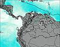
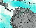
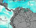
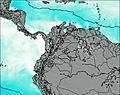
This table gives the weather forecast for Ritacuba Blanco at the specific elevation of 2500 m. Our advanced weather models allow us to provide distinct weather forecasts for several elevations of Ritacuba Blanco. To see the weather forecasts for the other elevations, use the tab navigation above the table. For a wider overview of the weather, consult the Weather Map of Colombia.
| Weather Station | Temp. | Weather | Wind | Gusts | Cloud / Visibility |
|---|---|---|---|---|---|
lightning 6km NW of Aratoca | |||||
lightning 7km W of Coromoro | |||||
lightning 6km WSW of Valle de San Jose | |||||
lightning 8km NE of Oiba | |||||
thunderstorm affecting Simacota | |||||
Bucaramang / alonegro Airport | |||||
BucaramangaPalonegro | |||||
lightning 8km SE of Guadalupe | |||||
Yopa / l Alcarav | |||||
Cúcut / amilo Daza International Airport |
* NOTE: not all weather observatories update at the same frequency which is the reason why some locations may show data from stations that are further away than known closer ones.

