
– Lat/Long: 53.22° N 118.04° W
 Roche à Bosche
Weather Forecast, CanadaIssued: 11 am Tue 22 Apr Local TimeUpdates in: hr min sUpdate imminent
Roche à Bosche Weather Forecast, Canada
Issued: 11 am Tue 22 Apr Local Time
Updates in:
Update imminent hr min s

Issued: 11 am Tue 22 Apr Local Time
Updates in:
Update imminent hr min s
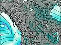
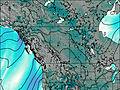
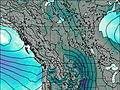
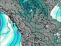
Days 1–3 Weather SummaryMostly dry. Freeze-thaw conditions (max 4°C on Thu afternoon, min -7°C on Tue morning). Wind will be generally light. | Days 4–6 Weather SummaryA moderate fall of snow, heaviest on Sun night. Freeze-thaw conditions (max 8°C on Sat afternoon, min -4°C on Sun night). Wind will be generally light. | |||||||||||||||||
Tuesday 22 | Wednesday 23 | Thursday 24 | Friday 25 | Saturday 26 | Sunday 27 | |||||||||||||
AM | PM | night | AM | PM | night | AM | PM | night | AM | PM | night | AM | PM | night | AM | PM | night | |
clear | cloudy | some clouds | cloudy | cloudy | some clouds | clear | some clouds | clear | clear | some clouds | some clouds | some clouds | cloudy | snow shwrs | cloudy | light snow | heavy snow | |
km/h | ||||||||||||||||||
 |  |  |  |  |  | |||||||||||||
— | — | — | — | — | — | — | — | — | — | — | — | — | — | 1.0 | — | 4 | 11 | |
— | — | — | — | — | — | — | — | — | — | — | — | — | — | 0.2 | — | — | — | |
max°C | -5 | -2 | -4 | -2 | 0 | -2 | 1 | 4 | 2 | 4 | 7 | 4 | 5 | 8 | 4 | 0 | 1 | -2 |
min°C | -7 | -3 | -6 | -4 | -1 | -4 | -2 | 3 | -1 | 1 | 6 | 1 | 2 | 7 | 1 | 0 | -1 | -4 |
-12 | -7 | -12 | -9 | -3 | -7 | -4 | 1 | -4 | -2 | 4 | -3 | 1 | 5 | 1 | -2 | -1 | -7 | |
1250 | 1850 | 1250 | 1650 | 2100 | 1450 | 1850 | 2450 | 2050 | 2350 | 2750 | 2600 | 2550 | 2900 | 2350 | 2150 | 2200 | 1600 | |
Cloud base (m) | 3900 | 2850 | 3000 | 2100 | 2500 | 2400 | 3050 | 3200 | 7800 | 4200 | 1650 | 1600 | 1500 | 900 | ||||
6:37 | — | — | 6:35 | — | — | 6:33 | — | — | 6:31 | — | — | 6:28 | — | — | 6:26 | — | — | |
— | — | 9:04 | — | — | 9:06 | — | — | 9:07 | — | — | 9:08 | — | — | 9:10 | — | — | 9:13 | |
Loading...
Roche à Bosche Weather (Days 0-3):
The weather forecast for Roche à Bosche is: Mostly dry. Freeze-thaw conditions (max 4°C on Thu afternoon, min -7°C on Tue morning). Wind will be generally light.
Roche à Bosche Weather (Days 3-6):
A moderate fall of snow, heaviest on Sun night. Freeze-thaw conditions (max 8°C on Sat afternoon, min -4°C on Sun night). Wind will be generally light.
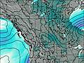
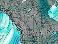
This table gives the weather forecast for Roche à Bosche at the specific elevation of 2148 m. Our advanced weather models allow us to provide distinct weather forecasts for several elevations of Roche à Bosche. To see the weather forecasts for the other elevations, use the tab navigation above the table. For a wider overview of the weather, consult the Weather Map of Alberta.
| Weather Station | Temp. | Weather | Wind | Gusts | Cloud / Visibility |
|---|---|---|---|---|---|
Willow Creek 1- Alta | |||||
JasperWarden-Alta | |||||
Jasper Warden Airport | |||||
Hendrickson Creek- Alta | |||||
EdsonClimate-Alta | |||||
BlueRiverCs- BC | |||||
Blue River Airport |
* NOTE: not all weather observatories update at the same frequency which is the reason why some locations may show data from stations that are further away than known closer ones.

