– Lat/Long: 60.42° N 5.37° E
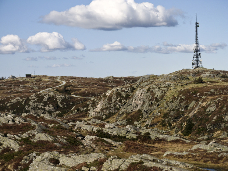
 Rundemanen
Weather Forecast, NorwayIssued: 12 am Sun 14 Dec Local TimeUpdates in: hr min sUpdate imminent
Issued: 12 am Sun 14 Dec Local Time
Updates in:
Update imminent hr min s

Issued: 12 am Sun 14 Dec Local Time
Updates in:
Update imminent hr min s
Days 1–4 Weather SummaryHeavy rain (total 101mm), heaviest during Sat night. Mild temperatures (max 7°C on Sun afternoon, min 3°C on Tue afternoon). Winds decreasing (strong winds from the S on Sun night, calm by Tue morning). | Days 5–7 Weather SummaryA moderate fall of snow, heaviest on Wed night. Turning milder with moderate rain (total 17mm), heaviest on Wed night. Mild temperatures (max 7°C on Thu night, min 1°C on Tue night). Winds increasing (calm on Tue night, severe gales from the S by Thu night). | ||||||||||||||||||
Sunday 14 | Monday 15 | Tuesday 16 | Wednesday 17 | Thursday 18 | Friday 19 | ||||||||||||||
night | AM | PM | night | AM | PM | night | AM | PM | night | AM | PM | night | AM | PM | night | AM | PM | night | |
heavy rain | mod. rain | light rain | heavy rain | heavy rain | light rain | light rain | light rain | light rain | rain shwrs | some clouds | rain shwrs | snow shwrs | rain shwrs | light rain | rain shwrs | light rain | rain shwrs | risk tstorm | |
km/h | |||||||||||||||||||
 |  |  |  |  |  |  | |||||||||||||
— | — | — | — | — | — | — | — | — | — | — | — | 12 | — | — | — | — | — | — | |
50 | 10 | 1.1 | 24 | 11 | 1.9 | 0.6 | 3 | 0.2 | 0.5 | — | 0.2 | 6 | 2 | 0.2 | 1.3 | 3 | 5 | 12 | |
max°C | 5 | 6 | 7 | 6 | 5 | 5 | 5 | 4 | 3 | 3 | 2 | 2 | 3 | 3 | 3 | 7 | 6 | 5 | 4 |
min°C | 4 | 6 | 6 | 6 | 5 | 5 | 4 | 4 | 3 | 1 | 1 | 2 | 1 | 3 | 3 | 5 | 5 | 4 | 4 |
-2 | 2 | 1 | 0 | 2 | 3 | 2 | 4 | 3 | -3 | -4 | -4 | -6 | -2 | -1 | -1 | -2 | -3 | -3 | |
1250 | 1750 | 1800 | 2050 | 1450 | 1300 | 1300 | 1200 | 1100 | 950 | 800 | 900 | 900 | 900 | 1300 | 1850 | 1350 | 1200 | 1100 | |
Cloud base (m) | 100 | 50 | 50 | 50 | 50 | 150 | 800 | 200 | 700 | 1600 | 800 | 500 | 150 | 700 | 850 | 3500 | 250 | 50 | 650 |
— | 9:37 | — | — | 9:38 | — | — | 9:40 | — | — | 9:41 | — | — | 9:41 | — | — | 9:42 | — | — | |
— | 3:26 | — | — | 3:26 | — | — | 3:26 | — | — | 3:26 | — | — | 3:26 | — | — | 3:26 | — | — | |
Loading...
Rundemanen Weather (Days 0-3):
The weather forecast for Rundemanen is: Heavy rain (total 101mm), heaviest during Sat night. Mild temperatures (max 7°C on Sun afternoon, min 3°C on Tue afternoon). Winds decreasing (strong winds from the S on Sun night, calm by Tue morning).
Rundemanen Weather (Days 3-6):
A moderate fall of snow, heaviest on Wed night. Turning milder with moderate rain (total 17mm), heaviest on Wed night. Mild temperatures (max 7°C on Thu night, min 1°C on Tue night). Winds increasing (calm on Tue night, severe gales from the S by Thu night).
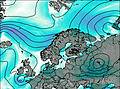
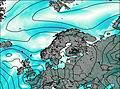
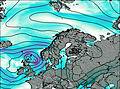
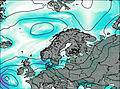
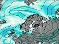
This table gives the weather forecast for Rundemanen at the specific elevation of 568 m. Our advanced weather models allow us to provide distinct weather forecasts for several elevations of Rundemanen. To see the weather forecasts for the other elevations, use the tab navigation above the table. For a wider overview of the weather, consult the Weather Map of Norway.
| Weather Station | Temp. | Weather | Wind | Gusts | Cloud / Visibility |
|---|---|---|---|---|---|
Bergen Ulriken NØ | |||||
BergenFlorida | |||||
Bergen Ulriken SV | |||||
Bergen Ulriken NV | |||||
Bergen Vemånen | |||||
Bergen Skåldalsnipa | |||||
Brekkedalen Gullfj. | |||||
Brandalsfj. Sv.hytta | |||||
Framo Flatøy | |||||
Berge / lesland Airport |
* NOTE: not all weather observatories update at the same frequency which is the reason why some locations may show data from stations that are further away than known closer ones.
Rundemanen Photos
View all
photos (8) |
Scandinavia/European Arctic Ranges photos (14) |
photos from mountains in Norway (113) |
all photos
 Upload new photo
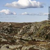
Rundemanen