– Lat/Long: 18.10° S 68.90° W
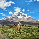
 Sajama
Weather Forecast, BoliviaIssued: 12 am Fri 09 May Local TimeUpdates in: hr min sUpdate imminent
Issued: 12 am Fri 09 May Local Time
Updates in:
Update imminent hr min s

Issued: 12 am Fri 09 May Local Time
Updates in:
Update imminent hr min s
Days 1–4 Weather SummaryA light covering of new snow mostly falling on Sat afternoon. Temperatures will be well below freezing (max -7°C on Fri morning, min -10°C on Thu night). Winds decreasing (fresh winds from the WNW on Thu night, light winds from the S by Sun afternoon). | Days 5–7 Weather SummaryMostly dry. Temperatures will be well below freezing (max -8°C on Sun night, min -9°C on Sun night). Wind will be generally light. | ||||||||||||||||||
Friday 9 | Saturday 10 | Sunday 11 | Monday 12 | Tuesday 13 | Wednesday 14 | ||||||||||||||
night | AM | PM | night | AM | PM | night | AM | PM | night | AM | PM | night | AM | PM | night | AM | PM | night | |
clear | clear | clear | clear | some clouds | snow shwrs | snow shwrs | some clouds | snow shwrs | clear | clear | some clouds | clear | clear | clear | clear | clear | some clouds | some clouds | |
km/h | |||||||||||||||||||
 |  |  |  |  |  |  | |||||||||||||
— | — | — | — | — | 5 | 1.0 | — | 1.0 | — | — | — | — | — | — | — | — | — | — | |
— | — | — | — | — | — | — | — | — | — | — | — | — | — | — | — | — | — | — | |
max°C | -9 | -7 | -8 | -8 | -8 | -8 | -9 | -7 | -8 | -8 | -8 | -8 | -8 | -8 | -8 | -8 | -9 | -9 | -9 |
min°C | -10 | -8 | -8 | -9 | -8 | -9 | -9 | -8 | -8 | -9 | -8 | -8 | -9 | -8 | -8 | -9 | -9 | -9 | -9 |
-20 | -18 | -16 | -18 | -16 | -17 | -18 | -17 | -15 | -15 | -14 | -12 | -13 | -13 | -12 | -16 | -16 | -14 | -18 | |
5050 | 5400 | 5550 | 5250 | 5400 | 5450 | 5050 | 5400 | 5450 | 5250 | 5400 | 5600 | 5300 | 5400 | 5500 | 5250 | 5400 | 5450 | 5250 | |
Cloud base (m) | 5700 | 5850 | 5950 | 5600 | 6150 | 5650 | 6800 | 6650 | 9250 | 7150 | 6750 | ||||||||
— | 5:50 | — | — | 5:52 | — | — | 5:52 | — | — | 5:52 | — | — | 5:52 | — | — | 5:52 | — | — | |
— | — | 5:10 | — | — | 5:10 | — | — | 5:10 | — | — | 5:09 | — | — | 5:09 | — | — | 5:09 | — | |
Loading...
Sajama Weather (Days 0-3):
The weather forecast for Sajama is: A light covering of new snow mostly falling on Sat afternoon. Temperatures will be well below freezing (max -7°C on Fri morning, min -10°C on Thu night). Winds decreasing (fresh winds from the WNW on Thu night, light winds from the S by Sun afternoon).
Sajama Weather (Days 3-6):
Mostly dry. Temperatures will be well below freezing (max -8°C on Sun night, min -9°C on Sun night). Wind will be generally light.
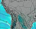
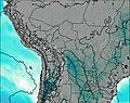
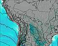
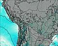
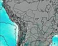
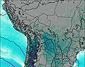
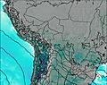
This table gives the weather forecast for Sajama at the specific elevation of 6530 m. Our advanced weather models allow us to provide distinct weather forecasts for several elevations of Sajama. To see the weather forecasts for the other elevations, use the tab navigation above the table. For a wider overview of the weather, consult the Weather Map of Bolivia.
| Weather Station | Temp. | Weather | Wind | Gusts | Cloud / Visibility |
|---|---|---|---|---|---|
Putre | |||||
Aric / hacalluta Airport | |||||
Defensa Civil- Arica | |||||
Arica | |||||
Cochabamb / orge Wilsterman Airport | |||||
Arequip / odriguez Ballon Airport |
* NOTE: not all weather observatories update at the same frequency which is the reason why some locations may show data from stations that are further away than known closer ones.
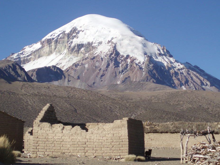
Sajama Photos
View all
Bolivian Andes photos (80) |
Andes photos (977) |
photos from mountains in Bolivia (68) |
all photos
 Upload new photo
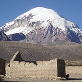
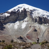
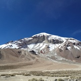
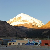
Sajama
Sajama
Taita Sajama
Sajama_JR