– Lat/Long: 62.69° N 8.81° E
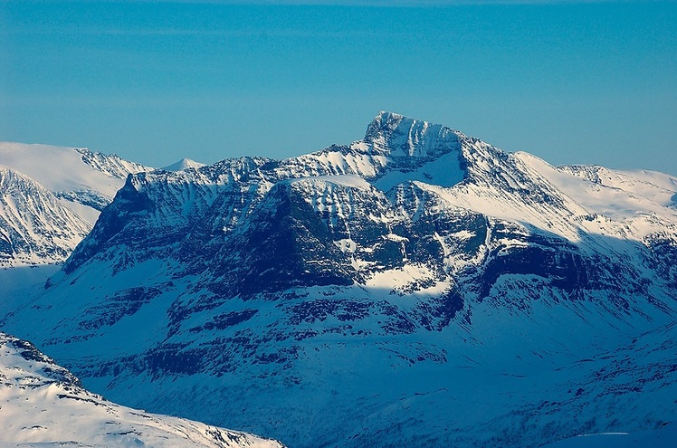
 Såtbakkollen (Satbakkollen)
Weather Forecast, NorwayIssued: 6 am Sun 14 Dec Local TimeUpdates in: hr min sUpdate imminent
Issued: 6 am Sun 14 Dec Local Time
Updates in:
Update imminent hr min s

Issued: 6 am Sun 14 Dec Local Time
Updates in:
Update imminent hr min s
Days 1–3 Weather SummaryA light covering of new snow mostly falling on Mon morning. Freeze-thaw conditions (max 3°C on Sun night, min -6°C on Tue afternoon). Winds decreasing (strong winds from the WSW on Sun morning, light winds from the SW by Tue afternoon). | Days 4–6 Weather SummaryA dusting of new snow. Freeze-thaw conditions (max 3°C on Thu night, min -6°C on Wed morning). Winds increasing (light winds from the SSW on Thu afternoon, near gales from the SW by Fri night). | |||||||||||||||||
Sunday 14 | Monday 15 | Tuesday 16 | Wednesday 17 | Thursday 18 | Friday 19 | |||||||||||||
AM | PM | night | AM | PM | night | AM | PM | night | AM | PM | night | AM | PM | night | AM | PM | night | |
some clouds | some clouds | some clouds | light snow | snow shwrs | some clouds | cloudy | light snow | some clouds | some clouds | clear | cloudy | snow shwrs | cloudy | some clouds | clear | some clouds | some clouds | |
km/h | ||||||||||||||||||
 |  |  |  |  |  | |||||||||||||
— | — | — | 2 | 2 | — | — | 2 | — | — | — | — | 4 | — | — | — | — | — | |
— | — | — | — | — | — | — | — | — | — | — | — | — | — | — | — | — | — | |
max°C | -2 | 0 | 3 | -3 | -4 | -4 | -4 | -5 | -5 | -5 | -4 | -2 | -6 | -3 | 3 | 1 | -1 | -3 |
min°C | -2 | -2 | 0 | -4 | -4 | -4 | -4 | -6 | -6 | -6 | -5 | -6 | -6 | -4 | 0 | 0 | -2 | -5 |
-10 | -10 | -6 | -8 | -8 | -9 | -8 | -10 | -11 | -14 | -12 | -13 | -15 | -12 | -7 | -8 | -10 | -15 | |
1550 | 1600 | 2300 | 1200 | 1000 | 1200 | 1200 | 950 | 850 | 350 | 350 | 1050 | 550 | 300 | 2200 | 2050 | 1700 | 1400 | |
Cloud base (m) | 550 | 500 | 2350 | 500 | 500 | 550 | 600 | 800 | 600 | 2350 | 2050 | 550 | 850 | 2600 | 1950 | |||
9:49 | — | — | 9:51 | — | — | 9:52 | — | — | 9:52 | — | — | 9:53 | — | — | 9:55 | — | — | |
2:48 | — | — | 2:48 | — | — | 2:47 | — | — | 2:47 | — | — | 2:47 | — | — | 2:47 | — | — | |
Loading...
Såtbakkollen Weather (Days 0-3):
The weather forecast for Såtbakkollen is: A light covering of new snow mostly falling on Mon morning. Freeze-thaw conditions (max 3°C on Sun night, min -6°C on Tue afternoon). Winds decreasing (strong winds from the WSW on Sun morning, light winds from the SW by Tue afternoon).
Såtbakkollen Weather (Days 3-6):
A dusting of new snow. Freeze-thaw conditions (max 3°C on Thu night, min -6°C on Wed morning). Winds increasing (light winds from the SSW on Thu afternoon, near gales from the SW by Fri night).
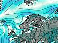
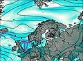
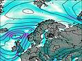
This table gives the weather forecast for Såtbakkollen at the specific elevation of 1840 m. Our advanced weather models allow us to provide distinct weather forecasts for several elevations of Såtbakkollen. To see the weather forecasts for the other elevations, use the tab navigation above the table. For a wider overview of the weather, consult the Weather Map of Norway.
Såtbakkollen Photos
View all
Scandinavia/European Arctic Ranges photos (14) |
photos from mountains in Norway (113) |
all photos
 Upload new photo
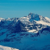
Såtbakkollen