– Lat/Long: 47.50° N 11.48° E
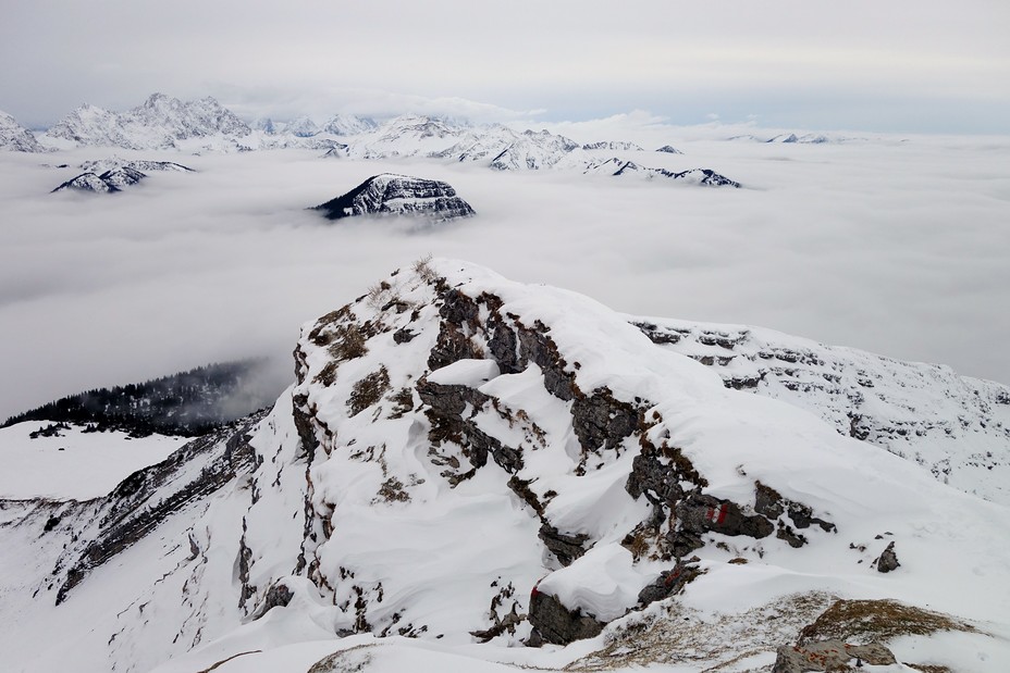
 Schafreuter
Weather Forecast, AustriaIssued: 7 pm Thu 24 Apr Local TimeUpdates in: hr min sUpdate imminent
Schafreuter Weather Forecast, Austria
Issued: 7 pm Thu 24 Apr Local Time
Updates in:
Update imminent hr min s

Issued: 7 pm Thu 24 Apr Local Time
Updates in:
Update imminent hr min s
Days 1–4 Weather SummaryA dusting of new snow. Freeze-thaw conditions (max 6°C on Sun morning, min -2°C on Thu night). Wind will be generally light. | Days 5–7 Weather SummaryLight rain (total 4mm), mostly falling on Mon afternoon. Mild temperatures (max 8°C on Tue afternoon, min 3°C on Mon morning). Wind will be generally light. | ||||||||||||||||||
Friday 25 | Saturday 26 | Sunday 27 | Monday 28 | Tuesday 29 | Wednesday 30 | ||||||||||||||
night | AM | PM | night | AM | PM | night | AM | PM | night | AM | PM | night | AM | PM | night | AM | PM | night | |
cloudy | cloudy | light snow | cloudy | cloudy | light rain | clear | clear | risk tstorm | rain shwrs | rain shwrs | risk tstorm | risk tstorm | rain shwrs | rain shwrs | rain shwrs | clear | some clouds | clear | |
km/h | |||||||||||||||||||
 |  |  |  |  |  |  | |||||||||||||
— | — | 1.0 | — | — | — | — | — | — | — | — | — | — | — | — | — | — | — | — | |
— | — | — | — | — | 0.1 | — | — | 0.6 | 0.7 | 0.4 | 1.9 | 0.8 | 0.1 | 0.2 | 0.2 | — | — | — | |
max°C | -1 | -1 | -1 | -1 | 0 | 4 | 4 | 6 | 6 | 5 | 6 | 6 | 6 | 6 | 8 | 6 | 7 | 8 | 7 |
min°C | -2 | -2 | -2 | -2 | -1 | 3 | 3 | 3 | 6 | 4 | 3 | 6 | 4 | 5 | 7 | 6 | 5 | 7 | 5 |
-6 | -6 | -7 | -5 | -5 | 1 | 2 | 1 | 6 | 4 | 3 | 6 | 4 | 4 | 6 | 5 | 4 | 6 | 4 | |
1850 | 1900 | 1700 | 1700 | 2250 | 3000 | 2800 | 2850 | 2850 | 2750 | 2850 | 2950 | 2950 | 3050 | 3050 | 3100 | 3000 | 2950 | 3100 | |
Cloud base (m) | 1500 | 1600 | 900 | 1550 | 900 | 2000 | 2400 | 2450 | 2400 | 2550 | 2200 | 2300 | 2150 | 2100 | 2900 | 2000 | 2450 | 2900 | |
— | 6:07 | — | — | 6:05 | — | — | 6:05 | — | — | 6:03 | — | — | 6:01 | — | — | 6:00 | — | — | |
— | — | — | 8:15 | — | — | 8:17 | — | — | 8:19 | — | — | 8:20 | — | — | 8:22 | — | — | 8:22 | |
Loading...
Schafreuter Weather (Days 0-3):
The weather forecast for Schafreuter is: A dusting of new snow. Freeze-thaw conditions (max 6°C on Sun morning, min -2°C on Thu night). Wind will be generally light.
Schafreuter Weather (Days 3-6):
Light rain (total 4mm), mostly falling on Mon afternoon. Mild temperatures (max 8°C on Tue afternoon, min 3°C on Mon morning). Wind will be generally light.
This table gives the weather forecast for Schafreuter at the specific elevation of 2102 m. Our advanced weather models allow us to provide distinct weather forecasts for several elevations of Schafreuter. To see the weather forecasts for the other elevations, use the tab navigation above the table. For a wider overview of the weather, consult the Weather Map of Austria.
Schafreuter Photos
View all
Eastern Austria photos (9) |
Alps photos (1456) |
photos from mountains in Austria (218) |
all photos
 Upload new photo
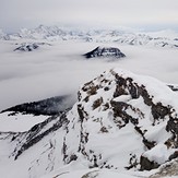
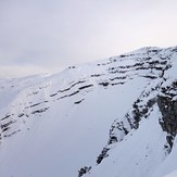
Schafreuter
Schafreuter
Schafreuter

