– Lat/Long: 44.16° N 74.20° W
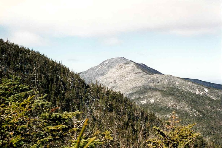
 Seward Mountain (New York)
Weather Forecast, United StatesIssued: 7 am Thu 24 Apr Local TimeUpdates in: hr min sUpdate imminent
Seward Mountain (New York) Weather Forecast, United States
Issued: 7 am Thu 24 Apr Local Time
Updates in:
Update imminent hr min s

Issued: 7 am Thu 24 Apr Local Time
Updates in:
Update imminent hr min s
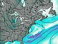
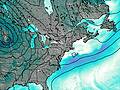
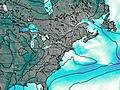
Days 1–3 Weather SummaryModerate rain (total 16mm) heaviest on Sat morning, then becoming colder with a dusting of snow on Sat night. Freeze-thaw conditions (max 12°C on Thu afternoon, min -5°C on Sat night). Winds increasing (light winds from the SW on Fri morning, gales from the NNW by Sat night). | Days 4–6 Weather SummaryA dusting of snow giving way to moderate rain (total 12mm) heaviest on Tue night. Freeze-thaw conditions (max 14°C on Tue afternoon, min -4°C on Sun morning). Winds increasing (moderate winds from the W on Mon morning, severe gales from the W by Tue night). | |||||||||||||||||
Thursday 24 | Friday 25 | Saturday 26 | Sunday 27 | Monday 28 | Tuesday 29 | |||||||||||||
AM | PM | night | AM | PM | night | AM | PM | night | AM | PM | night | AM | PM | night | AM | PM | night | |
clear | light rain | rain shwrs | some clouds | light rain | light rain | mod. rain | light rain | light snow | light snow | clear | clear | clear | clear | some clouds | light rain | rain shwrs | risk tstorm | |
km/h | ||||||||||||||||||
 |  |  |  |  |  | |||||||||||||
— | — | — | — | — | — | — | — | 3 | 1.0 | — | — | — | — | — | — | — | — | |
— | 0.5 | 0.5 | — | 3 | 3 | 8 | 0.6 | — | — | — | — | — | — | — | 0.1 | 1.1 | 11 | |
max°C | 8 | 12 | 10 | 10 | 11 | 9 | 9 | 3 | -4 | -3 | 2 | 3 | 5 | 8 | 10 | 12 | 14 | 14 |
min°C | 7 | 10 | 8 | 9 | 11 | 7 | 8 | -2 | -5 | -4 | 0 | 2 | 4 | 7 | 8 | 11 | 13 | 8 |
3 | 5 | 3 | 6 | 8 | 1 | 2 | -12 | -16 | -15 | -9 | -6 | -1 | 2 | 3 | 6 | 9 | 2 | |
2500 | 2700 | 2700 | 2750 | 2850 | 3100 | 2900 | 1100 | 650 | 850 | 1600 | 2000 | 2250 | 2900 | 3200 | 3700 | 3650 | 3400 | |
Cloud base (m) | 3450 | 1750 | 1900 | 3350 | 2100 | 700 | 400 | 400 | 400 | 450 | 850 | 4300 | 3250 | 2300 | 650 | 750 | 550 | |
5:58 | — | — | 5:56 | — | — | 5:56 | — | — | 5:54 | — | — | 5:52 | — | — | 5:50 | — | — | |
— | 7:51 | — | — | 7:52 | — | — | 7:52 | — | — | 7:54 | — | — | 7:55 | — | — | 7:57 | — | |
Loading...
Seward Mountain (New York) Weather (Days 0-3):
The weather forecast for Seward Mountain (New York) is: Moderate rain (total 16mm) heaviest on Sat morning, then becoming colder with a dusting of snow on Sat night. Freeze-thaw conditions (max 12°C on Thu afternoon, min -5°C on Sat night). Winds increasing (light winds from the SW on Fri morning, gales from the NNW by Sat night).
Seward Mountain (New York) Weather (Days 3-6):
A dusting of snow giving way to moderate rain (total 12mm) heaviest on Tue night. Freeze-thaw conditions (max 14°C on Tue afternoon, min -4°C on Sun morning). Winds increasing (moderate winds from the W on Mon morning, severe gales from the W by Tue night).
This table gives the weather forecast for Seward Mountain (New York) at the specific elevation of 1325 m. Our advanced weather models allow us to provide distinct weather forecasts for several elevations of Seward Mountain (New York). To see the weather forecasts for the other elevations, use the tab navigation above the table. For a wider overview of the weather, consult the Weather Map of New-York.
| Weather Station | Temp. | Weather | Wind | Gusts | Cloud / Visibility |
|---|---|---|---|---|---|
Saranac Lake Airport | |||||
Plattsburgh Air Force Base Airport | |||||
* NOTE: not all weather observatories update at the same frequency which is the reason why some locations may show data from stations that are further away than known closer ones.
Seward Mountain (New York) Photos
View all
Seward Mountains photos (5) |
Appalachians photos (861) |
photos from mountains in United States (2891) |
all photos
 Upload new photo
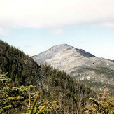
Seward Mountain (New York)

