– Lat/Long: 56.83° N 4.30° W
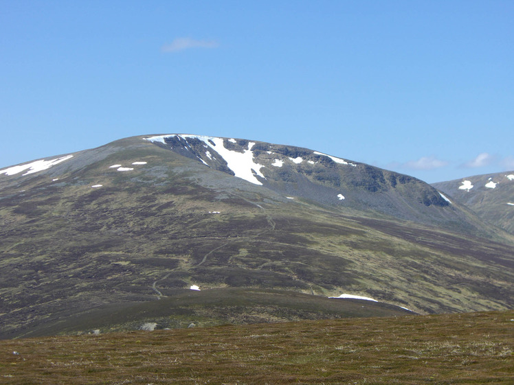
 Sgairneach Mhòr
Weather Forecast, United KingdomIssued: 5 pm Fri 28 Mar Local TimeUpdates in: hr min sUpdate imminent
Sgairneach Mhòr Weather Forecast, United Kingdom
Issued: 5 pm Fri 28 Mar Local Time
Updates in:
Update imminent hr min s

Issued: 5 pm Fri 28 Mar Local Time
Updates in:
Update imminent hr min s
Days 1–4 Weather SummaryA dusting of new snow. Freeze-thaw conditions (max 6°C on Mon morning, min -2°C on Fri night). Winds decreasing (severe gales from the WNW on Sat night, light winds from the WSW by Mon morning). | Days 5–7 Weather SummaryMostly dry. Very mild (max 10°C on Wed morning, min 5°C on Mon night). Wind will be generally light. | Days 8–10 Weather SummaryMostly dry. Very mild (max 12°C on Fri afternoon, min 7°C on Thu night). Winds increasing (light winds from the SSE on Thu afternoon, fresh winds from the SSE by Sat night). | Days 11–13 Weather SummarySome drizzle, heaviest during Tue afternoon. Very mild (max 11°C on Sun afternoon, min 6°C on Tue night). Wind will be generally light. | |||||||||||||||||||||||||||||||||
Fri 28 | Saturday 29 | Sunday 30 | Monday 31 | Tuesday 1 | Wednesday 2 | Thursday 3 | Friday 4 | Saturday 5 | Sunday 6 | Monday 7 | Tuesday 8 | Wed 9 | ||||||||||||||||||||||||
PM | night | AM | PM | night | AM | PM | night | AM | PM | night | AM | PM | night | AM | PM | night | AM | PM | night | AM | PM | night | AM | PM | night | AM | PM | night | AM | PM | night | AM | PM | night | AM | |
some clouds | some clouds | cloudy | light snow | cloudy | clear | clear | some clouds | cloudy | cloudy | some clouds | some clouds | cloudy | clear | clear | clear | clear | clear | clear | clear | clear | clear | some clouds | some clouds | clear | clear | clear | clear | some clouds | some clouds | some clouds | some clouds | cloudy | light rain | rain shwrs | light rain | |
km/h | ||||||||||||||||||||||||||||||||||||
 |  |  |  |  |  |  |  |  |  |  |  |  | ||||||||||||||||||||||||
— | — | — | 2.0 | — | — | — | — | — | — | — | — | — | — | — | — | — | — | — | — | — | — | — | — | — | — | — | — | — | — | — | — | — | — | — | — | |
— | — | — | — | — | — | — | — | — | — | — | — | — | — | — | — | — | — | — | — | — | — | — | — | — | — | — | — | — | — | — | — | — | 0.4 | 0.2 | 0.4 | |
max°C | -1 | -1 | -1 | 2 | 1 | 3 | 4 | 4 | 6 | 7 | 6 | 8 | 8 | 8 | 10 | 10 | 8 | 10 | 10 | 8 | 11 | 12 | 9 | 12 | 12 | 8 | 11 | 11 | 9 | 10 | 10 | 8 | 9 | 10 | 8 | 7 |
min°C | -1 | -2 | -1 | 1 | 0 | 1 | 3 | 3 | 5 | 6 | 5 | 7 | 8 | 6 | 8 | 9 | 7 | 9 | 10 | 7 | 10 | 11 | 9 | 10 | 11 | 7 | 9 | 10 | 8 | 9 | 10 | 7 | 8 | 9 | 6 | 7 |
-10 | -11 | -8 | -7 | -9 | -7 | -2 | -2 | 2 | 4 | 1 | 3 | 5 | 2 | 6 | 8 | 6 | 8 | 8 | 4 | 7 | 8 | 6 | 7 | 8 | 3 | 5 | 8 | 5 | 9 | 9 | 7 | 8 | 7 | 2 | 4 | |
850 | 800 | 850 | 1100 | 1100 | 1200 | 1400 | 2150 | 2200 | 2400 | 2900 | 3150 | 3200 | 3200 | 3200 | 3200 | 3000 | 2900 | 3100 | 2900 | 2700 | 2900 | 3150 | 3200 | 3150 | 2850 | 2950 | 2850 | 2750 | 2600 | 2650 | 2600 | 2400 | 2400 | 2350 | 2200 | |
Cloud base (m) | 500 | 450 | 550 | 300 | 400 | 550 | 800 | 950 | 650 | 900 | 900 | 550 | 7600 | 7500 | 3250 | 5100 | 7900 | 5350 | 6650 | 5450 | 1750 | 1800 | 900 | |||||||||||||
— | — | 5:54 | — | — | 6:52 | — | — | 5:48 | — | — | 5:47 | — | — | 5:43 | — | — | 5:41 | — | — | 5:39 | — | — | 5:35 | — | — | 5:33 | — | — | 5:30 | — | — | 5:28 | — | — | 5:24 | |
6:46 | — | — | 6:50 | — | — | 7:52 | — | — | 6:53 | — | — | 6:55 | — | — | 6:58 | — | — | 7:00 | — | — | 7:01 | — | — | 7:04 | — | — | 7:06 | — | — | 7:08 | — | — | 7:10 | — | — | |
Sgairneach Mhòr Weather (Days 0-3):
The weather forecast for Sgairneach Mhòr is: A dusting of new snow. Freeze-thaw conditions (max 6°C on Mon morning, min -2°C on Fri night). Winds decreasing (severe gales from the WNW on Sat night, light winds from the WSW by Mon morning).
Sgairneach Mhòr Weather (Days 3-6):
Mostly dry. Very mild (max 10°C on Wed morning, min 5°C on Mon night). Wind will be generally light.
Sgairneach Mhòr Weather (Days 6-9):
Mostly dry. Very mild (max 12°C on Fri afternoon, min 7°C on Thu night). Winds increasing (light winds from the SSE on Thu afternoon, fresh winds from the SSE by Sat night).
This table gives the weather forecast for Sgairneach Mhòr at the specific elevation of 991 m. Our advanced weather models allow us to provide distinct weather forecasts for several elevations of Sgairneach Mhòr. To see the weather forecasts for the other elevations, use the tab navigation above the table. For a wider overview of the weather, consult the Weather Map of United Kingdom.
Sgairneach Mhòr Photos
View all
Grampians photos (156) |
Scottish Highlands photos (288) |
photos from mountains in United Kingdom (1944) |
all photos
 Upload new photo
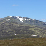
Sgairneach Mhòr

