– Lat/Long: 57.26° N 5.22° W
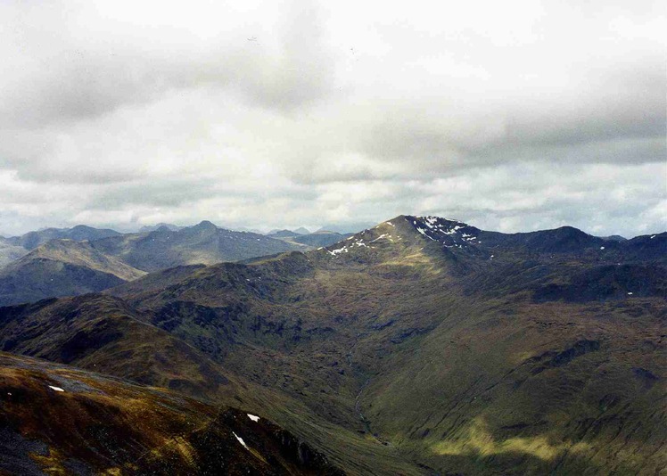
 Sgùrr nan Ceathramhnan
Weather Forecast, United KingdomIssued: 6 pm Mon 31 Mar Local TimeUpdates in: hr min sUpdate imminent
Sgùrr nan Ceathramhnan Weather Forecast, United Kingdom
Issued: 6 pm Mon 31 Mar Local Time
Updates in:
Update imminent hr min s

Issued: 6 pm Mon 31 Mar Local Time
Updates in:
Update imminent hr min s
Days 1–4 Weather SummaryMostly dry. Very mild (max 13°C on Wed afternoon, min 5°C on Wed night). Wind will be generally light. | Days 5–7 Weather SummaryMostly dry. Very mild (max 12°C on Fri afternoon, min 4°C on Thu night). Wind will be generally light. | Days 8–10 Weather SummaryMostly dry. Very mild (max 14°C on Mon afternoon, min 7°C on Sun night). Wind will be generally light. | Days 11–13 Weather SummaryMostly dry. Very mild (max 14°C on Wed afternoon, min 8°C on Wed night). Wind will be generally light. | |||||||||||||||||||||||||||||||||
Mon 31 | Tuesday 1 | Wednesday 2 | Thursday 3 | Friday 4 | Saturday 5 | Sunday 6 | Monday 7 | Tuesday 8 | Wednesday 9 | Thursday 10 | Friday 11 | Sat 12 | ||||||||||||||||||||||||
PM | night | AM | PM | night | AM | PM | night | AM | PM | night | AM | PM | night | AM | PM | night | AM | PM | night | AM | PM | night | AM | PM | night | AM | PM | night | AM | PM | night | AM | PM | night | AM | |
light rain | some clouds | some clouds | some clouds | clear | clear | clear | clear | clear | clear | clear | clear | clear | clear | clear | clear | clear | clear | clear | clear | clear | clear | cloudy | cloudy | clear | clear | clear | clear | some clouds | some clouds | clear | clear | cloudy | cloudy | cloudy | clear | |
km/h | ||||||||||||||||||||||||||||||||||||
 |  |  |  |  |  |  |  |  |  |  |  |  | ||||||||||||||||||||||||
— | — | — | — | — | — | — | — | — | — | — | — | — | — | — | — | — | — | — | — | — | — | — | — | — | — | — | — | — | — | — | — | — | — | — | — | |
0.2 | — | — | — | — | — | — | — | — | — | — | — | — | — | — | — | — | — | — | — | — | — | — | — | — | — | — | — | — | — | — | — | — | — | — | — | |
max°C | 8 | 7 | 11 | 12 | 10 | 12 | 13 | 8 | 10 | 11 | 6 | 10 | 12 | 5 | 10 | 12 | 6 | 11 | 13 | 9 | 13 | 14 | 9 | 12 | 14 | 9 | 13 | 14 | 11 | 13 | 14 | 9 | 12 | 13 | 9 | 11 |
min°C | 8 | 6 | 9 | 11 | 7 | 10 | 11 | 5 | 8 | 10 | 4 | 7 | 10 | 4 | 7 | 10 | 5 | 8 | 12 | 7 | 10 | 13 | 8 | 10 | 13 | 7 | 11 | 14 | 8 | 11 | 12 | 8 | 11 | 11 | 8 | 10 |
6 | 4 | 7 | 10 | 5 | 9 | 11 | 3 | 6 | 8 | 2 | 5 | 9 | 3 | 6 | 10 | 4 | 7 | 12 | 7 | 10 | 13 | 8 | 10 | 13 | 6 | 11 | 14 | 7 | 10 | 11 | 6 | 10 | 10 | 6 | 8 | |
2650 | 2450 | 3150 | 3200 | 3100 | 3100 | 3100 | 2750 | 2750 | 2650 | 2750 | 2650 | 2550 | 2850 | 2950 | 3100 | 3150 | 3250 | 3200 | 3150 | 2800 | 2750 | 2650 | 2500 | 2450 | 2550 | 2600 | 2750 | 2850 | 2750 | 2650 | 2700 | 2600 | 2700 | 2700 | 2600 | |
Cloud base (m) | 400 | 5850 | 6850 | 6850 | 8500 | 8250 | 400 | 8950 | 8950 | 9100 | 9200 | 8900 | 8450 | 9200 | 6800 | 4900 | 5000 | 8400 | 8700 | 6200 | 5150 | 5300 | 5650 | 7350 | ||||||||||||
— | — | 6:50 | — | — | 6:48 | — | — | 6:46 | — | — | 6:43 | — | — | 6:39 | — | — | 6:37 | — | — | 6:35 | — | — | 6:31 | — | — | 6:28 | — | — | 6:26 | — | — | 6:24 | — | — | 6:20 | |
7:57 | — | — | 7:59 | — | — | 8:00 | — | — | 8:02 | — | — | 8:06 | — | — | 8:07 | — | — | 8:09 | — | — | 8:12 | — | — | 8:14 | — | — | 8:15 | — | — | 8:17 | — | — | 8:21 | — | — | |
Sgùrr nan Ceathramhnan Weather (Days 0-3):
The weather forecast for Sgùrr nan Ceathramhnan is: Mostly dry. Very mild (max 13°C on Wed afternoon, min 5°C on Wed night). Wind will be generally light.
Sgùrr nan Ceathramhnan Weather (Days 3-6):
Mostly dry. Very mild (max 12°C on Fri afternoon, min 4°C on Thu night). Wind will be generally light.
Sgùrr nan Ceathramhnan Weather (Days 6-9):
Mostly dry. Very mild (max 14°C on Mon afternoon, min 7°C on Sun night). Wind will be generally light.
This table gives the weather forecast for Sgùrr nan Ceathramhnan at the specific elevation of 500 m. Our advanced weather models allow us to provide distinct weather forecasts for several elevations of Sgùrr nan Ceathramhnan. To see the weather forecasts for the other elevations, use the tab navigation above the table. For a wider overview of the weather, consult the Weather Map of United Kingdom.
Sgùrr nan Ceathramhnan Photos
View all
Northwest Highlands photos (38) |
Scottish Highlands photos (288) |
photos from mountains in United Kingdom (1944) |
all photos
 Upload new photo
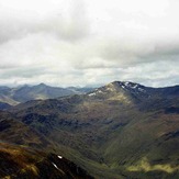
Sgùrr nan Ceathramhnan

