
– Lat/Long: 48.37° S 72.35° W
 Sierra de Sangra
Weather Forecast, ArgentinaIssued: 1 pm Tue 22 Apr Local TimeUpdates in: hr min sUpdate imminent
Sierra de Sangra Weather Forecast, Argentina
Issued: 1 pm Tue 22 Apr Local Time
Updates in:
Update imminent hr min s

Issued: 1 pm Tue 22 Apr Local Time
Updates in:
Update imminent hr min s
Days 1–4 Weather SummaryA dusting of new snow. Temperatures will be below freezing (max 0°C on Tue night, min -10°C on Fri morning). Winds decreasing (gales from the W on Tue night, light winds from the WSW by Thu night). | Days 5–7 Weather SummaryA light covering of new snow mostly falling on Fri night. Freeze-thaw conditions (max 1°C on Sun morning, min -10°C on Fri afternoon). Winds decreasing (extremely windy from the W on Sun morning, strong winds from the W by Mon morning). | ||||||||||||||||
Tue 22 | Wednesday 23 | Thursday 24 | Friday 25 | Saturday 26 | Sunday 27 | ||||||||||||
PM | night | AM | PM | night | AM | PM | night | AM | PM | night | AM | PM | night | AM | PM | night | |
cloudy | some clouds | some clouds | clear | some clouds | some clouds | snow shwrs | cloudy | some clouds | some clouds | snow shwrs | some clouds | some clouds | light snow | cloudy | cloudy | cloudy | |
km/h | |||||||||||||||||
 |  |  |  |  |  | ||||||||||||
— | — | — | — | — | — | 1.0 | — | — | — | 5 | — | — | 2.0 | — | — | — | |
— | — | — | — | — | — | — | — | — | — | — | — | — | — | — | — | — | |
max°C | -2 | 0 | -2 | 0 | -1 | -2 | -2 | -4 | -8 | -9 | -6 | -9 | -6 | -1 | 1 | 0 | 0 |
min°C | -2 | -3 | -3 | -1 | -2 | -2 | -2 | -7 | -10 | -10 | -9 | -9 | -7 | -5 | 0 | 0 | -1 |
-11 | -11 | -11 | -9 | -11 | -11 | -11 | -14 | -20 | -23 | -23 | -22 | -20 | -17 | -11 | -11 | -11 | |
1700 | 1400 | 1550 | 1900 | 2050 | 1900 | 1750 | 1100 | 800 | 900 | 950 | 800 | 1000 | 1200 | 3200 | 2000 | 2050 | |
Cloud base (m) | 750 | 700 | 650 | 1900 | 1600 | 550 | 600 | 600 | 1500 | 550 | 650 | 650 | 600 | 600 | 600 | 600 | |
— | — | 7:39 | — | — | 7:41 | — | — | 7:41 | — | — | 7:43 | — | — | 7:45 | — | — | |
5:55 | — | — | 5:53 | — | — | 5:52 | — | — | 5:51 | — | — | 5:49 | — | — | 5:46 | — | |
Loading...
Sierra de Sangra Weather (Days 0-3):
The weather forecast for Sierra de Sangra is: A dusting of new snow. Temperatures will be below freezing (max 0°C on Tue night, min -10°C on Fri morning). Winds decreasing (gales from the W on Tue night, light winds from the WSW by Thu night).
Sierra de Sangra Weather (Days 3-6):
A light covering of new snow mostly falling on Fri night. Freeze-thaw conditions (max 1°C on Sun morning, min -10°C on Fri afternoon). Winds decreasing (extremely windy from the W on Sun morning, strong winds from the W by Mon morning).
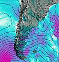
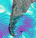
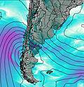
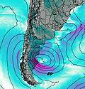
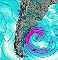
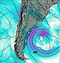
This table gives the weather forecast for Sierra de Sangra at the specific elevation of 2200 m. Our advanced weather models allow us to provide distinct weather forecasts for several elevations of Sierra de Sangra. To see the weather forecasts for the other elevations, use the tab navigation above the table. For a wider overview of the weather, consult the Weather Map of Argentina.
| Weather Station | Temp. | Weather | Wind | Gusts | Cloud / Visibility |
|---|---|---|---|---|---|
Chile Chico | |||||
Aeropuerto Internacional de El Calafate Airport | |||||
Balmaceda Airport | |||||
hy2c284E47S | |||||
Coyhaique | |||||
Puerto Aysan | |||||
hy2c283E47S | |||||
hy2c284E46S |
* NOTE: not all weather observatories update at the same frequency which is the reason why some locations may show data from stations that are further away than known closer ones.

