– Lat/Long: 52.86° N 117.97° W
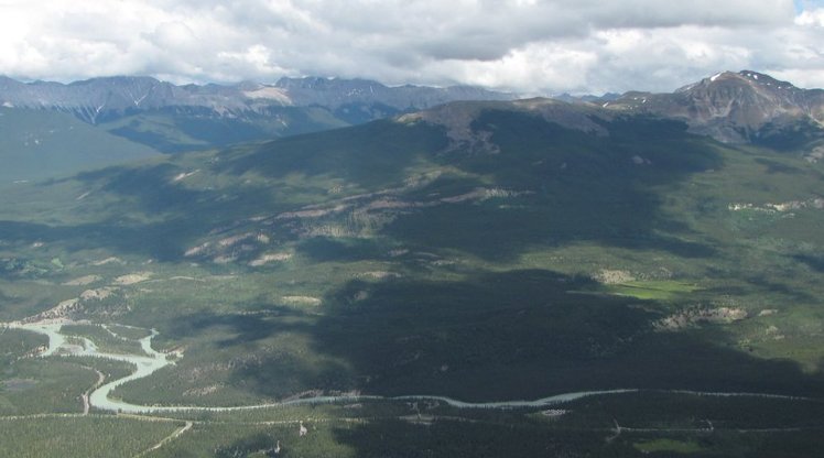
 Signal Mountain (Alberta)
Weather Forecast, CanadaIssued: 5 pm Mon 12 May Local TimeUpdates in: hr min sUpdate imminent
Issued: 5 pm Mon 12 May Local Time
Updates in:
Update imminent hr min s

Issued: 5 pm Mon 12 May Local Time
Updates in:
Update imminent hr min s
Days 1–4 Weather SummaryA heavy fall of snow, heaviest during Mon afternoon. Freeze-thaw conditions (max 2°C on Tue afternoon, min -5°C on Wed night). Wind will be generally light. | Days 5–7 Weather SummaryA light covering of new snow mostly falling on Fri afternoon. Freeze-thaw conditions (max 1°C on Fri afternoon, min -3°C on Thu night). Wind will be generally light. | ||||||||||||||||
Mon 12 | Tuesday 13 | Wednesday 14 | Thursday 15 | Friday 16 | Saturday 17 | ||||||||||||
PM | night | AM | PM | night | AM | PM | night | AM | PM | night | AM | PM | night | AM | PM | night | |
mod. snow | light snow | some clouds | rain shwrs | some clouds | cloudy | mod. snow | snow shwrs | cloudy | cloudy | cloudy | cloudy | light snow | light snow | light snow | some clouds | some clouds | |
km/h | |||||||||||||||||
 |  |  |  |  |  | ||||||||||||
10 | 2.0 | — | — | — | — | 6 | 6 | — | — | — | — | 1.0 | 4 | 2.0 | — | — | |
— | — | — | 0.4 | — | — | — | — | — | — | — | — | — | — | — | — | — | |
max°C | -2 | -2 | 0 | 2 | 1 | 1 | 2 | -3 | -2 | -1 | -1 | 0 | 1 | 0 | -1 | 1 | 0 |
min°C | -2 | -2 | -1 | 1 | -1 | 0 | -1 | -5 | -4 | -1 | -3 | -1 | 1 | -2 | -2 | 0 | -1 |
-8 | -6 | -1 | -2 | -4 | -3 | -4 | -5 | -4 | -3 | -6 | -1 | 1 | -2 | -2 | 0 | -1 | |
1850 | 1900 | 2000 | 2400 | 2300 | 2350 | 2500 | 1700 | 1450 | 2100 | 1750 | 2100 | 2400 | 2150 | 2000 | 2250 | 2200 | |
Cloud base (m) | 1800 | 1800 | 1800 | 2150 | 2750 | 2600 | 2250 | 1800 | 1800 | 1900 | 2050 | 2100 | 2450 | 1850 | 1800 | 1850 | 2250 |
— | — | 5:56 | — | — | 5:56 | — | — | 5:54 | — | — | 5:52 | — | — | 5:50 | — | — | |
— | 9:37 | — | — | 9:38 | — | — | 9:40 | — | — | 9:42 | — | — | 9:44 | — | — | 9:45 | |
Loading...
Signal Mountain (Alberta) Weather (Days 0-3):
The weather forecast for Signal Mountain (Alberta) is: A heavy fall of snow, heaviest during Mon afternoon. Freeze-thaw conditions (max 2°C on Tue afternoon, min -5°C on Wed night). Wind will be generally light.
Signal Mountain (Alberta) Weather (Days 3-6):
A light covering of new snow mostly falling on Fri afternoon. Freeze-thaw conditions (max 1°C on Fri afternoon, min -3°C on Thu night). Wind will be generally light.
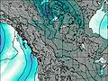
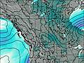
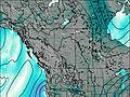
This table gives the weather forecast for Signal Mountain (Alberta) at the specific elevation of 2255 m. Our advanced weather models allow us to provide distinct weather forecasts for several elevations of Signal Mountain (Alberta). To see the weather forecasts for the other elevations, use the tab navigation above the table. For a wider overview of the weather, consult the Weather Map of Alberta.
| Weather Station | Temp. | Weather | Wind | Gusts | Cloud / Visibility |
|---|---|---|---|---|---|
JasperWarden-Alta | |||||
Jasper Warden Airport | |||||
lightning 22km NNW of Hinton | |||||
Hendrickson Creek- Alta | |||||
Blue River Airport | |||||
BlueRiverCs- BC | |||||
EdsonClimate-Alta | |||||
Nordegg Cs- Alta |
* NOTE: not all weather observatories update at the same frequency which is the reason why some locations may show data from stations that are further away than known closer ones.
Signal Mountain (Alberta) Photos
View all
Canadian Rockies photos (86) |
photos from mountains in Canada (441) |
all photos
 Upload new photo
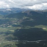
Signal Mountain (Alberta)