
– Lat/Long: 32.94° N 97.91° W
 Slipdown Mountain
Weather Forecast, United StatesIssued: 6 pm Fri 18 Apr Local TimeUpdates in: hr min sUpdate imminent
Slipdown Mountain Weather Forecast, United States
Issued: 6 pm Fri 18 Apr Local Time
Updates in:
Update imminent hr min s

Issued: 6 pm Fri 18 Apr Local Time
Updates in:
Update imminent hr min s
Days 1–4 Weather SummaryHeavy rain (total 26mm), heaviest during Sat night. Warm (max 28°C on Fri afternoon, min 15°C on Sat night). Winds decreasing (near gales from the SSE on Sat night, calm by Sun night). | Days 5–7 Weather SummaryModerate rain (total 18mm), heaviest on Thu morning. Warm (max 28°C on Tue afternoon, min 17°C on Mon night). Mainly fresh winds. | ||||||||||||||||
Fri 18 | Saturday 19 | Sunday 20 | Monday 21 | Tuesday 22 | Wednesday 23 | ||||||||||||
PM | night | AM | PM | night | AM | PM | night | AM | PM | night | AM | PM | night | AM | PM | night | |
some clouds | mod. rain | mod. rain | risk tstorm | risk tstorm | clear | clear | clear | clear | clear | clear | clear | rain shwrs | risk tstorm | clear | risk tstorm | risk tstorm | |
km/h | |||||||||||||||||
 |  |  |  |  |  | ||||||||||||
— | — | — | — | — | — | — | — | — | — | — | — | — | — | — | — | — | |
— | 9 | 6 | 3 | 8 | — | — | — | — | — | — | — | 0.2 | 10 | — | 0.2 | 0.5 | |
max°C | 28 | 24 | 19 | 22 | 21 | 18 | 20 | 16 | 23 | 25 | 19 | 25 | 28 | 22 | 24 | 26 | 23 |
min°C | 27 | 20 | 18 | 21 | 15 | 17 | 19 | 15 | 19 | 23 | 17 | 22 | 25 | 19 | 21 | 25 | 20 |
27 | 20 | 18 | 21 | 13 | 15 | 19 | 15 | 19 | 23 | 16 | 22 | 25 | 19 | 21 | 25 | 20 | |
4250 | 4000 | 3750 | 3750 | 4150 | 3550 | 3850 | 3750 | 3600 | 3800 | 4000 | 3950 | 4000 | 4000 | 3850 | 4050 | 4300 | |
Cloud base (m) | 4450 | 5750 | 2350 | 2300 | 750 | 9050 | 3050 | 300 | 1700 | 9100 | |||||||
— | — | 6:56 | — | — | 6:56 | — | — | 6:54 | — | — | 6:54 | — | — | 6:52 | — | — | |
8:02 | — | — | 8:04 | — | — | 8:05 | — | — | 8:06 | — | — | 8:06 | — | — | 8:07 | — | |
Loading...
Slipdown Mountain Weather (Days 0-3):
The weather forecast for Slipdown Mountain is: Heavy rain (total 26mm), heaviest during Sat night. Warm (max 28°C on Fri afternoon, min 15°C on Sat night). Winds decreasing (near gales from the SSE on Sat night, calm by Sun night).
Slipdown Mountain Weather (Days 3-6):
Moderate rain (total 18mm), heaviest on Thu morning. Warm (max 28°C on Tue afternoon, min 17°C on Mon night). Mainly fresh winds.
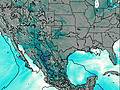
This table gives the weather forecast for Slipdown Mountain at the specific elevation of 417 m. Our advanced weather models allow us to provide distinct weather forecasts for several elevations of Slipdown Mountain. To see the weather forecasts for the other elevations, use the tab navigation above the table. For a wider overview of the weather, consult the Weather Map of Texas.
| Weather Station | Temp. | Weather | Wind | Gusts | Cloud / Visibility |
|---|---|---|---|---|---|
Decatur Airport | |||||
Fort Worth Naval Air Station Airport | |||||
Fort Worth Airport | |||||
FT Wort / lliance Airport |
* NOTE: not all weather observatories update at the same frequency which is the reason why some locations may show data from stations that are further away than known closer ones.

