
– Lat/Long: 53.97° N 66.93° W
 Smokey Mountains
Weather Forecast, CanadaIssued: 8 pm Thu 24 Apr Local TimeUpdates in: hr min sUpdate imminent
Smokey Mountains Weather Forecast, Canada
Issued: 8 pm Thu 24 Apr Local Time
Updates in:
Update imminent hr min s

Issued: 8 pm Thu 24 Apr Local Time
Updates in:
Update imminent hr min s
Days 1–4 Weather SummaryMostly dry. Freeze-thaw conditions (max 7°C on Sun afternoon, min -4°C on Thu night). Winds increasing (light winds from the NNW on Thu night, fresh winds from the WNW by Sun afternoon). | Days 5–7 Weather SummaryModerate rain (total 11mm) heaviest on Tue afternoon, then becoming colder with a dusting of snow on Tue night. Freeze-thaw conditions (max 6°C on Sun night, min -9°C on Wed morning). Winds increasing (light winds from the WSW on Mon morning, near gales from the SW by Mon night). | ||||||||||||||||||
Friday 25 | Saturday 26 | Sunday 27 | Monday 28 | Tuesday 29 | Wednesday 30 | ||||||||||||||
night | AM | PM | night | AM | PM | night | AM | PM | night | AM | PM | night | AM | PM | night | AM | PM | night | |
cloudy | some clouds | clear | clear | clear | clear | clear | clear | some clouds | rain shwrs | cloudy | cloudy | light rain | light rain | light rain | light snow | cloudy | some clouds | clear | |
km/h | |||||||||||||||||||
 |  |  |  |  |  |  | |||||||||||||
— | — | — | — | — | — | — | — | — | — | — | — | — | — | — | 2.0 | — | — | — | |
— | — | — | — | — | — | — | — | — | 0.3 | — | — | 1.0 | 3 | 4 | 2 | — | — | — | |
max°C | -2 | -3 | 0 | 0 | 2 | 5 | 4 | 4 | 7 | 6 | 0 | 6 | 6 | 5 | 5 | 4 | -6 | -3 | -4 |
min°C | -4 | -3 | -1 | -1 | 0 | 3 | 1 | 3 | 7 | 0 | -1 | 3 | 5 | 4 | 4 | -7 | -9 | -4 | -5 |
-7 | -7 | -4 | -5 | -5 | -1 | -4 | -2 | 3 | -6 | -5 | -2 | -1 | -3 | -2 | -17 | -20 | -14 | -14 | |
450 | 300 | 750 | 800 | 850 | 1200 | 1250 | 1350 | 1600 | 1600 | 550 | 1350 | 1650 | 1400 | 1950 | 1150 | 0 | 350 | 150 | |
Cloud base (m) | 550 | 450 | 550 | 6550 | 5550 | 1850 | 1950 | 9000 | 2250 | 1600 | 450 | 400 | 550 | 350 | 350 | 350 | 500 | 800 | |
— | 6:05 | — | — | 6:01 | — | — | 6:00 | — | — | 5:58 | — | — | 5:56 | — | — | 5:54 | — | — | |
— | — | 8:46 | — | — | 8:49 | — | — | 8:51 | — | — | 8:52 | — | — | 8:54 | — | — | 8:55 | — | |
Loading...
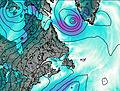
Smokey Mountains Weather (Days 0-3):
The weather forecast for Smokey Mountains is: Mostly dry. Freeze-thaw conditions (max 7°C on Sun afternoon, min -4°C on Thu night). Winds increasing (light winds from the NNW on Thu night, fresh winds from the WNW by Sun afternoon).
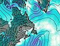
Smokey Mountains Weather (Days 3-6):
Moderate rain (total 11mm) heaviest on Tue afternoon, then becoming colder with a dusting of snow on Tue night. Freeze-thaw conditions (max 6°C on Sun night, min -9°C on Wed morning). Winds increasing (light winds from the WSW on Mon morning, near gales from the SW by Mon night).
This table gives the weather forecast for Smokey Mountains at the specific elevation of 838 m. Our advanced weather models allow us to provide distinct weather forecasts for several elevations of Smokey Mountains. To see the weather forecasts for the other elevations, use the tab navigation above the table. For a wider overview of the weather, consult the Weather Map of Newfoundland.
| Weather Station | Temp. | Weather | Wind | Gusts | Cloud / Visibility |
|---|---|---|---|---|---|
Schefferville A- QC | |||||
Wabush Lake Airport | |||||
Churchill Falls A- Nfld | |||||
Lac Benoit- Que | |||||
Sept Iles Airport |
* NOTE: not all weather observatories update at the same frequency which is the reason why some locations may show data from stations that are further away than known closer ones.

