– Lat/Long: 40.60° N 115.40° W
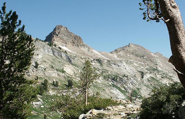
 Snow Lake Peak
Weather Forecast, United StatesIssued: 4 am Sun 27 Apr Local TimeUpdates in: hr min sUpdate imminent
Snow Lake Peak Weather Forecast, United States
Issued: 4 am Sun 27 Apr Local Time
Updates in:
Update imminent hr min s

Issued: 4 am Sun 27 Apr Local Time
Updates in:
Update imminent hr min s
Days 1–3 Weather SummaryA moderate fall of snow, heaviest on Sun night. Freeze-thaw conditions (max 5°C on Tue afternoon, min -3°C on Sun morning). Wind will be generally light. | Days 4–6 Weather SummaryMostly dry. Very mild (max 12°C on Fri afternoon, min 1°C on Wed morning). Winds increasing (calm on Wed night, strong winds from the SSW by Fri night). | |||||||||||||||||
Sunday 27 | Monday 28 | Tuesday 29 | Wednesday 30 | Thursday 1 | Friday 2 | |||||||||||||
AM | PM | night | AM | PM | night | AM | PM | night | AM | PM | night | AM | PM | night | AM | PM | night | |
cloudy | light snow | heavy snow | light snow | cloudy | some clouds | some clouds | some clouds | light snow | some clouds | some clouds | clear | clear | clear | clear | clear | clear | some clouds | |
km/h | ||||||||||||||||||
 |  |  |  |  |  | |||||||||||||
— | 3 | 14 | 1.0 | — | — | — | — | 1.0 | — | — | — | — | — | — | — | — | — | |
— | — | — | — | — | — | — | — | 0.4 | — | — | — | — | — | — | — | — | — | |
max°C | -2 | -1 | -1 | -1 | 1 | 1 | 3 | 5 | 5 | 2 | 5 | 4 | 4 | 8 | 7 | 8 | 12 | 12 |
min°C | -3 | -1 | -2 | -2 | 0 | 0 | 1 | 4 | 2 | 1 | 5 | 2 | 3 | 7 | 6 | 7 | 11 | 8 |
-8 | -5 | -8 | -5 | -4 | -3 | -2 | 1 | -2 | -3 | 2 | 2 | 3 | 7 | 4 | 5 | 9 | 3 | |
2200 | 2300 | 2150 | 2350 | 2600 | 2650 | 2850 | 3200 | 2850 | 2800 | 3100 | 2900 | 2950 | 3500 | 3450 | 3500 | 4000 | 3800 | |
Cloud base (m) | 3150 | 2550 | 2150 | 2200 | 2150 | 3050 | 2200 | 2200 | 2400 | 2200 | 2950 | 3600 | 4550 | 4750 | ||||
5:46 | — | — | 5:43 | — | — | 5:43 | — | — | 5:41 | — | — | 5:39 | — | — | 5:39 | — | — | |
— | 7:32 | — | — | 7:34 | — | — | 7:35 | — | — | 7:36 | — | — | 7:37 | — | — | 7:37 | — | |
Loading...
Snow Lake Peak Weather (Days 0-3):
The weather forecast for Snow Lake Peak is: A moderate fall of snow, heaviest on Sun night. Freeze-thaw conditions (max 5°C on Tue afternoon, min -3°C on Sun morning). Wind will be generally light.
Snow Lake Peak Weather (Days 3-6):
Mostly dry. Very mild (max 12°C on Fri afternoon, min 1°C on Wed morning). Winds increasing (calm on Wed night, strong winds from the SSW by Fri night).
This table gives the weather forecast for Snow Lake Peak at the specific elevation of 2500 m. Our advanced weather models allow us to provide distinct weather forecasts for several elevations of Snow Lake Peak. To see the weather forecasts for the other elevations, use the tab navigation above the table. For a wider overview of the weather, consult the Weather Map of Nevada.
| Weather Station | Temp. | Weather | Wind | Gusts | Cloud / Visibility |
|---|---|---|---|---|---|
Elko Airport | |||||
Battle Mountain Airport | |||||
Ely Airport |
* NOTE: not all weather observatories update at the same frequency which is the reason why some locations may show data from stations that are further away than known closer ones.
Snow Lake Peak Photos
View all
Ruby Mountains photos (2) |
Intermountain West photos (146) |
photos from mountains in United States (2892) |
all photos
 Upload new photo
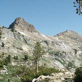
Snow Lake Peak

