– Lat/Long: 39.38° N 122.75° W
 Snow Mountain East
Weather Forecast, United StatesIssued: 10 pm Wed 01 Apr Local TimeUpdates in: hr min sUpdate imminent
Issued: 10 pm Wed 01 Apr Local Time
Updates in:
Update imminent hr min s

Issued: 10 pm Wed 01 Apr Local Time
Updates in:
Update imminent hr min s
Days 1–4 Weather SummaryA dusting of new snow. Freeze-thaw conditions (max 10°C on Sat afternoon, min -3°C on Wed night). Winds decreasing (gales from the WSW on Wed night, light winds from the ENE by Sat afternoon). | Days 5–7 Weather SummarySome drizzle, heaviest during Tue afternoon. Very mild (max 10°C on Sat night, min 4°C on Tue morning). Winds increasing (light winds from the E on Sat night, strong winds from the SW by Tue afternoon). | ||||||||||||||||||
Thursday 2 | Friday 3 | Saturday 4 | Sunday 5 | Monday 6 | Tuesday 7 | ||||||||||||||
night | AM | PM | night | AM | PM | night | AM | PM | night | AM | PM | night | AM | PM | night | AM | PM | night | |
snow shwrs | clear | clear | clear | clear | clear | clear | clear | clear | clear | clear | some clouds | some clouds | some clouds | clear | clear | rain shwrs | rain shwrs | rain shwrs | |
km/h | |||||||||||||||||||
 |  |  |  |  |  |  | |||||||||||||
3 | — | — | — | — | — | — | — | — | — | — | — | — | — | — | — | — | — | — | |
— | — | — | — | — | — | — | — | — | — | — | — | — | — | — | — | 0.2 | 0.9 | 0.3 | |
max °C | 0 | -1 | 3 | 5 | 7 | 9 | 9 | 9 | 10 | 10 | 9 | 10 | 9 | 8 | 9 | 8 | 5 | 5 | 3 |
min °C | -3 | -3 | 0 | 3 | 6 | 9 | 8 | 9 | 10 | 9 | 9 | 9 | 8 | 8 | 9 | 6 | 4 | 4 | 0 |
-12 | -12 | -5 | -2 | 2 | 7 | 6 | 7 | 8 | 7 | 7 | 7 | 5 | 5 | 7 | 2 | -1 | -2 | -5 | |
1200 | 1750 | 2950 | 3250 | 3400 | 3400 | 3600 | 3600 | 3550 | 3450 | 3400 | 3200 | 3300 | 3300 | 3250 | 3200 | 2850 | 2750 | 2350 | |
Cloud base (m) | 850 | 9250 | 4900 | 8850 | 1950 | 2100 | 750 | ||||||||||||
— | 6:54 | — | — | 6:52 | — | — | 6:50 | — | — | 6:48 | — | — | 6:48 | — | — | 6:46 | — | — | |
— | — | 7:35 | — | — | 7:36 | — | — | 7:37 | — | — | 7:37 | — | — | 7:38 | — | — | 7:39 | — | |
Loading...
Snow Mountain East Weather (Days 0-3):
The weather forecast for Snow Mountain East is: A dusting of new snow. Freeze-thaw conditions (max 10°C on Sat afternoon, min -3°C on Wed night). Winds decreasing (gales from the WSW on Wed night, light winds from the ENE by Sat afternoon).
Snow Mountain East Weather (Days 3-6):
Some drizzle, heaviest during Tue afternoon. Very mild (max 10°C on Sat night, min 4°C on Tue morning). Winds increasing (light winds from the E on Sat night, strong winds from the SW by Tue afternoon).
This table gives the weather forecast for Snow Mountain East at the specific elevation of 2151 m. Our advanced weather models allow us to provide distinct weather forecasts for several elevations of Snow Mountain East. To see the weather forecasts for the other elevations, use the tab navigation above the table. For a wider overview of the weather, consult the Weather Map of California.
| Weather Station | Temp. | Weather | Wind | Gusts | Cloud / Visibility |
|---|---|---|---|---|---|
Ukiah Airport | |||||
* NOTE: not all weather observatories update at the same frequency which is the reason why some locations may show data from stations that are further away than known closer ones.
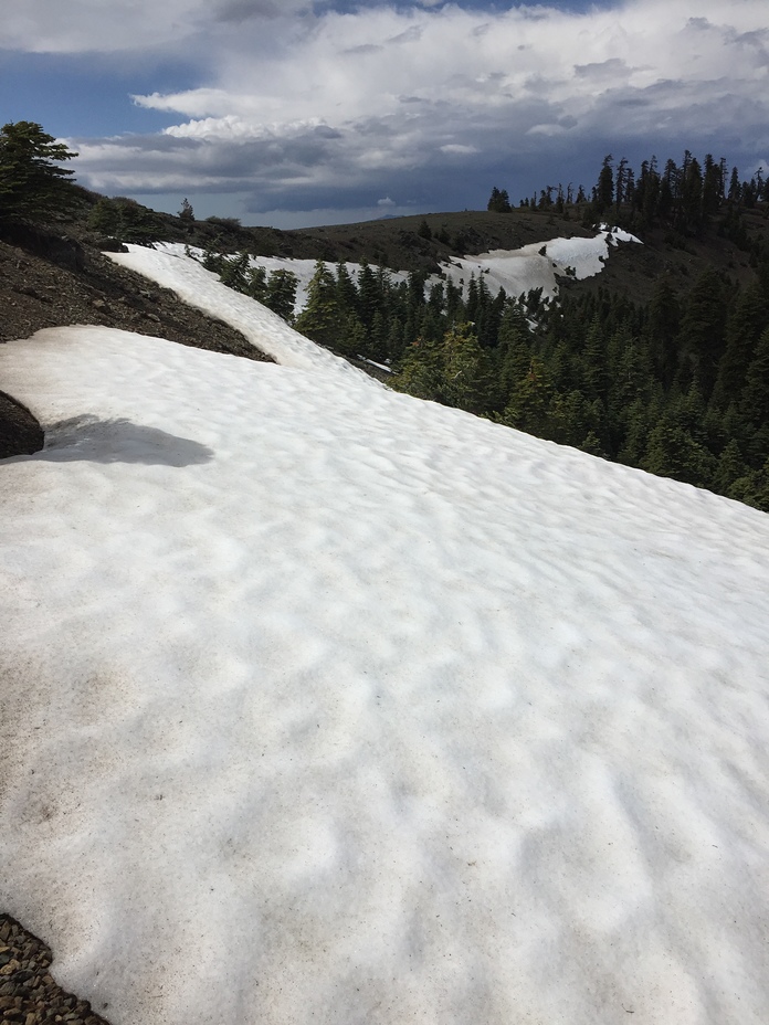
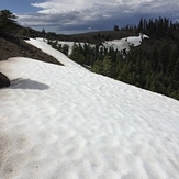
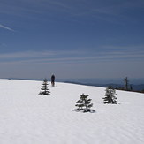
Snow Mountain East Photos
View all
North Coast Ranges photos (7) |
Pacific Coast Ranges photos (1047) |
photos from mountains in United States (3033) |
all photos
 Upload new photo
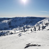
Snow Mountain
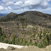
Snow Mountain East from Snow Mt. West
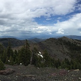
From the summit of Snow Mt. East
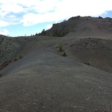
Near the summit
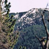
Snow Mountain East