– Lat/Long: 46.11° N 7.86° E
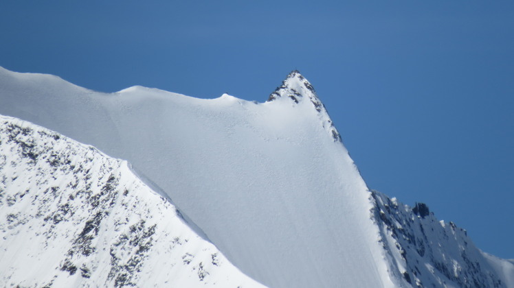
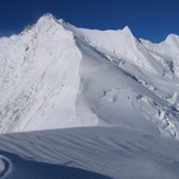
 Stecknadelhorn
Weather Forecast, SwitzerlandIssued: 7 pm Sun 27 Apr Local TimeUpdates in: hr min sUpdate imminent
Stecknadelhorn Weather Forecast, Switzerland
Issued: 7 pm Sun 27 Apr Local Time
Updates in:
Update imminent hr min s

Issued: 7 pm Sun 27 Apr Local Time
Updates in:
Update imminent hr min s
Days 1–4 Weather SummaryA moderate fall of snow, heaviest on Tue night. Temperatures will be below freezing (max -2°C on Wed afternoon, min -6°C on Sun night). Wind will be generally light. | Days 5–7 Weather SummaryA dusting of snow on Wed night. Freezing level rising with drizzle on Fri afternoon. Freeze-thaw conditions (max 3°C on Fri morning, min -2°C on Wed night). Wind will be generally light. | ||||||||||||||||||
Monday 28 | Tuesday 29 | Wednesday 30 | Thursday 1 | Friday 2 | Saturday 3 | ||||||||||||||
night | AM | PM | night | AM | PM | night | AM | PM | night | AM | PM | night | AM | PM | night | AM | PM | night | |
snow shwrs | clear | snow shwrs | snow shwrs | clear | snow shwrs | snow shwrs | clear | snow shwrs | snow shwrs | clear | some clouds | clear | clear | rain shwrs | risk tstorm | cloudy | snow shwrs | snow shwrs | |
km/h | |||||||||||||||||||
 |  |  |  |  |  |  | |||||||||||||
1.0 | — | 1.0 | 1.0 | — | 1.0 | 6 | — | 1.0 | 1.0 | — | — | — | — | — | — | — | 1.0 | 1.0 | |
— | — | — | — | — | — | — | — | — | — | — | — | — | — | 0.5 | 0.7 | — | — | — | |
max°C | -6 | -6 | -4 | -4 | -4 | -3 | -4 | -4 | -2 | -1 | -1 | 1 | 2 | 3 | 3 | 3 | 2 | 1 | 1 |
min°C | -6 | -6 | -5 | -5 | -4 | -3 | -4 | -4 | -2 | -2 | -1 | 0 | 0 | 2 | 3 | 3 | 1 | 1 | 0 |
-10 | -10 | -8 | -5 | -4 | -3 | -4 | -4 | -4 | -2 | -1 | 0 | -2 | -1 | 1 | 0 | 1 | 1 | -3 | |
2500 | 2700 | 2900 | 2800 | 2950 | 3050 | 2950 | 3000 | 3200 | 3300 | 3400 | 3650 | 3650 | 3850 | 3950 | 3900 | 3700 | 3600 | 3600 | |
Cloud base (m) | 2850 | 2950 | 3350 | 3050 | 3000 | 2850 | 2850 | 3000 | 3550 | 4650 | 7200 | 2950 | 3500 | ||||||
— | 6:20 | — | — | 6:18 | — | — | 6:16 | — | — | 6:16 | — | — | 6:13 | — | — | 6:13 | — | — | |
— | — | — | 8:31 | — | — | 8:32 | — | — | 8:34 | — | — | 8:36 | — | — | 8:37 | — | — | 8:37 | |
Loading...
Stecknadelhorn Weather (Days 0-3):
The weather forecast for Stecknadelhorn is: A moderate fall of snow, heaviest on Tue night. Temperatures will be below freezing (max -2°C on Wed afternoon, min -6°C on Sun night). Wind will be generally light.
Stecknadelhorn Weather (Days 3-6):
A dusting of snow on Wed night. Freezing level rising with drizzle on Fri afternoon. Freeze-thaw conditions (max 3°C on Fri morning, min -2°C on Wed night). Wind will be generally light.
This table gives the weather forecast for Stecknadelhorn at the specific elevation of 3500 m. Our advanced weather models allow us to provide distinct weather forecasts for several elevations of Stecknadelhorn. To see the weather forecasts for the other elevations, use the tab navigation above the table. For a wider overview of the weather, consult the Weather Map of Switzerland.
Stecknadelhorn Photos
View all
Pennine Alps photos (197) |
Alps photos (1456) |
photos from mountains in Switzerland (643) |
all photos
 Upload new photo
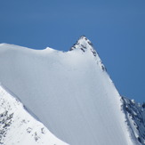
Stecknadelhorn
Stecknadelhorn

